 | | Catalog/List |
| a few yellow Sphene micros in one area (Sonnblick, Rauris, Salzburg,Germany) £15 ALMANDINE, quite sharp...inch size, with a smaller garnet growing out of one face. (Fauske, Norway) £6 ANALCITE nice coverage of 5mm...Northumberland CACOXENITE golden micros in cacoxenite rich area on magnetite lxlxl .5 Levaeniemi Mine, Norbotten...vein section with some clean white quartz (Timmins area,Ontario,Canada) 2x2 £15 less rich piece 2x2,5 £8...on the surface, on feldspar. (Globe Mine.Petaca District, Rio Arriba County, new Mexico) £15 b) smaller |
 | | Journal (article/letter/editorial) |
| from them into newer deposits with subapennine * See Annals of Philosophy, an. 1821, vol.xvii. p. 450...Dr. Buckland, he arrived at a similar conclusion (see Travels in the Tarentaise and various parts of Grecian...shale, &c. which occupy the external zone of the north-eastern/kips under the name of ' " Flysch" or Vienna...associated with it, we naturally concluded that these O * See Phil. Mag. and Annals, with coloured sections, June...deposits; an opinion from which I entirely recede. I am now persuaded that no form of the genus Nummulina |
 | | Book |
| a few such specimens have been found after 1960 (see the Amity-Edenville entry for Edenite and Spine!)...is not common in the metasedimentary rocks of the area which host these species, but "reasonably good"...Mount Malosa, Chilwa alkaline province, Zomba district. "Illite" is the name of a series of incompletely...to 2 cm which are pseudomorphs after bastnasite--see photo in Guastoni, Pezzotta and Zorzi (2008). ILMENITE... r ILMENITE QUEBEC Girardville, Lac Saint-Jean area. Just northwest of the town of Girardville, itself |
 | | Book |
| Asia. The general boundaries are therefore: in the North, Britain and Scandinavia, in the South, the Mediterranean...his views on the copper mines of Gt Ormes Head in North Wales. I would also like to thank the many archaeologists...Studies also kindly supplied up to date material. I am also grateful to Professor B. Jovanovic of the Institute...What must be remembered is that progress travelled north from the Near East and the Balkans in early Neolithic...Level surface, (b) steeply dipping terrain or cliff face. All seams outcrop at the surface unless laid down |
 | | Journal (article/letter/editorial) |
| dolerites are alike hitherto unrecorded from this district. The nearest outcrops of such basic rocks are...at present is exposed to show a better sequence (see next page). On account of the prevalence of EUheria...deposits, thin out in an opposite direction to the north-west or west. A section showing this was exposed...outcrop and the Shoulder-of-Mutton Hill district. This area is now known as New Parks. In the Western...Thick-bedded reddish-brown sandstone, current-bedded to north-east, with white specks ot kaolin and green clay |
 | | Journal (article/letter/editorial) |
| BULL. GEOL. SOC. AM., VOL. 47 KELLY, PL. 1 IN D ID U R A LIM E ST O N E T hinly bedded, rubbly lim..........•.............................. 1010 The area................................................................................ 1016 La Difunta district................................................................................ 1016 Las Uvas district................................................................................. 1017 Acatita district.............................................. |
 | | Journal (issue) |
| available these can be obtained from: Mrs. J. Spence, (see above). E. Otty ADVERTISING R. Watson For details...belt. An old open level was investigated on the north-east side of a hill 1.5 km N. W. of Bontddu. A small...being undertaken in other trials and mines in the area, and it is to be hoped that from time to time other...divergent needle crystals, associated with erythrite, gypsum, and monohydrocalcite. BROCHANTITE Cu4(SO 4)(OH)6...minute divergent crystals, associated with gypsum. When gypsum is associated with erythrite the crystals |
 | | Report (issue) |
| BULLETIN 68 Gypsum Resources of New Mexico by ROBERT H. WEBER and FRANK E. KOTTLOWSKI 1959 STATE BUREAU...PROPERTIES AND ORIGIN OF GYPSUM ........................................... 5 GYPSUM DEPOSITS IN NEW MEXICO................................... 12 Cretaceous gypsum beds ........................................................................... 13 Tertiary gypsum beds ............................................................................... 13 Quaternary gypsum beds and dunes ............................... |
 | | Book |
| reuse the copyright material in this book please see our website at www.wiley.com/wiley-blackwell. The...massif ) and Mesozoic sediments (Cavistrau nappe). See Fig. 6-10B for explanation. Photo by O. A. Pfiffner...Permian. . . . . . . . . . . . . . . . . . The North Swiss Permo-Carboniferous Trough. . . . . . . ....legends for consistency and typographic errors. I am grateful to my colleagues at the Institute, in Switzerland...that have been addressed in the second edition. I am grateful, in particular, to Hanspeter Funk for his |
 | | Report (issue) |
| Clear Creek district Cove district, by Thomas Gay, E. Jr. Paso Mountains district Erskine Creek...Creek district El Gorman tin 31 district : Greenhorn Mountain district Greenhorn Summit tungsten district...district Indian Wells Canyon district Jawbone Canyon district Kern River Canyon district Keysville district...district Kramer borate Loraine district Mojave district district, Mountains Piute Rademacher...Rademacher Rand district Tehachapi by William E. Ver Planck 41 1 43 45 47 47 district district _ Red |
 | | Report (volume) |
| rock, by B. N. Moore__-__-________________________ Gypsum, by B. N. Moore, Eugene Callaghan, and W. W. Rubey...pocket PLATE 1. Geologic map of the Kramer borate area, California___________ 98 2. Relations of shale...field. _ 98 4. A, The "eggshell" beds, West End area, Clark County, Nev.; B, Anniversary mine, West End...Bissell, Kern County, Calif.; B, Magnesite mine, Afton area, San Bernardino County, Calif _______________________..._.. .._ . 13. Geologic map of brucite-magnesite area in Paradise Range, Nye County, Nev_-----_______ |
 | | Journal (article/letter/editorial) |
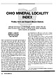
| mineral dis trict and the Serpent Mound zinc district continue to attract the attention of mining geologists...Findlay Arch district. )- 1 Findlay Arch District • 1 - LOUDEN Serpent Mound District OHIO Figure...Figure 2: Mineral localities of the Serpent Mound district. KENTUCKY Volume 65, November/December 1990...age from Ordovician to Permian at the bedrock sur face (King and Beikman, 1974) and are blanketed by Pleis...Ohio—the Findlay Arch mineral district and the Serpent Mound zinc district (Heyl, 1968; Carlson, in press) |
 | | Book |
| CONSERVATION REVIEW SERIES The comparatively small land area of Great Britain contains an unrivalled sequence...Geological setting North-west England Introduction Barrowmouth Beach Section, Saltom Bay 3 North-east England...Rocks Trimdon Grange Quarry Raisby Quarries 4 North-east England (Yorkshire Province) 13 15 15 19...space created by continuing episodic subsidence. In north-east England, especially, the late Permian rocks...recent search for hydrocarbons in the Irish and North seas accelerated the rate of learning and has revealed |
 | | Report (volume) |
| SURVEY GEOKGE OTIS SMITH, Director Bulletin 697 GYPSUM DEPOSITS OF THE UNITED STATES BY R. W. STONE....................... Mineralogy and geology of gypsum, by R. W. Stone....................... Chemical..................................... Analyses of gypsum, by R. W. Stone..................................in the chemical analysis of gypsum, by George Steiger............ The gypsum industry, by R. W. Stone......... Cost of gypsum plaster...... I................................... Uses of gypsum.............. |
 | | Report (volume) |
| (Permian) .. - ---__--.----.___-._-__.___. Castile gypsum and Rustler limestone __-._..--...--. Triassic...Mountain.._________ 125 Mesa Redonda and Suwanee area.___.___--_--__-__-_.__ 126 Grant region and western...________________._________.--......_. 131 Puertecito district.........____________________________ 133 Magdalena..._____________________________________ Salt and gypsum deposits.__-______-__--_______-_---_______ Pot...__---__-----___---__-__--__----._-----Central-western volcanic area.._________________________________ Plains of San |
 | | Report (volume) |
| SILVER: Notes on the gold lodes of the Carrville district, Trinity County, Cal., by D. F. MacDpnald.......account of the ore deposits of the Loon Creek district, Idaho, byJ. B.Umpleby................................................. Notes on the Antelope district, Nev., by F. C. Schrader................... Notes............ COPPER: The Turquoise copper-mining district, Ariz., by F. L. Ransome........... Survey publications...fuller's earth in Arkansas, by H. D. Miser.......... Gypsum along the west flank of the San Rafael Swell, Utah |
 | | Journal (article/letter/editorial) |
| DEVONIANROCKS in the .District around CORK; and on the DOLOmT~S of the same District. By Prof. ROBERTHARKNESS...the nature of the sedimentary rock occupying this area, and from certain physical changes which have operated...subsequent to their deposition. The contour of the district exhibits a series of low hills generally ranging...removed by denudation. The physical features of this district have originated from a succession of rolls, which...jointing exhibited in their most perfect form. North and south joints are even better developed in most |
 | | Report (issue) |
| .............................................. Gypsum .................................................Coal 52 Fluorspar 52 Gold ..'. 53 Graphite .... 53 Gypsum 54 Iron 55 Limestone 55 Manganese — 56 Mercury...purposes. CLAYS NORTHWESTERN COLORADO In this district, there are abundant outcroppingx of the M a n...WESTERN SLOPE COAL JACKSON COUNTY The coal beds of North Park are contained in the Coalmont formation, which...Michigan and Canadian rivers, and in the Coalmont district in the southwestern part of the field. Thinner |
 | | Report (issue) |
| Moenkopi Plateau ...... ~ .............. . 66 Agathla area ............................ . 100 68 Agathla ............................. . White Mesa copper district .............. : Development ................... Cross-bedded De Chelly sandstone near head of Gypsum Creek, Ariz.; B, Cross-bedded De Chelly sandstone...Fort Defiance, Ariz.; B, Chinle formation 2 miles north of Tyende, Ariz_._ 47 XII. A, C1·oss-bedded Navajo...neck at ·Porras Dikes, Ariz.; B, Volcanic neck, north end of Porras Dikes, Ariz .. _.. ______ . ______ |
 | | Journal (article/letter/editorial) |
| the largest of the rare single crystals from the area was only 4.4 x 3.2 x 3.2 cm. This crystal (Fig....minerals at the d, Bob Ingersoll Mine, Keystone District, South Dakota, U.S.A. and stated(p.77) that in...rhombohedraledgeshave been assrmed equal on one face so that the volume is the product of each of the...rounded that the k Palache(1923,p.363) wrote,,Gypsum Chile, Braden Mine. . l0 ft. x 3 in. (3 met€rsx...however, Lindgren (1933, p.6g5) stated ,.A crystal of gypsum l0 feet long and 2 feet in diameter was found in |
 | | Report (volume) |
| Location and extent________________ _________ 31 Salt, gypsum, and celestite deposits __ _________ 31 Saratoga...area__________ __ _ _________ Middle area ______________________ ____ Northern area ___________________________...Acreage . Tonnage _____ _ Summary for northwestern area Eastern area________ Location and extent_____ _...Index map of the niter fields of the Amargosa district ___ II. The Saratoga niter hills; view southwestward...greenish hills in sec. 7, T. 20 N., R. 7 E.; B, Trench north of locality Z-l, in the NW. i SW. £ sec. 7, T. 20 |
 | | Report (issue) |
| _____ . _.- : _.. _. __ ·______ , _: ___ . Cody district .............................................................. _____ .. : ___ _ ?\Ieeteetse district .................................................... ___ ... _.. ___ ·_. _.. _ Thermopolis district ......... _...... _..... __ .... _..... _..... ______...______ ... ___ . __ ..... _. ___ _ No Wood district ............................... : .......... __ ........ _.... __ . _____ ._. __ Basin district. .............. ~ ...... ___ ............... ____ .. _.. _ |
 | | Book |
| Sandstone structureless, reddish brown with gypsum nodules mudstones 65 144 structureless, reddish... Geology of the country around Blackpool The district described in this memoir lies on the western side...which sedimentation was largely controlled by large north-trending faults. The solid rocks are heavily mantled...preserved in a syncline, one of several folds in the area. The history of the salt mining and brine extraction...Basin. The hydrocarbon potential of the Blackpool district is discussed. The overlying Mercia Mudstones, |
| | Book |
| breccias structureless, reddish brown mudstones with gypsum nodules 144 structureless, reddish brown mudstoncs... Geology of the country around Blackpool The district described in this memoir lies on the western side...which sedimentation was largely controlled by large north-trending faults. The solid rocks are heavily mantled...preserved in a syncline, one of several folds in the area. The history of the salt mining and brine extraction...Basin. The hydrocarbon potential of the Blackpool district is discussed. The overlying Mercia Mudstones, |


