Log InRegister
Quick Links : The Mindat ManualThe Rock H. Currier Digital LibraryMindat Newsletter [Free Download]
Home PageAbout MindatThe Mindat ManualHistory of MindatCopyright StatusWho We AreContact UsAdvertise on Mindat
Donate to MindatCorporate SponsorshipSponsor a PageSponsored PagesMindat AdvertisersAdvertise on Mindat
Learning CenterWhat is a mineral?The most common minerals on earthInformation for EducatorsMindat ArticlesThe ElementsThe Rock H. Currier Digital LibraryGeologic Time
Minerals by PropertiesMinerals by ChemistryAdvanced Locality SearchRandom MineralRandom LocalitySearch by minIDLocalities Near MeSearch ArticlesSearch GlossaryMore Search Options
Search For:
Mineral Name:
Locality Name:
Keyword(s):
 
The Mindat ManualAdd a New PhotoRate PhotosLocality Edit ReportCoordinate Completion ReportAdd Glossary Item
Mining CompaniesStatisticsUsersMineral MuseumsClubs & OrganizationsMineral Shows & EventsThe Mindat DirectoryDevice SettingsThe Mineral Quiz
Photo SearchPhoto GalleriesSearch by ColorNew Photos TodayNew Photos YesterdayMembers' Photo GalleriesPast Photo of the Day GalleryPhotography

Garnet Group from
Dongguashan Mine, Shizishan ore field, Tongling, Anhui, China


Locality type:Mine
Classification
Species:'Garnet Group' (not an IMA approved species)
Formula:X3Z2(SiO4)3
Confirmation
Validity:Believed Valid
Data
Mineral Data:Click here to view Garnet Group data
Locality Data:Click here to view Dongguashan Mine, Shizishan ore field, Tongling, Anhui, China
Data Identifiers
Mindat Occurrence Record ID:528064
Long-form Identifier:1:3:528064:3
GUID (UUID V4):11815f07-6856-4721-b6f1-05cda3e14fce
Nearest other occurrences of Garnet Group
1.8km (1.1 miles) Xinqiao Mine, Xinqiao ore field, Tongling, Anhui, China
4.9km (3.1 miles) Baocun Au deposit, Shizishan ore field, Tongling, Anhui, China
7.0km (4.3 miles) Baoshantao deposit, Fenghuangshan ore field, Tongling, Anhui, China
7.3km (4.5 miles) Fenghuangshan Mine, Fenghuangshan ore field, Tongling, Anhui, China
8.3km (5.1 miles) Chaoshan Au deposit, Shizishan ore field, Tongling, Anhui, China
8.5km (5.3 miles) Datuanshan Cu deposit, Shizishan ore field, Tongling, Anhui, China
10.0km (6.2 miles) Laoyaling Cu-Mo deposit, Shizishan ore field, Tongling, Anhui, China
10.8km (6.7 miles) Baimangshan Au-Ag-Cu deposit, Yi'an District, Tongling, Anhui, China
12.2km (7.6 miles) Laomiaojishan Mine, Tongguanshan ore field, Tongling, Anhui, China
12.9km (8.0 miles) Laojiacun Cu-Mo-Au deposit, Jinkouling Mine (Jingkouling Mine), Tongguanshan ore field, Tongling, Anhui, China
References
Reference Search (possible matching items)
Journal (article/letter/editorial)
Cu(–Mo) deposit, Middle–Lower Yangtze Valley, Eastern China: constraints from geology, Re–Os geochronology,...are the most abundant and economically significant ore type in the Middle–Lower Yangtze River Valley, one...one of the most important metallogenic belts in China. The Datuanshan deposit is one of the largest and...representative stratabound Cu(–Mo) deposits in the Tongling district of the Middle–Lower Yangtze River metallogenic...sediments. The skarn consists mainly of prograde garnet and pyroxene and retrograde alteration assemblages
Conference Proceedings (Volume)
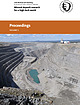
Cover photograph: View of the Aitik open pit copper mine in the very north of Sweden. Mining operations started...The production in 2012 was 34,3 million tonnes of ore containing 67 100 tonnes of copper, 51 700 tonnes...Jianping, Peng Runmin & Liu Zhenjiang 3D-modelling of ore deposits ..........................................Sadeghi 3D modelling of the ore body structural complexities: KDC East Gold Mine, South Africa . . .......Jana Michňová, Peter Koděra & Peter Pauditš 3-D ore body modeling of vein-hosted Co-Ni-Cu-Au- mineralization
 
Mineral and/or Locality  
Mindat Discussions Facebook Logo Instagram Logo Discord Logo
Mindat.org is an outreach project of the Hudson Institute of Mineralogy, a 501(c)(3) not-for-profit organization.
Copyright © mindat.org and the Hudson Institute of Mineralogy 1993-2024, except where stated. Most political location boundaries are © OpenStreetMap contributors. Mindat.org relies on the contributions of thousands of members and supporters. Founded in 2000 by Jolyon Ralph.
Privacy Policy - Terms & Conditions - Contact Us / DMCA issues - Report a bug/vulnerability Current server date and time: April 19, 2024 06:39:43
Go to top of page