| Locality type: | Quarry |
| Classification |
|---|
|
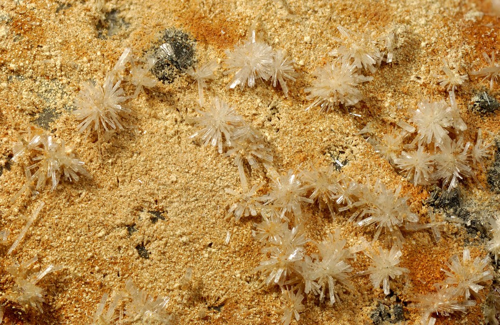
| Species: | Gypsum |
| Formula: | CaSO4 · 2H2O |
| Confirmation |
|---|
|
| Validity: | Believed Valid |
| Associated Minerals Based on Photo Data: |
|---|
|
| Pyrite | ⓘ1 photo of Gypsum associated with Pyrite at this locality. |
| Data |
|---|
|
| Mineral Data: | Click here to view Gypsum data |
| Locality Data: | Click here to view Grands Caous quarry, Saint-Raphaël, Draguignan, Var, Provence-Alpes-Côte d'Azur, France |
| Data Identifiers |
|---|
|
| Mindat Occurrence Record ID: | 531358 |
| Long-form Identifier: | 1:3:531358:7 |
| GUID (UUID V4): | f9f2318e-8160-49b0-8733-17a59e412d36 |
| Nearest other occurrences of Gypsum |
|---|
|
|
| 7.6km (4.7 miles) | ⓘLe Charbonnier Mine, Fréjus, Draguignan, Var, Provence-Alpes-Côte d'Azur, France |
| 9.8km (6.1 miles) | ⓘSaint Jean - La Berle Mine, Fréjus, Draguignan, Var, Provence-Alpes-Côte d'Azur, France |
| 10.1km (6.3 miles) | ⓘL'Avellan mine, Fréjus, Draguignan, Var, Provence-Alpes-Côte d'Azur, France |
| 11.4km (7.1 miles) | ⓘMaurevieille Mine, Mandelieu-la-Napoule, Grasse, Alpes-Maritimes, Provence-Alpes-Côte d'Azur, France |
| 59.7km (37.1 miles) | ⓘRaganeous Cave, Saint-Benoît, Castellane, Alpes-de-Haute-Provence, Provence-Alpes-Côte d'Azur, France |
| 71.8km (44.6 miles) | ⓘPont des Roberts, Guillaumes, Nice, Alpes-Maritimes, Provence-Alpes-Côte d'Azur, France |
| 75.0km (46.6 miles) | ⓘCap Garonne Mine, Le Pradet, Toulon, Var, Provence-Alpes-Côte d'Azur, France |
| 77.0km (47.8 miles) | ⓘSaint-Pierre-de-Péone, Péone, Nice, Alpes-Maritimes, Provence-Alpes-Côte d'Azur, France |
| 90.0km (55.9 miles) | ⓘVallauria Mine, Tende, Nice, Alpes-Maritimes, Provence-Alpes-Côte d'Azur, France |
| 96.0km (59.6 miles) | ⓘPunta Chistafort, Entracque, Cuneo Province, Piedmont, Italy |
| References |
|---|
|
|


Grands Caous quarry, Saint-Raphaël, Draguignan, Var, Provence-Alpes-Côte d'Azur, France