 | | Report (issue) |
| the U.S. Geological Survey and Servicio Geologico de Bolivia in cooperation with the Trade Development...by the U.S. Geological Survey-Servicio Geol6gico de Bolivia as part of the Mineral Resource Evaluation...unpublished reports in the files of the Servicio Geologico de Bolivia located in their main office in La Paz. All...throughout the United States, and the Servicio Geol6gico de Bolivia in La Paz, Bolivia. This report is an edited...deposits, or a formally designated mining district. For some mining districts described in this report |
 | | Report (volume) |
| Geology of the Bernal-Jalpan Area Estado de Queretaro Mexico By KENNETH SEGERSTROM GEOLOGIC INVESTIGATIONS...with the Instituto Nacional para la Investigation de Recursos Minerales, under the auspices of the International...along the canyon of the Rio Ext6rax___-_ 22. Pena de Bernal_______________________________________ 23..._-___-----_-----26. Small fold on a limb of the San Lorenzo syncline___________ 27. Boudinage and chevron...MEXICO GEOLOGY OF THE BERNAL-JALPAN AREA, ESTADO DE QUERETARO, MEXICO By KENNETH SEGERSTROM ABSTRACT |
 | | Journal (article/letter/editorial) |
| tidelands sediments along the north shore of San Pablo Bay, California, are neutral in reaction and subjected...Undrained sediments from the area contain montmorillonite, chlorite, mica, and kaolinite that all give...The study area extends along the north shore of San Pablo Bay, California, from the Napa River on the east...Map of sampling area along the north shore of San Pablo Bay, California. into the bay. Samples for study...10 9peak in the magh~sium-saturated sample; montmorillonite by the 18 ~_peak in the glycerol-solvated sample; |
 | | Report (issue) |
| Purpose of investigation On March 22, 1956, the San Francisco Office of the Federal Housing Authority...the East Bay Municipal Utility District, Oakland, California, The San Francisco Office of the Federal...Highway and then flow southsouthwestward into San Pablo Creek, immediately south of the mapped area. Most...southwestward into San Pablo Creek. San Pablo Creek flows northwestward into San Pablo Reservoir, approximately...and kaolinite clays are associated with the montmorillonite. Sandstone makes up approximately 15 percent |
 | | Journal (article/letter/editorial) |
| GEORGE B. CLEVELAND California Division of Mines, San Francisco and Los Angeles, California and R. J....traverses low b ay-margin land through Richmond and San Pablo. In preSpanish days this area was thickly populated...1826, and became part of a Spanish grant, Rancho San Pablo. Remains of two adobes from the early Spanish...OFF FREEWAY TO SAN PABLO AVE. At stop light 0.1 mile farther, turn left on San Pablo Ave. toward Vallejo...Pass through town of SAN PABLO. 10.3 Road starts upward over north end of San Pablo Ridge. The low road |
 | | Report (issue) |
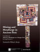
| Mining and Metallurgy in Ancient Perú A translation of Minería y Metalurgia en el Antiguo Perú Arqueológicas...[Minería y metalurgia en el antiguo Perú. English] Mining and metallurgy in ancient Perú / by Georg Petersen... Contents Introduction to the English translation of Mining and Metallurgy in Ancient Perú . . . . . . . .... . . . . . . . . . . . . . . . . . . . . . xvi Mining and Metallurgy in Ancient Perú Prologue . . . .... . . . . . . . . . . . . . . 24 Alluvial Gold Mining . . . . . . . . . . . . . . . . . . . . . . . |
 | | Book |
| The endsheet maps are reprinted from The Mexican Mining Industry 1890-1950 by Marvin D. Bernstein, by permission... CONTENTS • Foreword lX Preface Xl Important Mining Districts 1 Discovery and Developments in Mexico...authoring Boletfn numeros 40 and 41 (Instituto Geol6gico de Mexico, 1922, 1923), has an author been able to provide...introduction contains an interesting summary of the mining history and the development of mineralogy. It also...The author discusses eight of the more important mining districts in Mexico, which produce fine mineral |
 | | Report (volume) |
| By U.S. GEOLOGICAL SURVEY and SERVICIO GEOLOGICO DE BOLIVIA With a section on Application of economic...by U.S. Geological Survey and Servicio Geol6gico de Bolivia; with a section on Application of economic... Geological Survey (U.S.) II. Servicio Geol6gico de Bolivia. Ill. Series. QE75.B9 no. 1975 [TN39.A4]...history of cooperation between the Servicio Geologico de Bolivia and the U.S. Geological Survey. The geologic...application of mineral deposit models to classic mining areas in Bolivia. The data that result from these |
 | | Report (issue) |
| MARCH, Ph.D. 1914 Issued by California State Mining Bureau McN. HAMILTON STATE MINERALOGIST F. F...Minerals of herewith Bulletin 67 of the State Mining California. This work was made possible at this...localities new and quently the The second list ^Mining' State Mineralogist. This known localities...literature of a general nature on the geology and mining industry of the State. bibliography of A. may...The excellent Vodges, Bulletin 30 of the State Mining Bureau, be referred to for such literature. The |
 | | Book |
| .....• ••~.. lnstituto Tecnol6gico i ~ GeoMinero de Espana Special Publication No. 8 f_o_r_G~e~o-lo_g_y_...CARDOZO Universidad Nacional de lngenieria, and Newmont Peru Limited Gerente de Exploraciones Av. Jose Galvez...Barrenechea 218, Urb. Corpac Lima-San Isidro, Peru Prof. Dr. ESTEBAN CEDILW Facultad de Minas, Metalurgia y Geologia...Geologia, Universidad de Guanajuato Ex-Hacienda de San Matias s/n Apartado Postal 347 Guanajuato, Gto. 36020...Prof. Dr. Lwfs FONTBOTE Departement de Mineralogie, Universite de Geneve 12, rue des Maraichers CH-1211 |
 | | Journal (volume) |
| 1958 LIBRARY DIVISION OF MINES FERRY BUILDING, SAN FRANCISCO 9 67 177 STATE OF CALIFORNIA GOODWIN... DIVISION Director OF MINES FERRY BUILDING. SAN FRANCISCO OLAF P. JENKINS, Chief Vol. 54 JANUARY...OLAF Headquarters Third Floor, Ferry Building, San Francisco Branch 11 Offices State Building, 217...Mines maintains at its headquarters offices in San Francisco a technical library containing several...several thousand books and journals on geology, mining, mineralogy, chemistry, metaland related subjects; a |
| | Book |
| The endsheet maps are reprinted from The Mexican Mining Industry 1890-1950 by Marvin D. Bernstein, by permission...is * CONTENTS Foreword Preface Important Mining Districts Discovery and Developments in México...Boletin nuimeros 40 and 41 (Instituto Geoldgico de México, 1922, 1923), has an author been able...introduction contains an interesting summary of the mining history and the development of mineralogy. It also...The author discusses eight of the more important mining districts in México, which produce fine mineral |
 | Cazañas, X., Melgarejo, J. C., Luna, J. A., Barrabí, H. (1998) El depósito volcanogénico de Cu-Zn-Pb-Au El Cobre, Cuba Oriental: estructura y mineralogía [The Cu-Zn-Pb-Au volcano genic deposit El Cobre, Western Cuba: structure and mineralogy]. Acta Geologica Hispanica, 33. 277-333 | Journal (article/letter/editorial) |
| (1998), nº 1-4,p. 277-333 El depósito volcanogénico de Cu-Zn-Pb-Au El Cobr Cuba Oriental: estructura y mineralogía...BARRABÍ(3) (1) Instituto de Geología y Paleontología, La Habana, Cuba. (2) Departament de Cristal·lografia,...Mineralogia i Dipòsits Minerals. Facultat de Geologia. Universitat de Barcelona. joanc@natura.geo.ub.es. (3)...(3) Empresa Geominera Oriental, Santiago de Cuba, Cuba. RESUMEN El depósito “El Cobre” encaja en series...volcanosedimentarias del arco de islas Paleógeno de Cuba Oriental. Los tipos de mineralización presentes son |
 | | Report (issue) |
| the Morrison Formation along the east side of the San Juan Basin, New Mexico..... 2. 4 Photograph showing...of Cuba, N. Mex., along the east margin of the San Juan Basin, occurs in unoxidized gray, fluvial channel...of INTRODUCTION In the southern part of the San Juan Basin, uranium in the Westwater Canyon Member...Goodner and Collins leases, about 27 km north of San Ysidro (fig. 1). In In this oxidation-reduction...may contain sparse amounts of pyrite. North from San Ysidro to Cuba along the outcrop belt, intervals |
 | | Journal (issue) |
| Famous mineral localities: The Trucco mining district, Taxco de Alarcon, Guerrero, Mexico ..............Jlline Famous mineral localities: The Refugio mine, Municipio de Choix, Sinaloa, Mexico ....................453 by WE. Wilson Jlerro de Jllercado Famous mineral localities: Cerro de Mercado, Durango, Mexico ...Front Cover Smithsonite, 4 cm wide, from the Refugio mine, Choix, Sinaloa, Mexico. William Dameron collection;...that were collected and stored more carefully. The mine is still being actively worked today, as the city |
 | | Report (issue) |
| _ Etchegoin Formation (Pliocene) _____________ _ San Joaquin Formation (Pliocene) ___________ _ Tulare...late Cenozoic deposits of the west border of the San Joaquin Valley in the LosBanos-Kettlemen City area...500 square miles on the central west side CJf the San Joaquin Valley, Calif., chiefly in western Fresno...report. They include the Jacalitos, Etchegoin, and San Joaquin Formations of Pliocene age and the Tulare...part of the area where fresh water occurs in the San Joaquin and Etchegoin Formations. In a series of |
 | | Journal (article/letter/editorial) |
| which had properties that did not fit those of montmorillonite, vermiculite, or chlorite. In (1960) Dixon...by precipitating Mg(OH)2 in the presence of montmorillonite, interest in the natural process of interlayering...1961 Matsui and Tontani, 1963 Sudo, 1963 Le Roux and de Villiers (1965) Wilson, 1966 Jackson, 1963a Zverev...estuary Chesapeake Bay Gulf of Mexico California San Pablo Bay Brown and Ingram, 1954 Griffin and Ingram...glycerol solvation (Tamura, 1957, 1958), but montmorillonite does when interlayers are removed and the clay |
 | | Report (issue) |
| --_------_---------_------------100-102. Map of San Antonio Bay, Tex., showing 100. Bathymetry-_____...___._______________________ 112-114. Map of the San Francisco Bay system, California, showing 112. Bathymetry...coast and in the eastern Gulf of Mexico; and montmorillonite is common along the coasts of the western Gulf...principal clay minerals illite, kaolinite, and montmorillonite occur respectively in the following ratios:...of quartz and plagioclase feldspar. Illite, montmorillonite, and quartz predominate in the finer material |
 | | Report (issue) |
| PALEOENVIRONMENT OF MIOCENE PHOSPHATIC ROCKS IN THE EAST SAN FRANCISCO BAY REGION, CALIFORNIA by James M. Hill...correlation ............................... 27 SAN PABLO GROUP .................................................... 33 PHOSPHATE OCCURRENCES IN THE EAST SAN FRANCISCO BAY REGION ..............................Figure Page 1. Location of study area in the East San Francisco Bay Region (shaded)...................... Correlation of stratigraphic units of the East San Francisco Bay Region ........................ 8 |
 | | Report (volume) |
| Uraniun1 Potential of Jurassic Forn1ations in the San Ysidro-Cuba and Majors Ranch Areas, Northwestern...uranium potential of Jurassic formations in the San Ysidro-Cuba and Majors Ranch areas, northwestern...ILLUSTRATIONS Page PLATE 1. Geologic maps of the San Ysidro-Cuba and Majors Ranch areas, Sandoval County...vertical sections of part of the Morrison Formation, San Ysidro-Cuba and Majors Ranch areas ----------------------------...correlation of Jurassic formations between the Laguna and San Ysidro-Cuba areas ---------------------III 2 5 |
 | | Report (issue) |
| Geology of the San Francisco North Qu^lrangle, California GEOLOGICAL SURVEY PROFESSIONAL Public inquiry... 782 t GEOLOGY OF THE SAN FRANCISCO NORTH QUADRANGLE, CALIFORNIA 1 San Francisco Bay area aerial...bottom center; San Francisco at bottom right. San Pablo Bay at left center. Geology of the San Francisco...surficial deposits in the northern part of the City of San Francisco and southern Marin County, Calif., including........ 23 Northeastern San Francisco.............. 23 Central highlands of San Francisco.. 24 Cliff House |
 | | Report (issue) |
| ;wIFORNIA STATE Mii^ix^v BtmiiAU FERRY BUILDING - SAN FRANOSCC im^ ibiiiiiiliiii .III— Bb^aa^Aai^^...FERRY BUILDIN(;. MININC; BUREAU SAN FRANCISCO FLETCHER HAMILTON San Francisco] State Mineralogi8l ...particular service in co- operating with the State ^Mining Bureau in making possible this addition to our...a part of the Fourth Annual Report of the State Mining Bureau, by Henry G. Hanks, who was then quently...the thirty years which elapsed since the State Mining Bureau. appearance of the second list, our knowledge |
 | | Report (issue) |
| area__:__________ 5 Section of the Berkeley Hills-San Pablo Bay region Reliz Canyon section _. ______________...Indian Creek and Quailwater Creek section______ 6 San Luis Obispo Creek section___________ 6 Lompoc Quarry...Stratigraphic relations of Miocene sections of the San Joaquin Valley, Calif._______.______:_________ 4...in sea cliffs about 3 miles northwest of Pismo, San Luis Obispo County; B, Crest of small fold in the...in sea cliff about 2% miles northwest of Pismo, San Luis Obispo County _________~______._ 11. A, Diatoms |
 | | Report (issue) |
| 1947 142 1949 DIVISION OF MINES FERRY BUILDING. SAN FRANCISCO LIBRARY COLLEGE Of AGRICULTURF DAVIS ...DIVISION OF MINES FERRY BUILDING, SAN FRANCISCO OLAF P. JENKINS, Chief SAN FR-\NCISCO BULLETIN II JULY...geologic features, mineral resources, significant mining activities during 1947, and mineral production...142 was done by Charles V. Averill, Supervising Mining Engineer of the State Division of Mines. Other...Sacramento County San Benito County San Bernardino County San Diego County San Francisco County San Joaquin County |
 | | Book |
| pyrophyllite, paragonite, hydrous mica, and montmorillonite by Lindqvist (1962) indicate that when two...endellite, montmorillonite versus smectite), and also on the status of the names (e.g. montmorillonite as a...unresolvable differences of opinion. The use of montmorillonite or of smectite as a group name was argued (a)...generating strong feeling on both sides, concerns montmorillonite-saponite or smectite for the 2:1 minerals with...Dioctahedral smectites or Montmorillonites Montmorillonite, beidellite, nontronite Trioctahedral smectics |


