| Locality type: | Quarry |
| Classification |
|---|
|
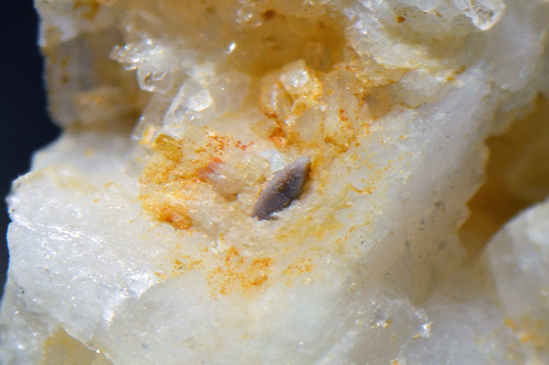
| Species: | Zircon |
| Formula: | Zr(SiO4) |
| Confirmation |
|---|
|
| Validity: | Believed Valid |
| Data |
|---|
|
| Mineral Data: | Click here to view Zircon data |
| Locality Data: | Click here to view Poschacher Quarry, Artolz, Pfaffenschlag bei Waidhofen, Waidhofen an der Thaya District, Lower Austria, Austria |
| Photo Gallery | View Gallery (4 photos) |
| Data Identifiers |
|---|
|
| Mindat Occurrence Record ID: | 565037 |
| Long-form Identifier: | 1:3:565037:8 |
| GUID (UUID V4): | f7658682-6b8e-4a00-b2dd-c16bfbb03838 |
| Nearest other occurrences of Zircon |
|---|
|
|
| 4.6km (2.9 miles) | ⓘWidy quarry, Gebharts, Schrems, Gmünd District, Lower Austria, Austria |
| 17.3km (10.8 miles) | ⓘHalámky feldspar deposit, Nová Ves nad Lužnicí, Jindřichův Hradec District, South Bohemian Region, Czech Republic |
| 23.1km (14.4 miles) | ⓘSerpentinite quarries, Dietmannsdorf an der Wild, Brunn an der Wild, Horn District, Lower Austria, Austria |
| 26.4km (16.4 miles) | ⓘHomolka Hill, Stráž nad Nežárkou, Jindřichův Hradec District, South Bohemian Region, Czech Republic |
| 28.3km (17.6 miles) | ⓘGraphite quarry, Wollmersdorf (Zettlitz-Wollmersdorf), Drosendorf-Zissersdorf, Horn District, Lower Austria, Austria |
| 28.6km (17.8 miles) | ⓘNonndorf gabbro quarry, Nonndorf bei Raabs, Raabs an der Thaya, Waidhofen an der Thaya District, Lower Austria, Austria |
| 29.4km (18.2 miles) | ⓘHengl quarry, Eibenstein an der Thaya, Raabs an der Thaya, Waidhofen an der Thaya District, Lower Austria, Austria |
| 32.6km (20.3 miles) | ⓘHäuslern, Groß-Gerungs, Zwettl District, Lower Austria, Austria |
| 35.1km (21.8 miles) | ⓘWolfsbach, Drosendorf-Zissersdorf, Horn District, Lower Austria, Austria |
| 35.8km (22.2 miles) | ⓘArzberg, Kottaun, Geras, Horn District, Lower Austria, Austria |
| References |
|---|
|
|
| Reference Search (possible matching items) |
|---|
 | | Journal (article/letter/editorial) | | Institut fiir Petrologie, Universit~it Wien, und der Mineralogisch-Petrographischen Abteilung, Naturhistorisches...Naturhistorisches Museum, Wien, Osterreich Die Petrologie der Diorite irn N6rdlichen Waldviertel, Nieder6sterreich...N6rdlichen Waldviertels aus dem Raum Gebharts-Pfaffenschlag werden petrologisch untersucht und ihre Genese...Bildung yon Anthophyllit oder Mg- und Ca-Amphibolen. Der Abbau yon Cummingtonit zu Biofit sowie die Verdr/ingung...wobei ein PH20 ~ 3 kb ~ Ptotal bei einer angenommenen H20-S~ittigung der Schmelze einer Mindestintrusionstiefe |  | | Report (chapter) | | Upper and Lower Austria L U D W I G R. W A G N E R Wolfersberggasse 6, A-1140 Wien, Austria Abstract:...Bavarian border across Salzburg, Upper and Lower Austria to the border of the Tschech Republic provides...during its exploration in Salzburg, Upper and Lower Austria. In the Tertiary (from the late Eocene) the...palaeogeography for the area of Salzburg and Upper Austria were recently described and illustrated in more...basement The Crystalline of the Bohemian Massif in Austria is composed of medium- to high-grade WAGNER,L |
|


Poschacher Quarry, Artolz, Pfaffenschlag bei Waidhofen, Waidhofen an der Thaya District, Lower Austria, Austria