 | | Book |
| columns of DSDP Sites after Initial Reports of the Deep Sea Drilling Project. Note: Leg 79 Sites 544-547...sediment cover the birth and evolution of the Atlantic Ocean Basins during the past 200 million years. Due...multichannel seismic reflection lines, numerous Deep Sea Drilling Project (DSDP) sites and petroleum...During the late 1970's, the International Phase of Ocean Drilling (IPOD), including its pre- and post-site...the offshore petroleum potential of the North Atlantic continental margins helped also to stimulate new |
 | | Book (volume) |
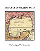
| and W. R. Bryant 13. Seismic stratigraphy of the deep Gulf of Mexico basin and adjacent margins . . ....orogenic belts rimming the Gulf of Mexico basin—the Sierra Madre Oriental in Mexico, the Ouachita orogenic...industrial organizations. To all of them I express my deep gratitude. The Bureau of Economic Geology of the...Columbus discovered the New World, most of the Atlantic coasts of both North and South America had been... Vasco Nunez de Balboa had reached the Pacific Ocean by crossing the isthmus of Panama, but the search |
 | | Journal (article/letter/editorial) |
| B and G11B signatures in the shallow subduction zone forearc: Examples from Barbados, Costa Rica and...USA – (dsaffer@geosc.psu.edu) 2 Research Center Ocean Margins, Univ. Bremen, P.O.Box 330440, 28334 Bremen...boreholes and mud volcanoes indicate a contribution from deep sources. These observations include pore water freshening...one critical step toward characterizing subduction zone fluid transport. Here, we present a simple model...mudstones in subduction zones. In a generic subduction zone with a taper angle of 8º, we evaluate two end-member |
 | | Book |
| Europe, the Jurassic of the much larger Pacific rim has been studied intensively only in the past few...zonal names. Scientific interchange between Pacific-rim countries often remained minimal, and the creation..."final" breakup of Pangea. The history of the Pacific Ocean (with its ancestor, Panthalassa) and the motions...to the Jurassic, which formed the oldest extant ocean floor. Palinspastic reconstructions by geophysicists...required for the Jurassic paleogeography of the Pacific rim, because most of the current continental margins |
 | | Journal (article/letter/editorial) |
| immediately surrounding monogenetic scoria cones of the Sierra Chichinautzin Volcanic Field, central Mexico. Magma...pschaaf@geofisica.unam.mx KEY WORDS: Popocatépetl; Sierra Chichinautzin Volcanic Field; arc petrogenesis;...of an 80 km long, north–south-trending highland (Sierra Nevada) that includes Iztaccı́huatl volcano (5272...East Pacific Rise; OFZ, Orozco Fracture Zone; OGFZ, O’Gorman Fracture Zone. The numbers along the Middle...& Suárez, 1995). Volcanoes (triangles): SCVF, Sierra Chichinautzin Volcanic Field; NT, Nevado de Toluca; |
 | Bolourchifard, Farid, Fayazi, Farajollah, Mehrabi, Behzad, Memarkouchehbagh, Ayyub (2019) Evidence of high-energy storm and shallow water facies in Pabdeh sedimentary phosphate deposit, Kuhe-Lar-anticline, SW Iran. Carbonates and Evaporites, 34 (4) 1703-1721 doi:10.1007/s13146-019-00520-4 | Journal (article/letter/editorial) |
| deposits in the Middle East extend in Neo-Tethys basin rim through several countries from North Africa, Syria...that it may be formed within the suboxic-to-anoxic zone, almost 100-cm depths (under seafloor). These values...setting of the Middle East conform the NeoTethys basin rim (Zuza and Yin 2009). Phosphate deposits in the Middle...Middle East extend in the Neo-Tethys basin rim through several countries such as North Africa, Syria,...passive margin sedimentation along the Neo-Tethys Ocean (Heydari 2008). The similarity could be distinguished |
 | | Report (issue) |
| investigations_ Marine and coastal geology ------------------Atlantic continental margin --------------Shelf geophysical...Estuarine and co·astal hydrology --------------Atlantic coast ---------------------------Gulf coast -...________________ Department of Defense DSDP _____________ Deep Sea Drilling Project dyn _______ ------- _____ -----...joule JOIDES ____ Joint Oceanographic Institutions Deep Earth Sampling JTU ________________ Jackson turbidity...side-looking airborne radar SMOW __________ standard mean ocean water TAPS _________ trans-Alaska pipeline system |
 | | Journal (volume) |
| deposits. The on ly deposit of Paleozoic age is an apatite bearing carbonatite intrusion. Key words: economic...beils \ Caledonian c=:J Vounger eonr Arehean mID r~~~:li~~'UkOSk i c=:J c=:J EJ Granu lil e be...of Finland, Bulletin 305 dissemination or as fracture filling in the brec ciated host rock. According...northern margin of the Lake Ladoga- Gulf of Bothnia zone and north-south aligned fractures. The deposit is...followed by syenite that intruded in the marginal zone and in the surrounding bedrock. The main constituents |
 | | Report (volume) |
| High-resolution sequence stratigraphy of a mid-Cretaceous estuarine 41 complex: the Woburn Sands of the Leighton...their sequencestratigraphical significance 109 Deep marine sequences SHANMUGAM,G. BLOCH, R. B., MITCHELL...having been deposited largely as an estuarine complex within superimposed incised valleys, rather than...biostratigraphical methods. Deep marine sequences The prediction of deep-marine sedimentary facies and...a detailed and basin-wide study of predominantly deep-water siliciclastic deposits Woodcock et al. build |
 | Hickey, Leo J., Johnson, Kirk R., Dawson, Mary R. (1988) The Stratigraphy, Sedimentology, and Fossils of the Haughton Formation: A Post-Impact Crater-Fill, Devon Island, N.W.T., Canada. Meteoritics, 23 (3) 221-231 doi:10.1111/j.1945-5100.1988.tb01284.x | Journal (article/letter/editorial) |
| 22.4 ± 1.4 Ma, using fission-track analysis of apatite grains in shocked gneiss fragments contained in...to Silurian Allen Bay Formation which forms the rim of the crater. The dip of the Paleozoic section was...portion of the crater, within the so-called middle rim of Robertson and Sweeney (1983), and farthest removed...downcutting by the Haughton River which breaches the northeastern rim of the structure. The formation consists of...physical tracing of unit I ofthe latter section into a zone of solifluction immediately below the base of the |
 | | Book |
| . . . . 1.2 Northern Grauwackenzone (Greywacke Zone), Land Salzburg 1.3 Hohe Tauern, Land Salzburg ... . . . . . . . . . 4.1.1 Ilimaussaq Intrusive Complex, Kvanefjeld . . 4.1.2 Puissagtaq Area, Igaliko.... . . . . . . . 6.4.1 Saint-Hippolyte Area, Northeastern Vosges, Dpt. Haut-Rhin . . . . . . 6.4.2 Pegmatitic...Sedimentary Basins in Saxony . . . . 7.3.1 Elbtal Zone. . . . . . . . . . . . . . . . 7.4 Northwest Saxony...West Carpathians . . . . . . 14.1.1 North Gemer Zone . . . . . . . . . . . . . . . . . . . . 14.1.2 Central |
 | | Report (issue) |
| widely. Domes and flows were erupted in the northeastern third of the eastern source area between 21...tend to be localized above the buried ring-fracture zone of the caldera. Neither the Mount Belknap nor...from these and associated centers constitute the complex accumulation of rhyolite ash-flow tuffs, lava flows...sheet is more than 25 km northeast of the caldera rim. Other major remnants are southeast of Marysvale...facies of the Mount Belknap Volcanics consists of a complex sequence of units derived from both the eastern |
 | | Book |
| Lava fountains near Aloi Crater, on the east rift zone of Kilauea volcano, in May 1969. Photo by U.S. Department...Stream Erosion 161 Mass Transfer 185 Work of the Ocean 195 Sedimentary Rocks 219 Work of the Wind 225 Work...of the Hawaiian Islands and other islands of the mid-Pacific have beckoned the traveler and charmed the...Introduction ACROSS THE FACE OF THE CENTRAL PACIFIC OCEAN, 2,000 miles from the nearest continent and 500...of a great mountain rising from the floor of the ocean. The islands in the northwestern part of the |
 | Liou, J. G., Tsujimori, T., Zhang, R. Y., Katayama, I., Maruyama, S. (2004) Global UHP Metamorphism and Continental Subduction/Collision: The Himalayan Model. International Geology Review, 46 (1) 1-27 doi:10.2747/0020-6814.46.1.1 | Journal (article/letter/editorial) |
| contributions to the studies of both HP and UHP subduction-zone metamorphism and tectonics. We emphasize the interactions...continental crust. Eclogites with compositions of mid-oceanic ridge basalt (MORB) + H2O have been experimentally...consist of rock assemblages forming an accretionary complex, including bedded cherts, MORB-origin greenstones...lithosphere and development of an accretionary complex, forearc basin, huge tonalite-trondhjeimite-granitoid...Northeast Greenland Southeast Brazil Chuacus Complex, northern Guatemala Rhodope Massif, Greece Lanterman |
 | | Report (volume) |
| widely. Domes and flows were erupted in the northeastern third of the eastern source area 21 m.y. ago...tend to be localized above the buried ring-fracture zone of the caldera. Neither the Mount Belknap nor...from these and associated centers constitute the complex accumulation of rhyolite ash-flow tuffs, lava flows...sheet is more than 25 km northeast of the caldera rim. Other major remnants are southeast of Marysvale...facies of the Mount Belknap Volcanics consists of a complex sequence of units derived from both the eastern |
 | | Journal (article/letter/editorial) |
| locations were first concentrated along a main E^W rift zone, which was responsible for the lateral collapse...landslides, further erosion, etc. In the southern Paci¢c Ocean, the tropical volcanic island of Tahiti is strongly...rare outcrops in this tropical highly weathered complex. Under such hot and wet conditions, the alteration...linear volcanic chains of the south-central Paci¢c Ocean. Located near the southeastern end of this alignment...chain. The circle indicates the current hot-spot zone in which crosses localize recent seamounts. The |
 | Groulier, Pierre-Arthur, Indares, Aphrodite, Dunning, Gregory, Moukhsil, Abdelali, Jenner, George (2018) Syn-orogenic magmatism over 100 m.y. in high crustal levels of the central Grenville Province: Characteristics, age and tectonic significance. Lithos, 312. 128-152 doi:10.1016/j.lithos.2018.04.025 | Journal (article/letter/editorial) |
| juxtaposition of the low-P Belt with the high-T mid-P Belt in the hinterland of the Grenville Province...Rivers et al., 1989) is an US assembly of high-P to mid-P (dominant) granulite facies rock units that were...Krogh, 2002) in the central and southern part of the mid-P hinterland, also referred to as T the thermal...are particularly US abundant and diverse in the mid-P hinterland of the central Grenville (Owens and...environment. These are correlated with the Cap-à-l’Est complex defined farther north by Hébert and Lacoste (1998) |
 | | Report (volume) |
| 4. Ground tilting at seismograph stations on the rim of Kilauea caldera during 1952____________________________________...more than 4,000 earthquakes originated beneath the ocean a few miles south of the island of Hawaii. Their...earthquakes commenced at foci along the east rift zone and beneath the caldera region of Kilauea volcano...fountain more than 800 feet high overtopped the rim of the crater at the beginning of the eruption. Gradually...part of the fissure. By 04h on June 28 only the northeastern quarter of the fissure was active, but at about |
 | Laukamp, C., Cudahy, T., Thomas, M., Jones, M., Cleverley, J. S., Oliver, N. H.S. (2011) Hydrothermal mineral alteration patterns in the Mount Isa Inlier revealed by airborne hyperspectral data. Australian Journal of Earth Sciences, 58 (8) 917-936 doi:10.1080/08120099.2011.571287 | Journal (article/letter/editorial) |
| 1: major fault zones, such as the Mt Dore fault zone in the Selwyn Corridor, are interpreted as important...Cloncurry District north of the Saxby Granite (Suicide Ridge). The MgOH and Fe2þ mineral maps were also used... and calcsilicate breccias pipes (e.g. Suicide Ridge). KEY WORDS: hydrothermal, alteration patterns,...et al. 2006a). (a) HyMap swaths Block H (Selwyn Zone) and I (Cloncurry Fault) indicated as black frames...919 fluid channels 2—breccia pipes (e.g. Suicide Ridge north of the Saxby Granite). The most prominent |
 | | Report (issue) |
| appropriated for electrical power production in the mid 1930s. Back: (Top) Lizard Butte near Marsing, an...magmatic, structural, and tectonic evolution of this complex geologic system. We have organized the book into...midpoint of the 1,100-km-long NevadaOregon rift zone. Strontium isotopic variations reflect crustal and...lithosphere variations along the trend of this rift zone, with the basalt area of Oregon and Washington lying...generated by the interaction of a relatively fixed deep thermal plume with a moving lithospheric plate. |
 | | Report (issue) |
| INIS Clearinghouse. FOREWORD Since about the mid seventies, the International Atomic Energy Agency...the year 2000 and implies that somewhere in the mid-nineties additional production will be needed, which...Complete control of the Rabbit Lake mine/mill complex was purchased by Eldorado Mines, Ltd., a Crown...exploration in Canada (Table 1). In the early to mid-1960s, concerns were expressed that as nuclear power...GROUPS EXPLORING FOR URANIUM IN CANADA During the mid-to-late 1970s, uranium exploration in Canada was |
 | Crósta, A.P., Reimold, W.U., Vasconcelos, M.A.R., Hauser, N., Oliveira, G.J.G., Maziviero, M.V., Góes, A.M. (2019) Impact cratering: The South American record – Part 1. Geochemistry, 79 (1) 1-61 doi:10.1016/j.chemer.2018.06.001 | Journal (article/letter/editorial) |
| comets” (page 1). Between the early 1980′s and the mid-1990′s, impact cratering studies experienced three...strengthened (e.g. Morgan et al., 2016, on the latest deep drilling results carried out at the peak-ring of...Gondwana continent, with the opening of the South Atlantic Ocean, caused extensive rifting along the continental...least 250 km wide Vredefort impact structure are mid-crustal levels involved) where these conditions exceed...currently known largest impact structure on Earth, the complex Vredefort impact structure in South Africa (Reimold |
 | | Report (issue) |
| correlative strata in Montana, western Wyoming, and northeastern Utah, by William J. Sando _________________...Cretaceous strand lines in northwestern Colorado and northeastern Utah, by A. D. Zapp and W. A. Cobban_ 113. Strn...___________________ _ 114. Salt anticlines and deep-seated structures in the Paradox basin, Colorado...141. The Republic graben, a major structure in northeastern VVashington, by Mortimer H. Staatz ____________________...Evidence for two stages of deformation in the western Sierra Nevada metamorphic belt, California, by Lorin D |
 | Stark, J. T., Johnson, J. H., Behre, C. H. Jr., Powers, W. E., Howland, A. L., Gould, Don B. (1949, January) Geology and Origin of South Park, Colorado. GSA Memoir 33. Geological Society of America doi:10.1130/mem33 | Report (issue) |
| ... . . .......... . ...... . .... . 95 Basin Ridge group ... ... .. ... ... ... . ............... ...... ....... . . . . . ... . . . .. . . . Basin Ridge syncline .. . . . .. ...... ... . ... . . . . ......... . .. . .. . . . ... . .. . ... . Mexican Ridge anticline ............. . ............ . . . . ... . . . . . . . . . . . . . . . . . . . . Basin Ridge volcanic rocks. . .. . . . . . . . . . . . . . ...boulders on surface and in loose soil of Mexican Ridge. . . . . . . . . . . . . . . . . . . . . . . 117 |
 | | Report (volume) |
| plateau of British Columbia, as seen from Bauernian Ridge, Okanogan Mountains, Washington; B, Rugged topography...from a peak about 8,000 feet iu height on Bauerman Ridge. This feature is noticeable for essentially the...prominently developed, the range is apparently a complex one and should be subdivided. This was recognized...nearly every ridge and mountain in the range. As a rule, the south slope of every spur or ridge is regular...of from 1,400 to 1,700 feet, and isolated by the deep 16 CASCADE RANGE NEAR FORTY-NINTH PARALLEL. |


