 | | Report (volume) |
| Radioactivity Investigations in the Cache Creek Area Yentna District Alaska, 1945 GEOLOGICAL SURVEY BULLETIN... Radioactivity Investigations in the Cache Creek Area Yentna District Alaska, 1945 By G. D. ROBINSON, HELMUTH...LYONS MINERAL GEOLOGICAL RESOURCES SURVEY OF ALASKA BULLETIN 1024-A This report concerns work done...Topographic map of the Cache Creek area, showing sample localities. Traverses on Cache Creek upstream from Nugget...Nugget Creek. Traverses on Nugget Creek. Traverses on Cache Creek between Rambler Creek and Nugget Creek |
 | | Report (issue) |
| Mineral Resource Maps of the Talkeetna Quadrangle, Alaska The Alaskan Mineral Resource Assessment Program:...Mineral Resource Maps of the Talkeetna Quadrangle, Alaska By Bruce L. Reed, Gary C. Curtin, Andrew Griscom...13-17. 1. Mines and mineral resources-Alaska. 2. Geology-Alaska. I. Reed, Bruce L., 1934II. Title. III...ILLUSTRATIONS FIGURE 1. 2. 3. 4. Index map of Alaska showing location of Talkeetna quadrangle Map showing...showing Talkeetna quadrangle and the Alaska Range in south-central Alaska Map showing geologic terranes in |
 | | Report (volume) |
| Placer Deposits of Alaska By EDWARD H. COBB GEOLOGICAL SURVEY BULLETIN 1374 An inventory of the...the placer mines and prospects of Alaska, their history and geologic setting UNITED STATES GOVERNMENT...and method of presentation __ Definitions _-____ Alaska Peninsula region Aleutian Islands region ________...Inlet-Susitna River region Anchorage district _ Redoubt district ___-_ _ Valdez Creek district __ _ Willow...Willow Creek district Yentna district _____________ _ ____ __________ _____ Copper River region __ _ |
 | | Report (issue) |
| Mendenhall, Director Bulletin 864 MINERAL RESOURCES OF ALASKA REPORT ON PROGRESS OF INVESTIGATIONS IN 1933 BY...separate publication] Page (A) Mineral industry of Alaska in 1933, by P. S. Smith_________ Selected list...publications on Alaska______ (B) The Willow Creek-Kashwitna district, by S. R. Capps and Ralph Tuck_______...location of gold placer-mining operations___________________ 3. Sketch showing location of placer-mining claims...claims on Long Creek, in the Ruby district___________________ 4. Sketch map of Cripple, Ophir, Tolstoi, |
 | | Report (issue) |
| Director. Bulletin 868 MINERAL RESOURCES OF ALASKA REPORT ON PROGRESS OF INVESTIGATIONS IN 1934 BY...separate publication] Page (A) Mineral industry of Alaska in 1934, by P. S. Smith (published Jan. 25, 1936)_______...3. 4. Topographic map of Kodiak and vicinity, Alaska. ___________ Geologic map of Kodiak and vicini...upper Ugak Bay_ _______________________ 7. Kodiak, Alaska, in August 1912, several months after the explosion...sketch map of the Kaiyuh Hills and part of the Ruby district- ______________________________________________ |
 | | Report (volume) |
| Mcndenhall, Director Bulletin 926 MINERAL RESOURCES OF ALASKA REPORT ON PROGRESS OF INVESTIGATIONS IN 1939 PAPERS...industry of Alaska in 1939, by Philip S. Smith_____ .._._. (B) Geology of the Gerstle River district, Alaska...molybdenum minerals in Alaska, by Philip S. Smith.._ (D) Geology of the Portage Pass area, Alaska, by F. F. Barnes...107 161 211 ILLUSTRATIONS PLATE Page 1. Map of Alaska, showing areas covered by selected available reports...Topographic reconnaissance map of the Gerstle River district, Alaska _ _______________ _____l_______-_-__________ |
 | | Report (issue) |
| MINERAL INDUSTRY OF ALASKA IN 1926 By PHILIP S. SMITH* INTRODUCTION Records of what has been done in...The investigations of the imineral resources of Alaska which the Geological Survey has been [carrying...755, 773, 783, and 792. 2 MINERAL RESOURCES OF ALASKA, 1926 generously put at the disposal of the Geological...obtained from other sources. Many of the important Alaska newspapers are courteously sent toj the Geological...year] sends to each person known to be operating a mine or prospect sched-J ules on .which are queries to |
 | | Report (issue) |
| Director °\ Bulletin 880 MINERAL RESOURCES OF ALASKA REPORT ON PROGRESS OF INVESTIGATIONS IN 1935 ...separate publication] Page (A) Mineral industry of Alaska in 1935, by P. S. Smith (published in March 1937)...in January 1938). Ill (D) The Eska Creek coal deposits, Matanuska Valley, by Ralph Tuck (published in...publications on Alaska..___0n back of plate 1 ILLUSTRATIONS Page PLATB 1. Map of Alaska, showing areas...covered by selected available reports and maps of Alaska.._-______----___________ In pocket 2. Reconnaissance |
 | | Report (volume) |
| Director Bulletin 933 4 * MINERAL RESOURCES OF ALASKA REPORT ON PROGRESS OF INVESTIGATIONS IN PAPERS...industry of Alaska in 1940, by Philip S. Smith (B) Geology of the Nutzotin Mountains, Alaska .: _ __ (C)...at the Independence mine, Alaska : _ (D) Reconnaissance of Porcupine Valley, Alaska ) . 1 103 201 219...PLATE 1. Map of Alaska, showing areas covered by selected available reports and maps of Alaska _ __ _ 1 In...sedimentary members of the Permian rocks on Baultoff Creek, about 4 miles southeast of the pass to East Fo |
 | | Report (volume) |
| FINENESS OF GOLD FROM ALASKA PLACERS BY PHILIP S. SMITH Mineral resources of Alaska, 1937 (Pages 147-272)...fineness______________________-_____Metals other than gold in bullion from Alaska placers________ Descriptions of regions...fineness of placer gold Southeastern Alaska region__________________________ Juneau district ____________________...Slate Creek area__________________________ Middle Fork area___________________________ Rainy Creek area___...district_________________________________ Nelchimi district ______________________________ Cook Inlet-Snsitna |
 | | Report (issue) |
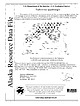
| mines, prospects and mineral occurrences throughout Alaska. 153 00 63 00 TL004 TL005 TL006 * (i|:4 TL069...Talkeetna 1:250,000-scale quadrangle, southcentral Alaska This and related reports are accessible through...110631 Anchorage, AK 99511 Location of map area in Alaska This report is preliminary and has not been...REPORT 99-139 ZUSGS science for a changing world Alaska Resource Data File TL001 Site name(s): Boedeker;...the Hidden River, a short distance east of Swift Creek. The prospect is at an elevation of 4000 feet in |
 | | Report (issue) |
| OCCURRENCES, AID GEOCHEMICAL ANOMALIES OF THE YENTNA DISTRICT, .ALASKA By A. L. Clark and C. C. Hawley Open-file...rocks Elemental composition of dike rocks Thunder Creek altered zone Structure Significance of silica-carbonate...the auriferous white quartz Willow Creek Dollar Creek Thunder Creek Distribution White quartz conglomerate...deposits xSllTu Windy Creek General features Glacio-fluvial placer deposits Cache Creek stream and bench...and recommendations Mt. Goldie anomaly Bunco Creek area Stream sediment geochemical anomalies LiOJ-Dy |
 | | Report (issue) |
| OTHER MAFIC-ULTRAMAFIC METALLOGENIC PROVINCES IN ALASKA (WEST OF THE 141st MERIDIAN) By Jeffrey Y. Foley1...Mines, Alaska Field Operations Center. Present address: 3301 C Street, Suite 525, Anchorage, Alaska, 99503-3935...Introduction Metallogenic provinces Northern and western Alaska Western Brooks Range metallogenic province Seward...metallogenic province Alaska Range Eastern Alaska Range metallogenic province Central Alaska Range metallogenic...metallogenic province Southwestern Alaska metallogenic province South-Central Alaska Border Ranges metallogenic |
 | | Report (issue) |
| NONMETALLIFEROUS MINERAL DEPOSITS IN EASTERN SOUTHERN ALASKA TO ACCOMPANY OPEN-FILE MAP 77-169A This report...NONMETALLIFEROUS MINERAL DEPOSITS IN EASTERN SOUTHERN ALASKA (To accompany open-file map 77-169A) By E. M....eastern southern Alaska. The table and accompanying map -are part of the Regional Alaska Minerals Resource...Resource Assessment Program (RAMRAP).for. southern Alaska. They are based on an extensive literature search...Geological Survey and information derived from the Alaska Minerals Resource Appraisal Program (AMRAP) were |
 | | Book |
| os eua come] a.Batis aS i Ce. = of Alaska Ernest Wolff ALASKA Eastofof Green! Gre nwich MAP 170°...—GEOLOGICAL SURVEY. WASHINGTON, DC, MA ITOT ALASKA MAP A "sO 4 * « PSI1 TOA He REA LA Ope e...University of Alaska ERNEST WOLFF Formerly, Research Associate University of Alaska With Contributions...Formerly, Professor of English, University of Alaska Printed in the United States of America By Edwards...panertoes Fs, PREFACE To grow and prosper, Alaska must develop sources of products which can be exported |
 | | Report (volume) |
| of Metallic and Nonmetallic Mineral Deposits of Alaska Compiled From Published Reports of Federal and...of metallic and nonmetallic mineral deposits of Alaska, compiled from published reports of Federal and...resources Indexes. 2. Mines' and mineral resources Alaska. I. Kachadoorian, Reuben, 1921-, rjoint author...investigations__________________---_-_----____-__ Territory of Alaska Department of Mines pamphlets____________--_ 360...ILLUSTRATIONS PLATE 1. Map showing quadrangles of Alaska Reconnaissance Topographic Series (1:250,000)__ |
 | Pan, Kuo-Liang, Overstreet, W.C., Robinson, Keith, Hubert, A.E., Crenshaw, G.L. (1980) Equivalent uranium and selected minor elements in magnetic concentrates from the Candle Quadrangle, Solomon Quadrangle, and elsewhere in Alaska. Professional Paper 1135. US Geological Survey doi:10.3133/pp1135 | Report (issue) |
| Quadrangle, Solomon Quadrangle, and Elsewhere in Alaska GEOLOGICAL SURVEY PROFESSIONAL PAPER 1135 Equivalent...Quadrangle, Solomon Quadrangle, and Elsewhere in Alaska By KUO-LIANG PAN, WILLIAM C. OVERSTREET, KEITH...quadrangle, Solomon quadrangle, and elsewhere in Alaska. (Geological Survey Professional Paper 1135) Bibliography:...16:1135 I. Geochemical prospecting Alaska. 2. Ore-deposits Alaska. I. Pan, Kuo-liang. II. Title: Magnetic...quadrangle, Solomon quadrangle, and elsewhere in Alaska. III. Series: United States Geological Survey Professional |
 | | Book (volume) |
| THE GEOLOGY OF ALASKA The Geology of North America 'll L *• / ^ X, ^x /yj 5*? ^^vrA. j /X XxT &...Geology of North America Volume G-l The Geology of Alaska Edited by George Plafker U.S. Geological Survey...Congress Cataloging-in-Publication Data The Geology of Alaska / edited by George Plafker and Henry C. Berg, p...educational advancement. 1. Geology—Alaska. 2. Mines and mineral resources—Alaska. I. Plafker, George, 1929. II...north from over the Chaix Hills along the Gulf of Alaska. Bedded marine Tertiary rocks of the Yakutat terrane |
 | | Report (issue) |
| ages in the United States and the Russian Platform area. Phytoclasts viewed under the microscope by transmitted...containing argillaceous lignite and water vapor sealed in gold. They were heated under the pressure usually found...have been studied in detail in the Lower Lake-Cache Creek area northwest of Sacramento T ir | Dike-sediment...between Franciscan and Great Valley strata in this area, the Franciscan is in thrust contact beneath the...continuous structure. S FRANCISCO @) Lower Loke- Cache (Y / a> k Dioblo field ; Cr. field site Range |
 | | Report (volume) |
| so f Tungsten Deposits in the Fairbanks District Alaska w T GEOLOGICAL SURVEY BULLETIN 1024-1...Fairbanks District Alaska By F. M. BYERS, JR. MINERAL RESqURGES GEOLOGICAL SURVEY OF ALASKA BULLETIN...________________________________________ Steele Creek-First Chance Creek area_____-___-_-___-__--_----_ Spruce...mine____-_-______________--____-_______--__-,Cleary Hill mine..._________________________ Leslie prospect-___...Fairbanks, Alaska. 24. Geologic map showing scheelite deposits, Gilmore Dome, Fairbanks district. 25. Geologic |
 | | Report (Issue volume) |
| appropriate map or maps are indicated for each collecting area. Unless otherwise stated, these maps are issued...3 Where to Look Quarries, mine workings (pits, trenches, etc.), and mine dumps arc usually good places...sought before entering a mine, quarry or other private property; in active mining areas arrangements for...should be used. Other equipment might include a gold-pan, an ultraviolet lamp and a Geiger counter. Most...with the specimens. Some collectors paint a small area of white enamel on the specimen and write an index |
 | | Report (volume) |
| Advancement of Science A. I. M. E__.American Institute of Mining and Metallurgical Engineers Aardrijksk__. Aardrijkskundig...Direccion Dissert____ Dissertation dist_______ district distrib_____. distribution Div______ division...etc. Mimeo_____. Mimeographed Min_____ Mineral, Mining min. res____ mineral resources ig________ igneous...Report 17. University, Ala. Alaska Department of Mines Pamphlet 1. College, Alaska. Alberta University, Research...American Institute of Mining and Metallurgical Engineers: Contributions 122-131; Mining and Metallurgy vols |
 | | Report (issue) |
| Springs District, Alaska By RUSSELL G. WAYLAND MINERAL GEOLOGICAL RESOURCES SURVEY OF ALASKA BULLETIN...Occurrence and exploitation of r;assiterite-bearing gold placer deposits TNITED STATES GOVERNMENT PRINTING...___________________________________ ------____ 369 370 374 Cache Creek---------------------------------------------Dalton..._______________________ -------______ Sullivan Creek-------------------------------------------Tofty...Gulch______________________________________________ Deep Creek----------------------------------------------VVoodchopper |
 | | Report (volume) |
| Metalliferous Lode Deposits and Placer Districts of Alaska By WARREN j. NOKLEBERG, THOMAS K. BUNDTZEN, HENRY...metalliferous lode deposits and placer districts of Alaska. U.S. Geological Survey Bulletin 1786 Bibliography...No.: 119.3:1786 1. Placer deposits-Alaska. 2. Ore deposits-Alaska. I. Nokleberg, Warren j. II. Series...COVER Mill buildings at Kennecott, Alaska. The Kennecott district Cu-Ag mines in the Wrangell Mountains...deposit description for Kennecott district (number 30 for southern Alaska). Copyrighted drawing used by permission |
 | | Report (volume) |
| all the papers bearing on a particular subject or area; second, titles of papers, many of them abbreviated... nos. 1-8. Boston, Mass. American Institute of Mining Engineers: Bulletin, nos. 109-120; Transactions...Mineralogist, vol. 1. Philadelphia, Pa. American Mining Congress: Report of Proceedings, 18th Annual Session...nos. 1-7. San Francisco, Cal. California State Mining Bureau: Bulletin, no. 71. San Francisco, Cal. California...Summary report for 1915. Ottawa, Ont. Canadian Mining Institute: Monthly Bulletin, nos. 45-56; Transactions |


