| Locality type: | Mine |
| Classification |
|---|
|
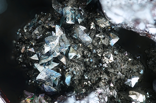
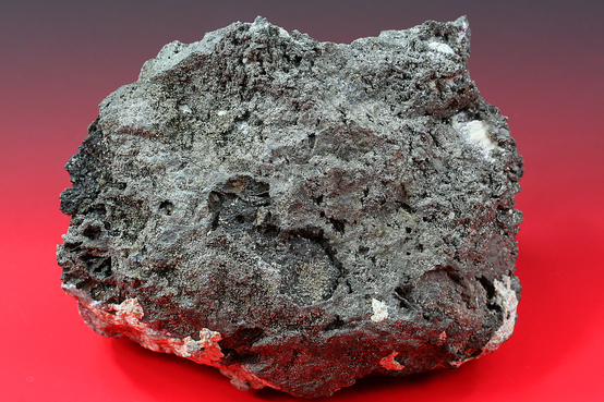
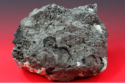
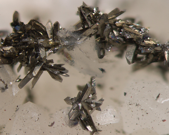
| Species: | Löllingite |
| Formula: | FeAs2 |
| Confirmation |
|---|
|
| Validity: | Believed Valid |
| Associated Minerals Based on Photo Data: |
|---|
|
| Silver | ⓘ2 photos of Löllingite associated with Silver at this locality. |
| Arsenic | ⓘ1 photo of Löllingite associated with Arsenic at this locality. |
| Calcite | ⓘ1 photo of Löllingite associated with Calcite at this locality. |
| Quartz | 1 photo of Löllingite associated with Quartz at this locality. |
| Dolomite | ⓘ1 photo of Löllingite associated with Dolomite at this locality. |
| Data |
|---|
|
| Mineral Data: | Click here to view Löllingite data |
| Locality Data: | Click here to view Shaft 371, Hartenstein, Zwickau District, Saxony, Germany |
| Photo Gallery | View Gallery (7 photos) |
| Data Identifiers |
|---|
|
| Mindat Occurrence Record ID: | 59665 |
| Long-form Identifier: | 1:3:59665:9 |
| GUID (UUID V4): | c305b679-049a-4d7b-8858-7c1b55987a78 |
| Nearest other occurrences of Löllingite |
|---|
|
|
| 1.8km (1.1 miles) | ⓘShaft 296 (dump), Alberoda, Aue-Bad Schlema, Erzgebirgskreis, Saxony, Germany |
| 2.2km (1.3 miles) | ⓘAlberoda, Aue-Bad Schlema, Erzgebirgskreis, Saxony, Germany |
| 2.9km (1.8 miles) | ⓘShaft 309, Niederschlema, Bad Schlema, Aue-Bad Schlema, Erzgebirgskreis, Saxony, Germany |
| 7.6km (4.7 miles) | ⓘDaniel Mine (St. Daniel Mine), Neustädtel, Schneeberg, Erzgebirgskreis, Saxony, Germany |
| 15.4km (9.5 miles) | ⓘShaft 235, Antonsthal, Breitenbrunn, Erzgebirgskreis, Saxony, Germany |
| 17.6km (11.0 miles) | ⓘSt Christoph Mine, Breitenbrunn, Breitenbrunn, Erzgebirgskreis, Saxony, Germany |
| 18.0km (11.2 miles) | ⓘPöhla-Tellerhäuser Mine, Schwarzenberg, Erzgebirgskreis, Saxony, Germany |
| 20.7km (12.9 miles) | ⓘSauberg Mine, Ehrenfriedersdorf, Erzgebirgskreis, Saxony, Germany |
| 27.8km (17.3 miles) | ⓘSt Johannis Mine, Bärenstein, Erzgebirgskreis, Saxony, Germany |
| 29.3km (18.2 miles) | ⓘPalmbaum Mine (Shaft 46), Gehringswalde, Wolkenstein, Erzgebirgskreis, Saxony, Germany |
| References |
|---|
|
|


Shaft 371, Hartenstein, Zwickau District, Saxony, Germany