| Classification |
|---|
|
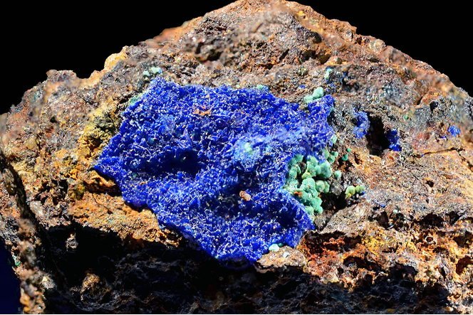
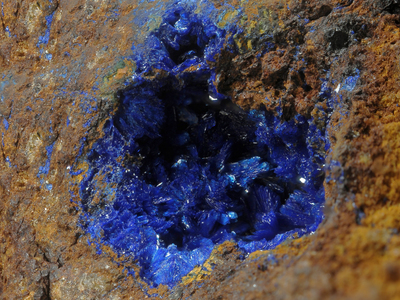
| Species: | Azurite |
| Formula: | Cu3(CO3)2(OH)2 |
| Confirmation |
|---|
|
| Validity: | Believed Valid |
| Associated Minerals Based on Photo Data: |
|---|
|
| Malachite | ⓘ1 photo of Azurite associated with Malachite at this locality. |
| Data |
|---|
|
| Mineral Data: | Click here to view Azurite data |
| Locality Data: | Click here to view Eichbüchl, Katzelsdorf, Wiener Neustadt-Land District, Lower Austria, Austria |
| Photo Gallery | View Gallery (3 photos) |
| Data Identifiers |
|---|
|
| Mindat Occurrence Record ID: | 600968 |
| Long-form Identifier: | 1:3:600968:7 |
| GUID (UUID V4): | 99cfe50c-808d-4910-abd3-116160777951 |
| Nearest other occurrences of Azurite |
|---|
|
|
| 27.8km (17.2 miles) | ⓘSemmering basis tunnel, Gloggnitz, Neunkirchen District, Lower Austria, Austria |
| 30.0km (18.6 miles) | ⓘGrillenberg, Payerbach, Neunkirchen District, Lower Austria, Austria |
| 35.1km (21.8 miles) | ⓘTalergraben (Thalergraben), Trattenbach, Neunkirchen District, Lower Austria, Austria |
| 35.2km (21.9 miles) | ⓘKatharinalager, Haidbachgraben (Myrthengraben; Myrtengraben; Heidbachgraben), Semmering, Neunkirchen District, Lower Austria, Austria |
| 35.3km (21.9 miles) | ⓘHirschwang an der Rax, Reichenau an der Rax, Neunkirchen District, Lower Austria, Austria |
| 35.4km (22.0 miles) | ⓘRedlschlag, Bernstein, Oberwart District, Burgenland, Austria |
| 35.8km (22.3 miles) | ⓘHoher Buchberg quarry, Alland, Baden District, Lower Austria, Austria |
| 36.9km (22.9 miles) | ⓘKnappenberg, Hirschwang an der Rax, Reichenau an der Rax, Neunkirchen District, Lower Austria, Austria |
| 37.0km (23.0 miles) | ⓘKleinau, Edlach an der Rax, Reichenau an der Rax, Neunkirchen District, Lower Austria, Austria |
| 40.2km (25.0 miles) | ⓘHocheck mine, Hasen valley, Fröschnitz valley (Fröschnitz), Steinhaus am Semmering, Spital am Semmering, Bruck-Mürzzuschlag District, Styria, Austria |
| References |
|---|
|
|


Eichbüchl, Katzelsdorf, Wiener Neustadt-Land District, Lower Austria, Austria