| Locality type: | Road Cutting |
| Classification |
|---|
|
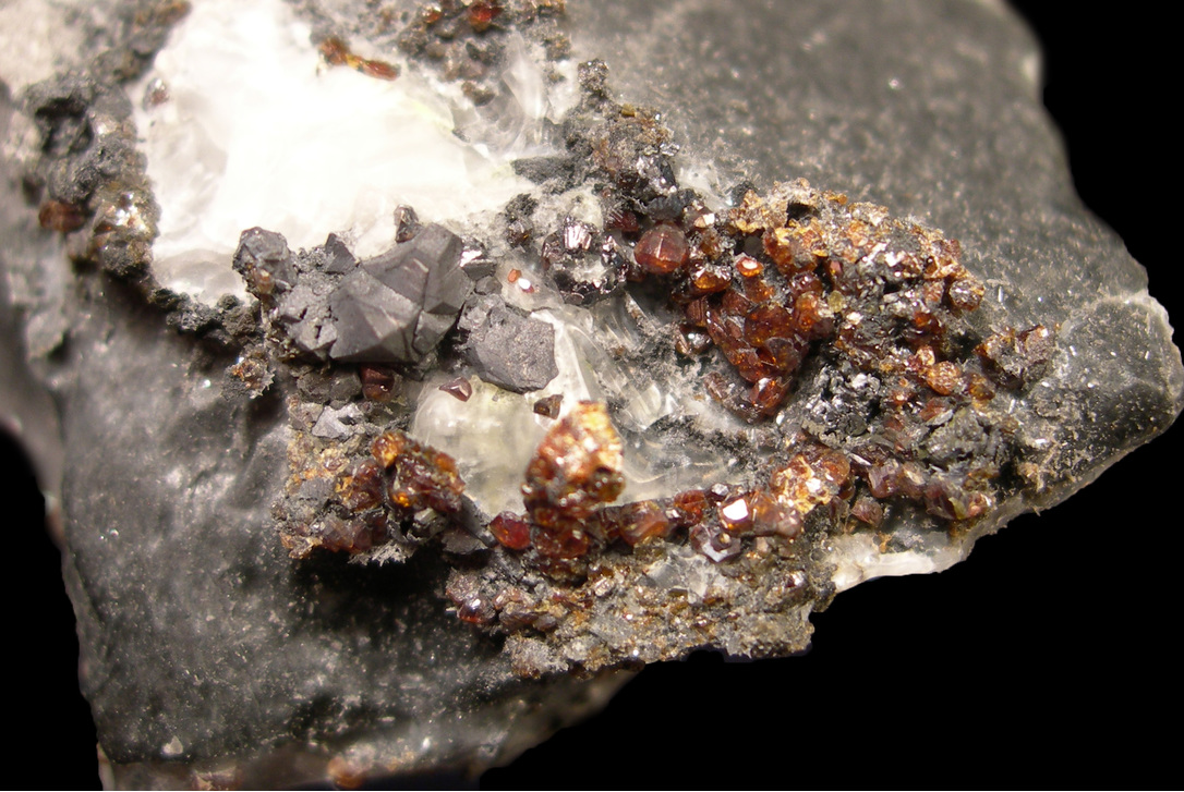
| Species: | Sphalerite |
| Formula: | ZnS |
| Confirmation |
|---|
|
| Validity: | Believed Valid |
| Associated Minerals: |
|---|
|
| Associates: | Chalcopyrite
Fluorite
Galena
|
| Associated Minerals Based on Photo Data: |
|---|
|
| Galena | ⓘ1 photo of Sphalerite associated with Galena at this locality. |
| Calcite | ⓘ1 photo of Sphalerite associated with Calcite at this locality. |
| Data |
|---|
|
| Mineral Data: | Click here to view Sphalerite data |
| Locality Data: | Click here to view M6 Road Cut, Doughiska, Galway County, Connacht, Ireland |
| Data Identifiers |
|---|
|
| Mindat Occurrence Record ID: | 653613 |
| Long-form Identifier: | 1:3:653613:8 |
| GUID (UUID V4): | 70232ac3-4057-4f88-9a20-3befbb2b3d48 |
| Nearest other occurrences of Sphalerite |
|---|
|
|
| 4.1km (2.6 miles) | ⓘRenville (Rinville) Mine, Renville, Galway County, Connacht, Ireland |
| 16.5km (10.2 miles) | ⓘGortmore, Moycullen, Connemara, Galway County, Connacht, Ireland |
| 27.5km (17.1 miles) | ⓘLemonfield Mine, Oughterard, Connemara, Galway County, Connacht, Ireland |
| 30.4km (18.9 miles) | ⓘGlengowla East Mine, Glengowla, Oughterard, Connemara, Galway County, Connacht, Ireland |
| 31.0km (19.2 miles) | ⓘGlengowla West Mine, Glengowla, Oughterard, Connemara, Galway County, Connacht, Ireland |
| 31.0km (19.3 miles) | ⓘSheshodonnell East Mine, Carran, The Burren, Clare County, Munster, Ireland |
| 31.7km (19.7 miles) | ⓘLarkin's Quarry, Shannapheasteen, Costelloe, Connemara, Galway County, Connacht, Ireland |
| 36.0km (22.4 miles) | ⓘCurraghduff, Glan Mines, Oughterard, Connemara, Galway County, Connacht, Ireland |
| 37.3km (23.2 miles) | ⓘLettermuckoo Quarry (Tess Quarry; Lough Naskeha Quarry), Kinvarra, Connemara, Galway County, Connacht, Ireland |
| 40.6km (25.2 miles) | ⓘDoolin Fluorspar Mine, Lisdoonvarna, The Burren, Clare County, Munster, Ireland |
| References |
|---|
|
|


M6 Road Cut, Doughiska, Galway County, Connacht, Ireland