 | | Report (issue) | | Commonwealth of Massachusetts Department of Public Works H* A* MacDonald, Commissioner U. S. Department...February Spodumene deposits in the Leominster-Sterling Area, Massachusetts by M. P. Billings and C. W. Wolfe...Note. Spodumene deposits in the Leominster-Sterling area, Massachusetts; by M. P. Billings and C. W. Wolfe...locations of the Rocky Hill and Long Hill pegnatite areas. Figure 2.- Map of the Long Kill area, showing...bedrock formations. Figure 3.- Map of the Rocky Hill area, showing locations of the pegmatite bodies |  | | Book | | MASSACHUSETTS MINERALAND FOSSIL LOCALITIES Compiled by Peter P. Gleba 'I!~·· . \. i r,'"--""'4' I...them. I wish the same joy I have found in the life-long pursuit of minerals and fossils to all those who...publication. Peter P. Gleba December 2008 Quincy, Massachusetts Member Boston Mineral Club Reprinted by permission...is some of the most valuable real estate in Massachusetts. Calculating it another way, [Peter Gleba] said...is some of the most valuable real estate in Massachusetts. It has access, it has convenience, it has exposure |  | | Report (issue) | | Silurian stratigraphy of northeastern Aroostook County, Maine 1 . David C. Roy and Ely Mencher Discussion:...Silurian stratigraphy of northeastern Aroostook County, Maine... Louis Pavlides Lower Devonian Seboomook...Shride Pre-Silurian stratigraphy of northeastern Massachusetts .Kenneth G. Bell and Donald C. Alvord Stratigraphic...Wachusett-Marlborough Tunnel, east-central Massachusetts .James W. Skehan. S.J.. and A. Adel Abu-moustafa...stratigraphy in the Brimfield area, Connecticut and Massachusetts .John D. Peper and M. H. Pease, Jr. Pre-Silurian |  | | Report (volume) | | BULLETIN 1380 Prepared in cooperation with the Massachusetts Department of Public Works A facies change and...in southwest Massachusetts are described) and correlations between western Massachusetts and Connecticut...----------Stratigraphic section of western Massachusetts ------------------Hoosac Formation ________...------------------------------------Summary of Massachusetts section -------------------------Discussion...quadrangle -------------------------------------Long Hill and Bridgeport quadrangles ----------------------Westport |  | | Book (edition) | | DATOLITE GARNET FLUORITE QUARTZ CRYSTALS SPINEL STAUROLITE •^^ VESUVIANITE WILLEMITE ZIRCON CRYSTALS...The bug bit in me you'll never you don't even long ago. bitten thousands of other folks, too, and...limits of the glacial advance in an area 600 miles long and 200 miles wide, which trends in a northwest-southeast...mine, Racooche Valley, White Co. 1866 Vs White County Daniel Light form, % mi. NE Less than 1887 ...Alabama has yielded a 4i%4 carat diamond from Shelby County, 30 miles south of Birmingham, found about 1900 |  | | Report (issue) | | Descriptions of Stratigraphic Units (continued) Tatnic Hill Formation (continued) Fly Pond Member.............sillimanite gneiss in the lower member of the Tatnic Hill Formation, Danielson quadrangle...................east movement in the lower member of the Tatnic Hill Formation.........................................quadrangle, Windham County, Connecticut. 3.--Geologic map of the Hampton quadrangle, Windham County, Connecticut...cataclasis of the sillimanite gneiss unit of the Tatnic Hill Formation. " --TVtails of cataclasis in gneisses |  | | Report (issue) | | folder Plate 2.West looking radar mosaic of Massachusetts.....in folder Plate 3.South looking radar mosaic...of the side looking airborn radar imagery of Massachusetts, Connecticut and Rhode Island indicates that...sensing device, was used to make imagery of Massachusetts in 1968 and Connecticut and Rhode Island in...made; an east and a west looking mosaic for Massachusetts and a north and a south looking mosaic for Connecticut...met amor phism ) in fault basins in eastern Massachusetts and Rhode Isl&nd. i Resistant Precambrian gneisses |  | | Report (issue) | | POTENTIAL OF EPA REGION 1 Connecticut Maine Massachusetts New Hampshire Rhode Island Vermont OPEN-FILE...POTENTIAL OF EPA REGION 1 Connecticut, Maine, Massachusetts, New Hampshire, Rhode Island, and Vermont R...Preliminary Geologic Radon Potential Assessment of Massachusetts R. Randall Schumann and Linda C.S. Gundersen...aerial radioactivity, and indoor radon data by county. Because of constraints on the scales of maps presented...The reports are available in county formats and State summaries. The county reports typically contain both |  | | Journal (article/letter/editorial) | | Copyright 0 1995 Elsevier Science Ltd Printed in the USA. All tightsreserved Pergamon 0016-7037/95$9.50...York at Stony Brook, Stony Brook, NY 11794-2100, USA January 25, 1994; accepted in revised form March...concordant ages with uncertainties as low as 5 Ma. Staurolite, kyanite, and garnet are older than metamorphic...below: mineral *06Pb/zwPb monazite, zircon staurolite garnet 48-623 22-46 kyanite chlorite, anatase...analyses of major rock forming minerals such as staurolite, garnet, ilmenite, kyanite, quartz, chlorite |  | | Report (issue) | | Tectonic Studies of the Berkshire Massif, Western Massachusetts, Connecticut, and Vermont A. Blastomylonites...Edge of the Berkshire Massif, Connecticut and Massachusetts-A Preliminary Report B. Chronology of Paleozoic...Part of the East Side of the Berkshire Massif, Massachusetts E. Recumbent Folding of the Goshen and Waits...Waits River Formations, \.Yestern Massachusetts F. Time and Space Relationships of Structures Associated...Associated With the Domes of Southwestern Massachusetts and Western Connecticut G. Minor Folds and Derived |  | | Journal (article/letter/editorial) | | Con struction, including that of highways, has long provided the best specimens, when collecting has...natrolite, pyrite, quartz, ruble, sillimanite, staurolite, stilbite, titanite. 1-95 construction, Southport:...magnetite, scapolite, sphalerite, spodumene, staurolite, zircon, zoisite. R o u t e 25 construction,...of view 10.2 cm across, 1-84, Newtown, Fairfield County; collected 1960. Weber specimen, Marcelle Weber...Figure 3 (below). Calcite, 2.6 cm long, Route 7, Brookfield, Fairfield County. Jeffrey Scovil specimen and |  | | Book | | Co. Hematite CALERA, Shelby Co. Wavkllite CLAY COUNTY, Sec. 24. T. 19 S R., 7 E. STATUARY, Coosa Co...Co., (W. border of* Marble Crystalline TALLADEGA COUNTY Marble, (crystalline) VALLEY HEAD, DeKalb Co. Hematite...Feldspar HISSOP, Coosa Co., (near) Beryl JACKSON COUNTY Hematite KENNEDYS, Clay Co., (near) Magnetite MILLERVILLE...DELANEY, Madison Co. Quartz, (clear crystals) GARLAND COUNTY Quartz Crystals HOT SPRINGS, Garland Co. Malachite...Malachite HOT SPRINGS DISTRICT Quartz Xls LAWRENCE COUNTY Pearls LITTLE ROCK Quartz Crystals MAGNET COVE, |  | | Journal (article/letter/editorial) | | Copyright 0 1995 Elsevier Science Ltd Printed in the USA. All nghts reserved 001&7037/95 $9.50 + .oo Pergamon...in garnets from The Straits Schist, Connecticut, USA, using the Synchrotron X-ray fluorescence (SXRF)...thin section of the Straits Schist, Connecticut, USA. Although modeling of the partitioning behavior of...Straits Schist also commonly contain graphite, staurolite, and kyanite and, less commonly, sillimanite...study consists of approximately 12% garnet, 9% staurolite, 38% muscovite and biotite, and 40% quartz and |  | | Book (volume) | | Palmer the bridge west of of the West Ammonoosuc hill Dummer, to gold — to the 51 52 Rocky pond...Me., locations of specimens collected in Coos county, Section lake to the Fig. 30 Mount Desert...Section from Mt. Lafayette to Bald Plate VII, Map hill, Washington, from the Glen house Plate VIII, Fig...Fig. 50, Section from Soapstone mountain to Pine hill, Orford, . . Fig. 52, Section from Connecticut...river to Bear . . Fig- S3, Section through North hill, Orford, Fig- 55. Section from Hanover, VOL |  | | Book | | discussion and classification of pseudomorphs is a long article by Hugo Strunz (1982). The classification...crystallographic orientation with the caxes (matching the long axis of the needles) oriented nearly at right angles...orientation of the aragonite. The direction of the long axes of the apatite needles (i.e., [001] of the...their stability and/or probable progression over long periods of time. One chief difference with the chlorapatite...solution is critical for the extrapolation of their long-term stability in a nuclear repository. Existing |  | | Book (volume) | | Dover, . g. 46, Section in kame south-east of Pine Hill cemetery, Dover, . 47, Section in sand near Wheelwright...rock is sufficiently durable, it is covered with long parallel scratches or s¢vig, which have the same...and Ohio rivers, passing into the ocean south of Long Island. Its greater extent east of the Missouri...not constant, but increases and diminishes through long periods. During the past fifty thousand years it...the globe would have a short, mild winter, and a long, cool Owing to other astronomical causes, known |  | | Report (volume) | | DIRECTOR THE GEOLOGY EASTERN BERKSHIRE COUNTY MASSACHUSETTS BY BENJAMIN KENDALL EMERSON WASHINGTON............................ 82 Mica-schist of Dry Hill in New Marlboro ........................ 82 Eastern... 101 101 Mineral lexicon of eastern Berkshire County .... .... ....'.......... .......... 103 Albite...-CONTENTS. Mineral lexicon of eastern Berkshire County Continued. Page. Opal........................................................................ Staurolite ............................................ |  | | Book (edition) | | from the Principal Localities in the Middlesex County Region in Connecticut Unclassified Material Page...Maps of the Interior of the Roxbury Iron Mine, Mine Hill, Roxbury, Connecticut . . . Maps and Directions...Directions to the Mineral Localities in the Middlesex County Region in Connecticut .... Additional Locality...Connecticut . . . Old Tungsten Mine and Topaz Prospect Long Hill, Trumbull, Connecticut The Type Danburite Locality...booklet devoted to the mineralogy of the Middlesex County region. Invaluable assistance in preparing the |  | | Report (volume) | | North Carolina.. .Dr. Joseph Hyde Pratt, Chapel Hill. North Dakota... .Dr. A. G. Leonard, Grand Forks...See Bauxite and Hallpysite. Asbestos. Tallapoosa County, with corundum deposits near Dudleyville; not found...commercial quantity or quality. Asphalt. Colbert County, small quantity has been shipped from near Leighton;...following localities: Bibb County, Pratts Ferry; Calhoun County, near Tampa; Clay County, T. 20, Pv. 7 E.; Jefferson...Jefferson County, at Elyton; Lee County, at Chewacla lime works; St. Clair County, at Gfeensport; Shelby |  | | Report (volume) | | .......................................... Massachusetts...............:...............................Albany. North Carolina_.Dr. Joseph Hyde Pratt, Chapel Hill. North Dakota_.Dr. A. G. Leonard, Grand Forks. Mr...See Bauxite and Halloysite. Asbestos. Tallapoosa County, with corundum deposits near Dudleyville; not found...commercial quantity or quality. Asphalt. Colbert County, small quantity has been shipped from near Leighton;...following localities : Bibb County, Pratts Ferry; Calhoun County, near Tampa; Clay County, T. 20 S., R. 7 E.; |  | | Book (volume) | | Kobuk jade locality. Descriptions of San Diego County, California, gemstones and the mines in which they...the generous assistance of many residents of that county. My special thanks are extended to Elbert H. McMacken...Andalusite, Kyanite, Epidote and Piedmontite, Staurolite, Colemanite, Barite, Celestite, Tektites. MassivE...crystal . Seven corundum crystals . Map of Corundum Hill—Ellijay area . Map of Cowee Creek area . Cowee Creek...a2; Epidote crystals 143. Twinned staurolite crystal 144. Staurolite crystals 145. Barite specimen 146 |  | | Journal (issue) | | December, 1941, is a thing of the past but it will long be remembered with many pleasant memories as one...in North Carolina that had been reopened not so long ago and which they had recently visited. He knew...discovered a very choice anglesite of a quality he had long desired to obtain and immediately tacked his name...some-· thing to crow about. The locality is Kern County, Calif. Apatite: This calcium phosphate is always...Bluish crystals on white natrolite from San Benito County, Calif., is one of the many minerals that has made |  | | Book (volume) | | .......................................198 Massachusetts...............................................rights, so remember you were told. If in doubt, a county map will tell you who the legal owner is. Good...my wife Becky for allowing me to put in all the long nights needed to bring this together. v A Location...gemmy qualities for cutting and polishing. AUTAUGA COUNTY PRATTVILLE, N. 6 mi., and just E of the Birmingham...well known to prehistoric Indians.) BARBOUR COUNTY BAKER HILL, SE 1 mi. : 1 in a deep ravine, as a bed deposit⎯yellow |  | | Book (volume) | | .......................................198 Massachusetts...............................................rights, so remember you were told. If in doubt, a county map will tell you who the legal owner is. Good...my wife Becky for allowing me to put in all the long nights needed to bring this together. v A Location...gemmy qualities for cutting and polishing. AUTAUGA COUNTY PRATTVILLE, N. 6 mi., and just E of the Birmingham...well known to prehistoric Indians.) BARBOUR COUNTY BAKER HILL, SE 1 mi. : 1 in a deep ravine, as a bed deposit⎯yellow |  | | Journal (issue) | | , dip vertical co 80°SW . west side of H udson County Boulevard These interecting joi nt systems made...operated by compressed air. Observations over a long period of time show that the rock is maintaining... as their emblem, the four directions of the staurolite) . Many of their members attend evening classes...for mer site of Bigelow Pond, in Union, Tolland County, Conn. (See Three Connecticut Localities, by Wilbur...chairmanship of Dr. Karl T. Compton, President of Massachusetts Institute of Techno'ogy. The membership comprises |
|
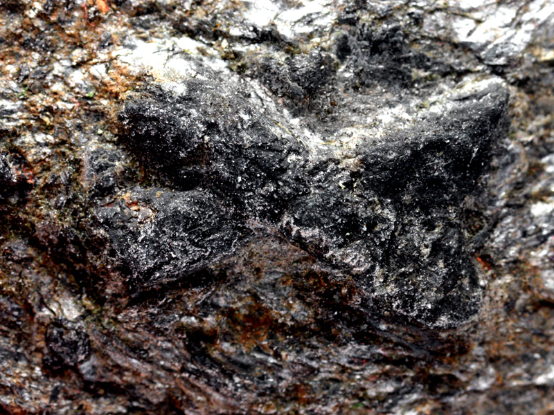


Long Hill, Leominster, Worcester County, Massachusetts, USA