| Locality type: | Hamlet |
| Classification |
|---|
|
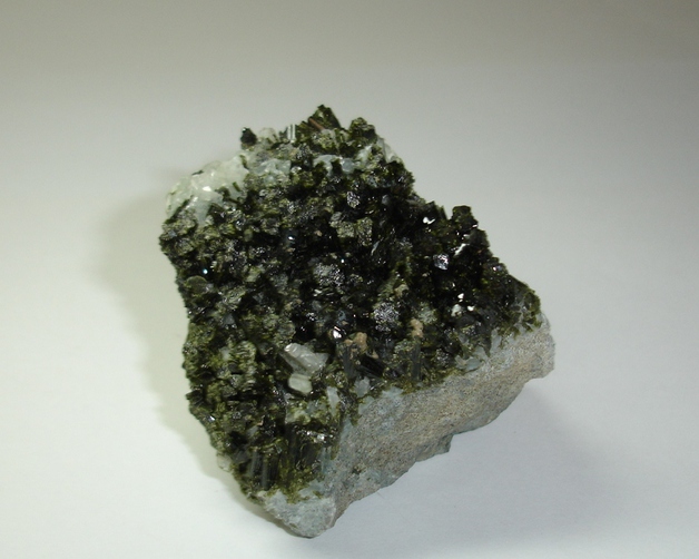
| Species: | Epidote |
| Formula: | (CaCa)(AlAlFe3+)O[Si2O7][SiO4](OH) |
| Confirmation |
|---|
|
| Validity: | Believed Valid |
| Associated Minerals Based on Photo Data: |
|---|
|
| Albite | ⓘ3 photos of Epidote associated with Albite at this locality. |
| Byssolite | ⓘ1 photo of Epidote associated with Byssolite at this locality. |
| Data |
|---|
|
| Mineral Data: | Click here to view Epidote data |
| Locality Data: | Click here to view Sant'Anna di Bellino, Bellino, Cuneo Province, Piedmont, Italy |
| Photo Gallery | View Gallery (6 photos) |
| Data Identifiers |
|---|
|
| Mindat Occurrence Record ID: | 671984 |
| Long-form Identifier: | 1:3:671984:5 |
| GUID (UUID V4): | e6369528-ed8b-48c9-9b49-1b98988747ab |
| Nearest other occurrences of Epidote |
|---|
|
|
| 1.8km (1.1 miles) | ⓘMonte Pence, Bellino, Cuneo Province, Piedmont, Italy |
| 2.6km (1.6 miles) | ⓘVaraita di Rui Valley, Bellino, Cuneo Province, Piedmont, Italy |
| 4.9km (3.0 miles) | ⓘManiglia Mt. Mine, Bellino, Cuneo Province, Piedmont, Italy |
| 6.5km (4.0 miles) | ⓘChabrière ravine, Maljasset, Saint-Paul-sur-Ubaye, Barcelonnette, Alpes-de-Haute-Provence, Provence-Alpes-Côte d'Azur, France |
| 9.1km (5.6 miles) | ⓘTête de Toillies south-west slope (Col Blanchâtre; Roc della Niera south-west slope), Saint-Paul-sur-Ubaye, Barcelonnette, Alpes-de-Haute-Provence, Provence-Alpes-Côte d'Azur, France |
| 9.2km (5.7 miles) | ⓘRoc della Niera east slope, Pontechianale, Cuneo Province, Piedmont, Italy |
| 10.2km (6.3 miles) | ⓘBlanchet lakes, Saint-Véran, Briançon, Hautes-Alpes, Provence-Alpes-Côte d'Azur, France |
| 11.5km (7.2 miles) | ⓘCaramantran peak, Saint-Véran, Briançon, Hautes-Alpes, Provence-Alpes-Côte d'Azur, France |
| 11.8km (7.4 miles) | ⓘLago del Pic d'Asti, Pontechianale, Cuneo Province, Piedmont, Italy |
| 12.0km (7.5 miles) | ⓘVallone delle Forciolline, Pontechianale, Cuneo Province, Piedmont, Italy |
| References |
|---|
|
|


Sant'Anna di Bellino, Bellino, Cuneo Province, Piedmont, Italy