| Locality type: | Mountain |
| Classification |
|---|
|
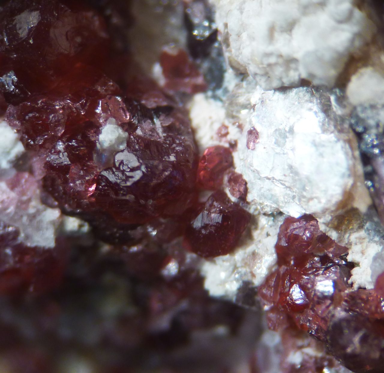
| Species: | 'Garnet Group' (not an IMA approved species) |
| Formula: | X3Z2(SiO4)3 |
| Confirmation |
|---|
|
| Validity: | Confirmed |
| Confirmation Methods: | Visually Identified |
| Data |
|---|
|
| Mineral Data: | Click here to view Garnet Group data |
| Locality Data: | Click here to view Beinn Resipol, Strontian, Fort William and Ardnamurchan, Highland, Scotland, UK |
| Photo Gallery | View Gallery (2 photos) |
| Data Identifiers |
|---|
|
| Mindat Occurrence Record ID: | 708671 |
| Long-form Identifier: | 1:3:708671:7 |
| GUID (UUID V4): | f278438d-bb36-4914-baf4-6243287c14db |
| Nearest other occurrences of Garnet Group |
|---|
|
|
| 25.6km (15.9 miles) | ⓘSgurr a Choire Riabhaich, Loch Morar, Caol and Mallaig, Highland, Scotland, UK |
| 30.7km (19.0 miles) | ⓘCoire Dhorrcail incl Allt Coire Dhorrcail, Knoydart, Caol and Mallaig, Highland, Scotland, UK |
| 38.2km (23.7 miles) | ⓘBeinn Fhada, Ben More, Isle of Mull, Argyll and Bute, Scotland, UK |
| 40.3km (25.0 miles) | ⓘAn Gearna, Ben More, Isle of Mull, Argyll and Bute, Scotland, UK |
| 40.5km (25.2 miles) | ⓘTraigh Doire Dhubhaig (beach), Loch na Keal, Isle of Mull, Argyll and Bute, Scotland, UK |
| 41.3km (25.7 miles) | ⓘMhuineil, Barrisdale Bay, Loch Hourn Complex, Highland, Scotland, UK |
| 41.6km (25.8 miles) | ⓘMaol nan Damh, Ben More, Isle of Mull, Argyll and Bute, Scotland, UK |
| 42.0km (26.1 miles) | ⓘFaire Donn, Letterfearn, Wester Ross, Strathpeffer and Lochalsh, Highland, Scotland, UK |
| 43.0km (26.7 miles) | ⓘGold and Copper trial, Carr Brae, Dornie, Lochalsh, Wester Ross, Strathpeffer and Lochalsh, Highland, Scotland, UK |
| 45.5km (28.3 miles) | ⓘCarnan Cruithneachd, Glen Elchaig, Wester Ross, Strathpeffer and Lochalsh, Highland, Scotland, UK |
| References |
|---|
|
|


Beinn Resipol, Strontian, Fort William and Ardnamurchan, Highland, Scotland, UK