| Locality type: | Mine |
| Classification |
|---|
|
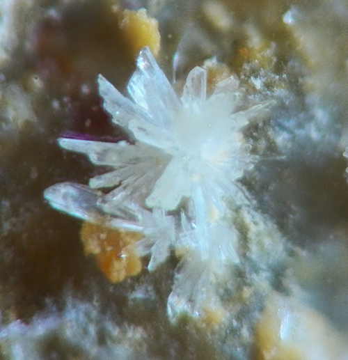
| Species: | Gypsum |
| Formula: | CaSO4 · 2H2O |
| Quality for species: | Poor for species, only of interest for locality collectors. (#) |
| Abundance at site: | Rare |
| Confirmation |
|---|
|
| Validity: | Believed Valid |
| Data |
|---|
|
| Mineral Data: | Click here to view Gypsum data |
| Locality Data: | Click here to view Font Ferrière Mine, Grezolles, Saint-Germain-Laval, Roanne, Loire, Auvergne-Rhône-Alpes, France |
| Data Identifiers |
|---|
|
| Mindat Occurrence Record ID: | 746434 |
| Long-form Identifier: | 1:3:746434:8 |
| GUID (UUID V4): | 4094e278-6846-43ec-9c83-c7d76cf7fe2a |
| Nearest other occurrences of Gypsum |
|---|
|
|
| 20.7km (12.8 miles) | ⓘCharrier Mine, Laprugne, Vichy, Allier, Auvergne-Rhône-Alpes, France |
| 21.6km (13.4 miles) | ⓘLe Limouzat Mine (incl. Le Limouzat Quarry; BN3; BN5; BN6), Les Bois-Noirs Mining Claim, Saint-Priest-la-Prugne, Roanne, Loire, Auvergne-Rhône-Alpes, France |
| 32.0km (19.9 miles) | ⓘBigay Mine, Lachaux, Thiers, Puy-de-Dôme, Auvergne-Rhône-Alpes, France |
| 35.1km (21.8 miles) | ⓘRoffin Mine, Lachaux, Thiers, Puy-de-Dôme, Auvergne-Rhône-Alpes, France |
| 35.2km (21.9 miles) | ⓘLes Rats Mine, Le Crozet, Roanne, Loire, Auvergne-Rhône-Alpes, France |
| 35.2km (21.9 miles) | ⓘLes Rats Mine slag dumps, Le Crozet, Roanne, Loire, Auvergne-Rhône-Alpes, France |
| 51.3km (31.9 miles) | ⓘChessy copper mines, Chessy, Villefranche-sur-Saône, Rhône, Auvergne-Rhône-Alpes, France |
| 51.5km (32.0 miles) | ⓘMarcillat stream alluvial deposits, Billom, Clermont-Ferrand, Puy-de-Dôme, Auvergne-Rhône-Alpes, France |
| 58.2km (36.2 miles) | ⓘLa Verrière (Montchonay), Les Ardillats, Villefranche-sur-Saône, Rhône, Auvergne-Rhône-Alpes, France |
| 59.1km (36.7 miles) | ⓘCrassier Saint-Pierre, La Ricamarie, Saint-Étienne, Loire, Auvergne-Rhône-Alpes, France |
| References |
|---|
|
|


Font Ferrière Mine, Grezolles, Saint-Germain-Laval, Roanne, Loire, Auvergne-Rhône-Alpes, France