| Locality type: | Dam |
| Classification |
|---|
|
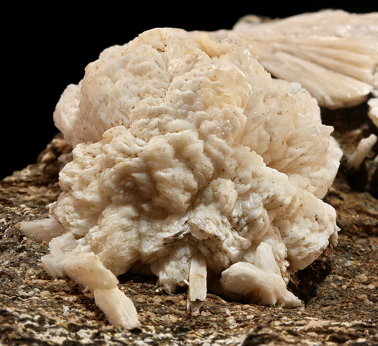
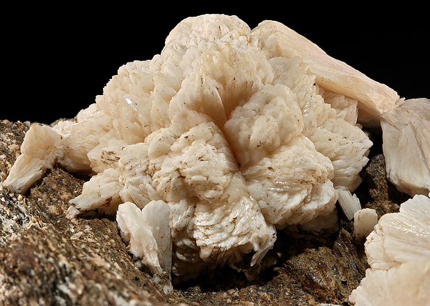
| Species: | 'Stilbite Subgroup' (not an IMA approved species) |
| Formula: | M6-7[Al8-9Si27-28O72] · nH2O |
| Formation: | Secondary |
| Comments: | One sample from here (https://www.mindat.org/photo-749754.html) was analyzed in 2018 via SEM-EDS and found to contain little or no Na, but does contain a significant amount of K, almost definitely too much for stellerite (not 100% sure without finding some published limits for K in stellerite). Therefore it is probably stilbite-Ca. |
| Habit: | radiating, wheat sheave bundles |
| Colour: | white |
| Confirmation |
|---|
|
| Validity: | Believed Valid |
| Data |
|---|
|
| Mineral Data: | Click here to view Stilbite Subgroup data |
| Locality Data: | Click here to view Bill's Brook Dam (Saville Dam), Barkhamsted, Litchfield County, Connecticut, USA |
| Data Identifiers |
|---|
|
| Mindat Occurrence Record ID: | 754543 |
| Long-form Identifier: | 1:3:754543:6 |
| GUID (UUID V4): | cf72ee17-3cb8-4fb4-b0d9-6ff8c0455f30 |
| Nearest other occurrences of Stilbite Subgroup |
|---|
|
|
| 10.3km (6.4 miles) | ⓘGoodwin Dam (Hogback Dam), Hartland, Hartford County, Connecticut, USA |
| 15.3km (9.5 miles) | ⓘTalcott Mountain (King Phillip's Cave), Simsbury, Hartford County, Connecticut, USA |
| 18.0km (11.2 miles) | ⓘRoncari Quarry, East Granby, Hartford County, Connecticut, USA |
| 19.8km (12.3 miles) | ⓘSouth Main Street construction site, Torrington (Wolcottville), Litchfield County, Connecticut, USA |
| 23.8km (14.8 miles) | ⓘFarmington Trap Rock Quarry, Farmington, Hartford County, Connecticut, USA |
| 25.5km (15.8 miles) | ⓘThomaston Dam railroad cut, Thomaston Dam, Thomaston, Litchfield County, Connecticut, USA |
| 26.3km (16.3 miles) | ⓘWhispering Pines residential construction site, Thomaston, Litchfield County, Connecticut, USA |
| 27.0km (16.8 miles) | ⓘState Routes 8 and 222 interchange, Thomaston, Litchfield County, Connecticut, USA |
| 27.9km (17.3 miles) | ⓘNorthfield Brook Dam, Thomaston, Litchfield County, Connecticut, USA |
| 28.0km (17.4 miles) | ⓘThomaston, Litchfield County, Connecticut, USA |
| References |
|---|
|
|


Bill's Brook Dam, Barkhamsted, Litchfield County, Connecticut, USA