| Locality type: | Creek |
| Classification |
|---|
|
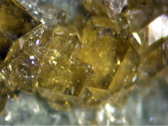
| Species: | Andradite |
| Formula: | Ca3Fe23+(SiO4)3 |
| Confirmation |
|---|
|
| Validity: | Believed Valid |
| Data |
|---|
|
| Mineral Data: | Click here to view Andradite data |
| Locality Data: | Click here to view Yost Creek, Reversed Peak, Mono County, California, USA |
| Photo Gallery | View Gallery (3 photos) |
| Data Identifiers |
|---|
|
| Mindat Occurrence Record ID: | 754942 |
| Long-form Identifier: | 1:3:754942:7 |
| GUID (UUID V4): | 486d0404-2a5d-4cc5-a280-d5ef0bb61b60 |
| Nearest other occurrences of Andradite |
|---|
|
|
| 28.9km (17.9 miles) | ⓘStrawberry Mine (Strawberry Tungsten Mine; Strawberry-Macdougald Tungsten; Strawberry Tungsten deposits), Timber Knob, Madera County, California, USA |
| 34.9km (21.7 miles) | ⓘScheelore Mine (Scheelore Tungsten deposit; Van Loon Scheelore 8 claims), Mount Baldwin, Mono County, California, USA |
| 66.8km (41.5 miles) | ⓘTungsten Hills, Bishop Mining District (Tungsten Hills Mining District), Inyo County, California, USA |
| 68.3km (42.5 miles) | ⓘAeroplane Mine (Mesa Mine; Standard Tungsten City Milling Co. Mine; Moonlight Mine), Tungsten Hills, West Bishop, Bishop Mining District (Tungsten Hills Mining District), Inyo County, California, USA |
| 68.3km (42.5 miles) | ⓘTungsten Blue Mine (Pappas property), West Bishop, Bishop Mining District (Tungsten Hills Mining District), Inyo County, California, USA |
| 86.3km (53.6 miles) | ⓘBirdsong Mine, Marietta Mining District, Mineral County, Nevada, USA |
| 86.6km (53.8 miles) | ⓘSilver Gulch Mine, Marietta Mining District, Mineral County, Nevada, USA |
| 96.7km (60.1 miles) | ⓘCowboy Mine (Cow Boy), Mount Etna (Mount Aetna), Pine Grove Hills, Wilson Mining District, Lyon County, Nevada, USA |
| References |
|---|
|
|


Yost Creek, Reversed Peak, Mono County, California, USA