 | | Book (volume) |
| Field Guide to GOLD, GEMSTONE & MINERAL SITES ot British Columbja “ee 7 Oat | I; Se Rees ce « to...Field Guide to GOLD, GEMSTONE & MINERAL SITES of British Columbjz Volume 2 Sites Within A Day’s Drive of...1947— Gold, gemstone and mineral sites of British Columbia Includes bibliographical references and index...resources — British Columbia — Handbooks, manuals, etc. 2. Prospecting — British Columbia. I. Title. II... Title, Gold, gemstone & mineral sites of British Columbia. TN27B9H82 1997 553.4’09711 ©C96-910287-9 |
 | | Report (issue) |
| 29(1)◦ X-ray Powder Pattern: Mount Washington, Canada. 5.14 (100), 5.56 (91), 3.75 (78), 2.795 (71),...29.97 Total 99.78 100.00 (1) Mount Washington, Canada; by electron microprobe, average of two analyses...alteration product of realgar in stibnite-bearing quartz veins, the alteration typically a result of exposure...lepidocrocite, pyrite. Distribution: In Canada, in British Columbia, from Mount Washington, Comox district...Siwash Creek, in the Kamloops district; and from the Gray Rock property, head of Traux Creek, in the |
 | | Journal (issue) |
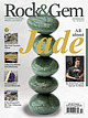
| in China A Rockhound’s 80-Year Odyssey, Part 4 ROCK & GEM • rockngem.com U.S. $5.99 • Vol 46 No. 12...Bob Jones WEST COAST JADE 16 Deposits from British Columbia to California. By Bill Rozday 16 20 AN...Steve Voynick 26 ROCK & GEM KIDS 46 MY FIRST TUCSON SHOW 48 A journey to the rock and mineral mecca...Month ....8 Bench Tips ......................... 24 Rock Science .................... 32 What to Cut ......(866) 287-9383 Printed in U.S.A. On The Cover Rock & Gem (ISSN 0048-8453, USPS 486290) is published |
 | | Book (volume) |
| cushion cut rhodochrosite (25.56 ct), Sweet Home Mine, Colorado; colorless scheelite (19.66 ct), Kern...events to bring the history of North American gem mining up to date. Here, then, is the latest, most complete...and interviews with persons actively engaged in mining gemstones. Pertinent references are furnished throughout...promising diamond fields being vigorously explored in Canada and the United States. Experts agree that in several...kimberlite bodies, most likely in Canada. Systematic large-scale mining of sapphire-bearing gravels in Montana |
 | | Report (volume) |
| SOUTHEASTERN ALASKA WITH A RECONNAISSANCE OF CHICKAMIN RIVER BY A. F. RUDDINGTON UNITED STATES GOVERNMENT...__-___-__---______-_-____-_-___--____-___-_-___-__-___ British Columbia____-_____-___-___________-_-___--___....rocks.._______.__.-.--__--_--_--_ Graywacke-slate division.._________-_-__--_-_-----_--_----_ Coast.Range...intrusives__________-__-__--___-----------_-----_Texas Creek batholith and associated dikes..__--__.__-__-__-...Granodiorite core.._____-___-_-_-__---_-___--_-_--__-. Quartz diorite border facies.__.__-___-__--_----___-__-_ |
 | | Report (volume) |
| ............................................... Area and location...................................................................... 50 History of mining............................................................................ 54 Condition of the mining industry.......................................... 58 Production and mining conditions. ................................. 59 Rock formations............deposits.................................. 80 Rebecca mine and adjacent prospects....................... 80 |
 | | Report (issue) |
| PROFESSIONAL PAPER 489 A study of the ore deposits, rock alteration, stratigraphy, and structure in the most.... _ _.__-__.____ Bedded dolomite __ ___________ Gray limestone. _ ___-__--__-____ Age.---------------------------...______________ Metaline thrust ___ _______ Washington Rock thrust __ Lee thrust________________ Argillite fault...the graben. Flume Creek fault. _ _______ Russian Creek fault.. ______ Slate Creek fault________ Page1..._________ Lead Hill fault___--__---------_-------Styx Creek fault _ _____________________ Divide fault __ _________ |
 | | Report (issue) |
| ORE DEPOSITS OF THE SALMON RIVER DISTRICT, PORTLAND CANAL REGION. By LEWIS G. WESTGATE. INTRODUCTION...northward by the alluvium-floored valley of Bear River, which reaches far back into the upland beyond the...Portland Canal is joined on the west by Salmon River, the mineral deposits of whose basin are here described...port, supply point, and post office of the Salmon River district. Its location is on the international boundary...Salmon River valley. Two miles to the northeast is the town of Stewart, on the British Columbia side of |
 | | Report (issue) |
| Jiyers Creek Mining District PART II Geology and Ore Deposits of the OrovilleNighthawk Mining District...Myers Creek Mining District, and Part II, Geology and Ore Deposits of the Oroville-Nighthawk Mining District...PART I. GEOLOGY AND ORE DEPOSITS OF THE MYERS CREEK MINING DISTRICT. Paoe I NTRODUCTION . . . . . . . .... . . . . . . . . . . . . . . 17 Description of rock formations............................... 17 Paleozoic...of properties.......................... 44 Grant mine . . . . . . . . . • . . . . . . . . . . . . . . |
 | | Journal (volume) |
| 1 Return to itss INDEX Canadian Mining Journal, Vol. 34 JANUARY 1st, 1913 TO DECEMBER 31st... The Canadian Mining Journal (With which A is incorporated "The Canadian Mining Review.") Journal...Journal Devoted to Mining and Metallurgy Published on the First and Subscription in Canada, $2.00 Fifteenth...The Canadian Mining Journal, 44-46 Lombard St., Toronto to — INDEX CANADIAN MINING JOURNAL. VOL,...JN'ephrite, British Columbia, Visit to Mines of Alberta Notes on, by W. J. Woolsey, 519.* Accidents, Mine, 250 |
 | | Report (issue) |
| INTERIOR GEOLOGICAL SURVEY GEOLOGY OF THE DEEP CREEK AREA, WASHINGTON, AND ITS REGIONAL SIGNIFICANCE By...standards. ERRATA for Geology of the Deep Creek Area, Washington, and its regional significance by...3rd paragraph and in table of contents: "The Lime Creek Mountain block and the decollement problem." Delete...Page Stratigraphy and structure of the Deep Creek area 1 Introduction 1 Field work and acknowledgements...__. TT- .,.- _________ 3 j Ledbetter 41 Lime Creek Mountain block 43 Rocks below the thrust fault |
 | | Report (volume) |
| Continued. Acidic intrusives________________________ 43 Quartz mouzonites_____._________________ 43 General d...Oreille____________ 45 Area at west base of- Cabinet Itnnge________ 46 Lightning Creek area ___________________...___________________ 46 Area east'of Bull Lake__________. _____ 46 Syenite__ __ _ __________ 46 Occurrence __ ___-_._______________...Bull Lake Valley__________ Observations along Bull River. . Bull Lake fault__________ _ 53 54 55 55 56 56...__________ ____ Observations near head of Fisher River and on Vermilion . Creek____________ ___ _ ___ |
 | | Report (issue) |
| •• • ••. • . • • •• • •• • • • •. Location and area of the region. . . . . . . . . . . . . . . . . ...Mountains.... . ................................. . Columbia-Kettle Valley.................................... . Metamorphic sedimentary formations in British Columbia and Idaho.. . . . . . . . . . . . . . . ........... ..... ........ . .... .. ....... Cedar Creek Ar gi!Ute. . ... . ............................... . . . . . . . . . . . . . . . . . . . . F ish Creek Argillite................................. . .. |
 | | Journal (article/letter/editorial) |
| FROM CANADA: LOCALITIES AND MORPHOLOGY. D.K.Joyce, 386 Park Avenue, Newmarket, Ontario, Canada, L3Y 1V5...localities in Canada representing diverse geological environments. They are: Henderson I1 mine (Cu, Au),...Strathcona mine (Ni, Cu), Levack, Ontario-massive sulfide deposits in norite and gabbro; Thompson mine (Ni,...orebodies associated with serpentinites; Nigadoo River mine (Pb, Zn, Cu), Gloucester County, New Brunswick-sulfide...sediments; Silvana mine 186 ROCKS & MINERALS (Ag, Pb, Zn), Sandon, British Columbia-remobilized veins |
 | | Report (volume) |
| Taylor Highway__._____ Sand dunes along Porcupine Creek.______--___--_-______Lake deposits._-__-_____-_..._____---_____..________ View from the Taylor Highway bridge across Mosquito Fork__ Post Office at Chicken__-_-_...typical entrenched meander of South Fork of Fortymile River.--_-______________----_--____-----------_----14...6. Mining on Wade Creek_____---___-_--_-_---_----_-_---17. A large meander of the Fortymile River...________________...__-__----____-_ 19. Taylor Highway bridge across Fortymile River.____________ 20. Intricately folded |
 | | Report (volume) |
| HOWLAND BANCROFT INCLUDING A SECTION ON THE REPUBLIC MINING DISTRICT BY WALDEMAR LINDGREN AND HOWLAND BANCROFT............ ^................................ 1 Area examined.............................................. History of mining activity.............................................. Mining and metallurgy....................................... Methods of mining..................................................zones in quartz latite........................................ Fissure veins in andesite and quartz latite |
 | | Report (issue) |
| Johnson, Chair Baker City Ronald K. Culbertson Myrtle Creek Donald A. Haagensen Portland STATE GEOLOGIST Donald...2 1st 1985 Tucson. Arizona 22nd 1986 Linle Rock. Arkansas 23rd 1987 24th 1988 Greenville. South.................... II Oregon bentonite Jerry J . Gray, Oregon Department of Geology and Mineral Industries...Production and potential Nancy L. Joseph, Washington Division of Geology and Earth Resources .................in British Columbia: Present producers and further development oppo rtunities Z.D. Hora, British Columbia |
 | | Book |
| Geological time scale Adopted by Geological Survey of Canada and Geological Society of America Time scale of...Tours Ben Gadd Corax Press Library and Archives Canada Cataloguing in Publication Gadd, Ben, 1946Canadian...403-678-2840 alpinebk@aeontech.ca Printed in Canada by Friesens, at Altona, Manitoba Printed on paper...How Earth's heat produced the Canadian Rockies The rock of the Rockies Three regions (well, seven, really)...Trench 13 16 Formations and groups 32 How the rock has been bent and broken North/south differences |
 | | Report (volume) |
| _____ _ Porphyritic quartz monzonite _________ -- _____________ --Equigranular quartz monzonite ___________________...--Fine-grained equigranular quartz monzonite ____ .,._-- __ ---Fine-grained quartz monzonite rich in mafic...Geology-Continued Tertiary rocks-Continued Columbia River basalt________________________________________...________________________________________ Cleavage ___ Spokane River Valley-Enterprise Valley lineament_____________...______________________ ·-______________________ Big Smoke mine ______________________ ·_____________________ Deer |
 | | Report (issue) |
| left some canyon walls more than 2 km deep (Snake River canyon west of the Seven Devils Mountains). Most...1. Sedimentology and stratigraphy of the Martin Bridge Limestone and Hurwal Formation (Upper Triassic...Geologic evolution of the Pittsburg Landing area, Snake River canyon, Oregon and Idaho David L. White and...deposits within the Wallowa terrane, Pittsburg Landing area, Oregon and Idaho James D.L. White 5. Physiography...Mountains and adjacent Hells canyon of the Snake River, Idaho and Oregon Tau Rho Alpha and Tracy L. Vallier |
 | | Report (volume) |
| and distribution ..... , ..................... Columbia and lower Okanogan valleys......................---.-.--. ................. Basin of upper Skagit River.. ................................ Lower Skagit...distribution.............-..-.-...-..----.-. Columbia River Valley. ......................................-...-..-. 35 Columbia and Okanogan valleys.......................... 35 Mountain area _....................'.......................... 41 Western area __....._....__..._____.!.^_................I. 42 Intrusive |
 | | Report (issue) |
| thumbnails of cerussite attributed to the Daoping mine, Guilin, Guangxi Zhuang Autonomous Region, China...English and in Chinese) that it came from the Yangshuo mine. In any case, these are very distinctive and very...========= Cerussite, 2.5 cm, from the Daoping mine, Guilin, Guangxi Zhuang Autonomous Region, China...thumbnails from the Robert Noble collection; antique “gray uglies” from an old classic locality; and, topping...in Turkey, Peru and Morocco. Take those antique gray uglies first. From an old collection Jordi has acquired |
 | | Report (volume) |
| Theodore Chapin.___ _________ Notes on history of mining development- _____-______----__--____ Geography...__-_-___---__Lower division of the Permian___________-_-_______--.Upper division of the Permian_____...Canal-Fanshaw-Kupreanof area _ ____-_____-_-Kupreanof- Mitkof-Etolin Islands area ___________________ Chichagof...Dall-Baranof belt._... ._.._...._- _ ....... ___ ..__._____ Rock types_-_-_______-___________-_____________-_-_-----Ultrabasic...-_-_-_ Syenite. ______________________________ Quartz diorite. ______ ___ ._ __ ._ __ __ __ _________ |
 | | Journal (volume) |
| NATURAL RESOURCES D. H. RLOOD, Director MINES DIVISION C FERRY BUILDING, SAN FRANCISCO WALTER Vol....CHAPTER OF STATE MINERALOGIST'S REPORT XXIX STATE DIVISION OF MINES FERRY BUILDING, SAN FRANCISCO, CALIFORNIA...*"a. ' . < miv op CAJU- wu<' =f= DAVIS DIVISION OF MINES EXECUTIVE AND TECHNICAL STAFF WALTER...Jenkins, Chief Geologist C. A. Logan, District Mining Engineer C. McK. Laizure, District W. Burling...Sampson, Assistant Mining Engineer District Engineer Chas. V. Averill, District Mining Engineer Frank |
 | | Journal (volume) |
| THE CAxXADIAN MINING REVIEW. i Westinghouse Motors For nine Thoroughly reliable, highly...particulars address nearest office Sovereign Baak of Canada Bldg. Lawlor Bids., Kinn and Yonne Sts. Hastiti|t<4...MANUFACTURERS OF HAMMERED AND ROLLED STEEL FOR MINING PURPOSES Tee Rails, Edge Rails, Fish Plates, Bevelled...-MIXING REV1E:W. in COAL DOMINION COAL BAY, C.B., CANADA MINERS OF GLACE INTERNATIONAL" GAS GOAL BITUMINOUS... THE CANADIAN MIMING REVIEW. IV RUBBER GOODS "OR MINING OF EVERY DESCRIPTION PURPOSES Rubber Belting |


