| Locality type: | Vein |
| Classification |
|---|
|
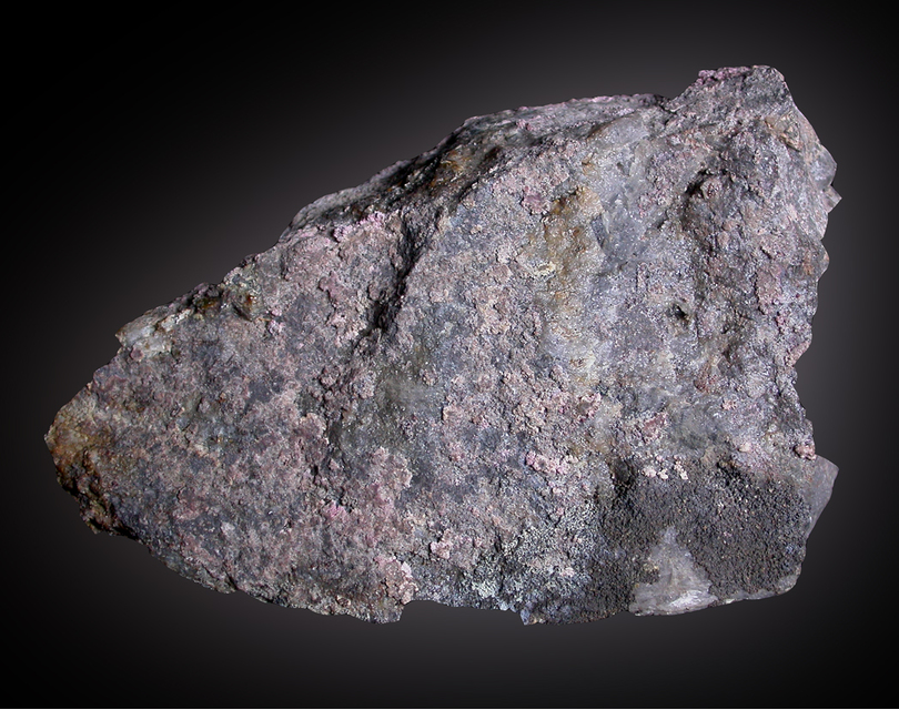
| Species: | Erythrite |
| Formula: | Co3(AsO4)2 · 8H2O |
| Confirmation |
|---|
|
| Validity: | Believed Valid |
| Data |
|---|
|
| Mineral Data: | Click here to view Erythrite data |
| Locality Data: | Click here to view Chrétien Vein, Neuenberg, Sainte-Marie-aux-Mines, Colmar-Ribeauvillé, Haut-Rhin, Grand Est, France |
| Data Identifiers |
|---|
|
| Mindat Occurrence Record ID: | 79381 |
| Long-form Identifier: | 1:3:79381:8 |
| GUID (UUID V4): | a44e965e-f4e9-4c57-978a-62a027a64243 |
| Localities for Erythrite in this Region |
|---|
|
| Kobaltschacht, Chrétien vein, Neuenberg, Sainte-Marie-aux-Mines, Colmar-Ribeauvillé, Haut-Rhin, Grand Est, France |
| Lower Chrétien Mine, Chrétien vein, Neuenberg, Sainte-Marie-aux-Mines, Colmar-Ribeauvillé, Haut-Rhin, Grand Est, France |
| Nearest other occurrences of Erythrite |
|---|
|
|
| 0.4km (0.2 miles) | ⓘGiftgrube mine, Sankt Jakob vein, Neuenberg, Sainte-Marie-aux-Mines, Colmar-Ribeauvillé, Haut-Rhin, Grand Est, France |
| 0.6km (0.4 miles) | ⓘLower Chrétien Mine, Chrétien vein, Neuenberg, Sainte-Marie-aux-Mines, Colmar-Ribeauvillé, Haut-Rhin, Grand Est, France |
| 0.7km (0.4 miles) | ⓘKobaltschacht, Chrétien vein, Neuenberg, Sainte-Marie-aux-Mines, Colmar-Ribeauvillé, Haut-Rhin, Grand Est, France |
| 0.7km (0.4 miles) | ⓘGlückauf Mine (XVIIIth; St Peter Mine high level area), Sankt Wilhelm vein, Neuenberg, Sainte-Marie-aux-Mines, Colmar-Ribeauvillé, Haut-Rhin, Grand Est, France |
| 1.6km (1.0 miles) | ⓘSankt Johann mine (Engelsbourg mine), Sankt Johann vein, Neuenberg, Sainte-Marie-aux-Mines, Colmar-Ribeauvillé, Haut-Rhin, Grand Est, France |
| 33.9km (21.0 miles) | ⓘFanny mine (Kruth 1), Kruth, Thann-Guebwiller, Haut-Rhin, Grand Est, France |
| 57.8km (35.9 miles) | ⓘAmalie Mine, Grunern, Staufen im Breisgau, Breisgau-Hochschwarzwald, Freiburg Region, Baden-Württemberg, Germany |
| 57.9km (36.0 miles) | ⓘNew St Daniel Mine, Giromagny, Belfort, Territoire-de-Belfort, Bourgogne-Franche-Comté, France |
| 60.2km (37.4 miles) | ⓘCobalt mine (Segen Gottes mine; Gottes Segen mine), Sulzburg, Breisgau-Hochschwarzwald, Freiburg Region, Baden-Württemberg, Germany |
| 61.6km (38.3 miles) | ⓘMichael Mine, Weiler, Seelbach, Seelbach, Ortenaukreis, Freiburg Region, Baden-Württemberg, Germany |
| References |
|---|
|
|


Kobaltschacht, Chrétien vein, Neuenberg, Sainte-Marie-aux-Mines, Colmar-Ribeauvillé, Haut-Rhin, Grand Est, France