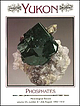
 | | Journal (issue) | | ‘D ’ Ottawa, Ontario, Canada K IP 6P4 H. Gary Ansell Geological Survey of Canada 601 Booth Street Ottawa...Ottawa, Ontario, Canada K1A 0E8 (Geological Survey of Canada contribution number 38290) B. Darko Sturman...Ontario Museum 100 Queen’s Park Toronto, Ontario, Canada M5S 2C6 $ 1992 T h e M in e r a l o g ic a l R... 1.5 cm, with siderite and pale purple fluorapatite, from the Rapid Creek area, Yukon Territory. Keith...45 46 Figure 1. The Big Fish River, northern Yukon Territory, as viewed from collecting area “ C.” |  | | Book | | appear after page numbers. () Reported from this locality; no further information b Book review c Crystal...Historical information m A map of the locality or a map on which the locality appears n Brief descriptive note... etc.) s Specimen locality attribution only; no information about the locality itself In the case...special issues, the letter precedes the page number. Yukon Phosphates (vol. 23, no. 4) Therefore, the Tsumeb...Tsumeb; 23/#2, Michigan Copper Country; 23/#4, Yukon Phosphates; 24/#2, Greenland; and 25/#6, The History |  | | Report (issue) | | ............. 10 12 History of Gem Mining ..... .......................... . 12 Important Gem Stones.................................................. 12 Diamond ......................................................................................... 12 Ruby...................................................................... APPENDIX 1 — Mineral Locality Maps 46 47 Map 1................................................................ 58 vii Map 12 Map 13 59 Map 14 Map 15 Map 16 Map 17 61 62 63 | | | Report (issue) | | NORTH CAROLINA 12 History of Gem Mining 12 Important Gem Stones 12 Diamond 12 Corundum 13 Ruby... 46 Yancey County 46 APPENOIX 1 -- Mineral Locality Maps 47 Map 1 48 Map 2 49 Map 3 50 Map... 55 Map 9 56 Map 10 57 Map 11 58 vii Map 12 59 Map 13 60 Map 14 61 Map 15 62 Map 16 ... The rest of the text consists of the aineral locality descriptions. which are listed by county. These...construction activity affect the condition of each locality, it may be useful to contact n ~ineral club in |  | | Report (issue) | | Actinolite. 0 , f # Minerals of the Hamme-Tungsten District . Amethyst Kyanite 0 \ \ . .."..... . Beryl...MAPS Map No. 1. 2. 3. 4. 5. 6. 7. 8. 9. 10. 11. 12. 13. Alexander County • ....••.••....••.... Alleghany......... Gaston County ......... ..••••.••.. * 10 12 14 17 21 25 27 31 Iredell County Jackson County... who mistakingly thought the Indians had beer* mining silver. Two mines which contained ancient workings...minerals. The early jniners and promoters of the mining industry were also interested in mineral collecting |  | | Report (volume) | | _____________ ______________ ______ 1 1 3 4 6 7 11 12 16 28 31 364 ILLUSTRATION PLATE 1. Map showing...location and means of access to all the metallic mining districts in the State, as well as a large number...documented summary of the beginning of Colorado mining history. Part of his summary is given here in the...galena that had been recently found in the Tenmile district, Summit County. In his booklet, which today would...lists of the mines and mining districts that were active at the time in Clear Creek, Gilpin, and Summit |  | | Report (issue) | | catalogue was produced for the Great Exhibition of Mining and Metallurgy heid in London in 1890. This exhibition...reputation as a suitable place in which to invest in mining shares. In 1893 the Government Geologist, H.Y.L...Mineralogical Society of South Australia, Western Mining Corporation Ltd, and Asarco Australia Pty Ltd,...Cowell; in very coarse-grained wernerite rock at a locality 21 km northwest of Cowell. Flinders Ranges—commonly...the magnetite-bearing marble of the Yudnamutana mining field which extends over a strike length of 26 |  | | Report (volume) | | Formation........._________________________ Skull Creek Shale....'......................_._._..._.. Newcastle...__________ Nl 2 2 3 3 4 4 4 4 5 8 8 11 11 11 12 12 12 14 15 15 15 16 18 18 18 26 33 34 39 41 41 43 45...coal sample from the Antelope 4 mine, Cambria district, Weston County, Wyo___.------_-. N6 52 67 69...followed in turn by the Lakota, Fall River, Skull Creek, Newcastle, and Mowry Formations of Early Cretaceous...yields oil in the Skull Creek, North Skull Creek, and Southeast Skull Creek oil fields, which lie wholly |  | | Report (volume) | | 27-36. Minneapolis, Minn. American Institute of Mining Engineers: Transactions, vols. 30-35; Bimonthly...Bulletin, vol. 2, no. 8-vol. 4, no. 13. Berkeley, Cal. Canada: Geological Survey: Annual Reports, new ser., vols...Catalogue of the Marine Invertebrata of Eastern Canada. Canada, Royal Society: Proceedings and Transactions...Ottawa, Canada. , . . .Canadian Institute: Transactions, vol. 7 and vol. 8, pt. 1. Toronto, Canada. Canadian...Canadian Mining Institute: Journal, vols. 4-7. Ottawa, Canada. Canadian Mining Review: vols. 20-24. Ottawa |  | | Report (issue) | | than 21 horizontal kilometers) and demonstrates rapid Neogene uplift and denudation (see article by O'Sullivan...gold-quartz veins in the Fairbanks, Willow Creek, and Juneau gold belt mining districts. All samples were analyzed...valley adjacent to the Hi-Yu mine in the Fairbanks district had a pH of 5.2. Near Juneau, processing of ore...flowing from placer tailings along Too-Much-Gold Creek near Fairbanks, whereas dissolved iron at the same...same site was only 490 ppb. Within the Fairbanks district, maximum dissolved-arsenic levels of 260270 ppb |  | | Report (volume) | | Bulletin, vol. 41. New York. American Institute of Mining Engineers: Bulletin, nos. 25-36; Transactions,...series, vols. 27, 28. New Haven, Conn. American Mining Congress: Papers and Addresses, llth Annual Session;...History, 8th ser., vols. 3, 4. London. Appalachia, vol. 12, no. 1. Boston, Mass. Arkansas Geological Survey:... vol. 2, no. 2. Oakland, Cal. California State Mining Bureau: Bulletin, nos. 54-56. San Francisco, Cal...Geology: Bulletin, vol. 5, nos. 18-23. Berkeley, Cal. Canada, Geological Survey: Summary Report for 1908; and |  | | Report (volume) | | rocks, including the Lower Mississippian McGowan Creek Formation and the Upper Mississippian White Knob...1988), and on December 7, 1989, at the Northwest Mining Association 95th Annual Convention and Trade Show...certain areas in the Mineral Hill and Warm Springs mining districts, Blaine County, Idaho: Idaho Bureau of...Structural Setting of Ore Deposits in the Lake Creek Mineralized Area, Blaine County, South-Central Idaho...H. Mineral Deposits at Leadbelt, Lava Creek Mining District, South-Central Idaho By Sandra J. Soulliere |  | | Book (volume) | | James H. Dover . 141 . 153 6. Geology of the Yukon-Tanana area of east-central Alaska Helen L. Foster... Roland von Huene, and Andrew J. Stevenson 367 12. Geology of the southern Alaska margin . George Plafker...Lithotectonic terrane map of Alaska and adjacent parts of Canada, 1 sheet, scale 1:2,500,000 (Norman J. Silberling...Robinson, Thomas E. Smith, and Warren Yeend) Plate 12. Neotectonic map of Alaska, 1 sheet, scale: 1:2,500...the volumes published by the Geological Survey of Canada vu . Foreword To those of you who are using |  | | Report (issue) | | Geological Survey Board and the Colorado Metal Mining Fund ~ oopr is PUBliC P[O'J>ERTY aud 1• DOt ~re~~o~...__________________________________________ _ 1 Summary of mining districts---.---------------------Introduction...hornblende gneiss ____________ _ Quartzite at Coal Creek ________________ _ Igneous rocks _____________________________...Quartz diorite and associated hornblendite_ Boulder Creek granite _________________ _ Pikes Peak granite ..._ _ Benton shale ______________________ _ 7 8 8 12 15 19 19 19 19 20 23 23 23 25 25 25 28 28 29 29 |  | | Report (issue) | | description and accuracy: Reed and others (1978, locality 47) locate this prospect north of the Hidden River...River, a short distance east of Swift Creek. The prospect is at an elevation of 4000 feet in the southeast...description and accuracy: Reed and others (1978, locality 32) locate this occurrence west of the Lacuna...the northwest quarter of Section 26, T. 32 N., R. 12 N., of the Seward Meridian within Denali National...description and accuracy: Reed and others (1978, locality 30) locate this occurrence west of the Lacuna |  | | Report (issue) | | Resource Data File BN001 Site name(s): Idaho Creek Site type: Mine ARDFno.: BN001 Latitude: 65.241...description and accuracy: This location is on Idaho Creek, 3,000 to 4,500 feet north of its mouth on the Kuzitrin...10,500 feet east of the Nome-Taylor road. It is locality 46 of Cobb (1972; MF 417). Commodities: Main:... Alaska Resource Data File BN002 Site name(s): Camp Creek Site type: Mine ARDFno.: BN002 Quadrangle: BN...workings centered on the mouth of Camp Creek where it joins with Coffee Creek. This location is 1,000 feet |  | | Report (issue) | | Triassic deposits 31 Mineral localities 38 District of Columbia Mavtrl a Tirl IWlCfci JT XClilUl...Water-filled adit of the Choate chromite mine in the Figure 12. Soldiers Delight region, Baltimore County, Maryland...Delight quarry, Delight, Maryland. Specimen is about 12 cm by 7.5 cm. Figure 13. Location of the Bok Asbestos...Figure 26. Location of the Point of Rocks goethite locality (1), Point of Rocks, Maryland, and the Furnace...black goethite from the Point of Rocks goethite locality, Point of Rocks, Maryland. Figure 28. Location |  | | Report (issue) | | ___:______:________ 253 40. Faults exposed along Sage Creek, about 3 miles south of Gildford.. _____--____-_____-_____________...Coal in upper part of Eagle formation, T. 26 N.,R. 12 E.,__. 262 IV GEOLOGY AND MINERAL RESOURCES OF...miles wide; it includes Tps. 26 to 37 N., Rs. 7 to 12 E. Field work and acknowledgments. The field work...35 to 37 N., Rs. 10 to 12 E., T. 26 N., Es. 11 and 12 E., and T. 25 N., R. 12 E., comprising one-sixth...beds along the Milk River and Canada Coulee in Tps. 85 to "37 N., Rs. 10 to 12 E:, and T. 3T N., R. 9 E. |  | | Report (issue) | | partly conglomeratic, and medium- to thick-bedded. Siderite, magnetite, pyrite, and apatite are present in...of finegrained Tertiary sandstone contained 11 and 12 ppm uranium and up to 30 percent magnetite. (Description...File PE002 Site name(s): Unnamed (near Gunnuk Creek) Site type: Prospect ARDFno.: PE002 Latitude: 56...description and accuracy: Claims on upper Gunnuk Creek, northwestern Kupreanof Island, about three miles...miles northeast of the town of Kake. Locality 9 of Grybeck, Berg, and Karl (1984). Location known only generally |  | | Report (issue) | | host-rock bedding. Black Cloud mine, Leadville district. Sherman-type ore (bottom) in paleokarst breccia...with ferroan dolomite. rv1oose mine, North Alma district. Photographs b)' \Villiarn Sacco, Peabody Museum...Johansing Leadville district: Geology and the origin of ore deposits in the Leadville district, Colorado: Part...and the origin of ore deposits in the Leadville district, Colorado: Part II. Oxygen, hydroge n, carbon...David W. Beaty Breccia homes in the Leadville district, with emphasis on occurrences in th e Black Cloud |  | | Report (issue) | | Terminus of Hubbard Glacier from Osier Island, january 12, 1986. Photograph by L.R. Mayo. Geologic Studies...Age Determination for the Limestone of the Lost Creek Unit, Livengood C-4 Quadrangle, East-Central Alaska...Comparative Petrologic Study of Sandstone from the Wilber Creek, Cascaden Ridge, and Wickersham Units in the Livengood...Mineralization by Metamorphic Fluids in the Chandalar District, Southern Brooks Range--Fluid Inclusion and Oxygen-Isotopic...lcefield Ranges of Yukon Territory, Canada, and in the St. Elias Mountains of Canada and Alaska. It flows |  | | Journal (article/letter/editorial) | | specimen and photo. Novemberficember: Gold, Ten Mile district, Humboldt County, Nevada. Coogan Gold specimen...Allanite, Connecticut, 121 Almandine, Connecticut, 12 1 ; Maine, 188 Amphibole group, New York. 246 Amphiboles...M. E.. Minerals for Which Mexico Is the Type Locality, 12-14 Balkanite, Nevada, 41 1 Barite, Cerro de...Sphalerite, B. Muntyan. 220-35 Columbite, Connecticut, 12 1 Columbite-tantalite, Maine, I89 Coming Events,...425-27 Concretions, 266-69 Connecticut, Dayton Road district, 1 10-2 I Connoisseur's Choice, R. B. Cook; Adamite |  | | Report (issue) | | ........................................ Apple Creek Formation................................................................................ Lawson Creek Formation.................................................. Carbonate rocks in the Bayhorse mining district................................................... Basal dolomite of Bayhorse Creek....................................................................................... Upper carbonate of Cash Creek................................................ |  | | Report (issue) | | Thorium and Rare-Earth Minerals in Powderhorn District, Gunnison County, Colorado By J. C. OLSON and...PLATE 55. Generalized geologic map of Powderhorn district showing localities examined....____________________________...map of Colorado, showing location of Powderhorn district, Gunnison County, Colo_-__-__--_-_-_----_-_--_...Deposits showing abnormal radioactivity, Powderhorn district 700 704 707 718 A CONTRIBUTION TO ECONOMIC...THORIUM AND RARE-EARTH MINERALS IN THE POWDERHORN DISTRICT, GUNNISON COUNTY, COLORADO By JERRY C. OLSON and |  | | Report (issue) | | report date: 12/13/98 Page 3 Alaska Resource Data File MG002 Site name(s): Candle Creek Site type:...accuracy: The Candle Creek placer deposit is located in the valley of Candle Creek, which flows 11 miles...deposit occupies the upper headward reaches of Candle Creek valley at an elevation ranging from 550 feet (168... R. 35 W., of the Seward Meridian. Most placer mining activities took place about 8 miles (13 km) southwest...heavy minerals and placer gold found in the Candle Creek placer deposit were derived from quartz veins, and |
|


