 | | Journal (issue) |
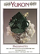
| ; \ y \ ' A v:.; «# %,r ' , \ 4 ; . % . ' *> ‘ •■' Jfc ,-V .■*23r * $ ¥ YS a H ¥5 uJ® '...' d te ' ' *V J ~ ■ jgaafc£*V . 1 4 ':; -;. f ^ >• t * .i. * V X - , . ; n * *’yL ^ ...\0 4% r ;Y f ♦ V ^ •**$ ' ''• A * '. / T i l 'V T T y x r ("IflT A T T Tjl Wayne & Dona Leicht, 332...fSc ly _ y I / Y _ j - 1 - J Open Tues.-Sat. 10-5. (Closed Sun.-Mon.) K )\n\A photo by Harold and Erica...2 . M in e r a l o g y o f th e R a p id C reek a n d B i g F is h R iv e r A r e a Y u k o n T e r |
 | | Report (Issue volume) |
| Qc 1 'i!:5 E; 3t "") fr ; Y(..1 '· I OE ,, ~6 1J64 f \ i • t ... , ...Printer, Ottawa, from the Geological Survey of Canada, 601 Booth St., Ottawa, and at the following Canadian...Cath erin e St. West or through your bookseller. A deposit copy of this publication is also available...reference in public libraries across Canada. Price $1.30 Catalogue No. M41-8/8-1 Price subject to change without...Controller of Stationery Ottawa, Canada 1964 Page 1 e INTRODUCTION 2 3 4 4 5 6 6 7 11 21 39 101 107 113 133 |
 | | Report (issue) |
| and pr other a . < »<.. .•«; J — ;cr3r- ces iti- ate to CRYSTALS NOT PISTOLS Th. i a series cn uuncuiu...Brantley iii PREFACE Information Circular 24 is a compendium of viable mineral collecting sites through...operated during the spring, summer, and fall months for a collecting fee. Those not commercially operated arc... The prospect of a continued privilege of collecting minerals should dictate a special emphasis on...but later identified as a chromium spodumene, the mineral hiddenite has become a valuable collector's item |
| | Report (issue) |
| citizens of North Carolina. The Section conducts a number of basic and applied research projects in environmental...systematic geologic mapping. Services constitute a major portion ofthe Sections's activities and include...Geological Survey Section publishes results of research in a series of Bulletins, Economic Papers, Information...Series, Geologic Maps, and Special Publications. For a complete list of publications or more information...Brantley iii PREFACE Information Circular 24 is a compendium of viable mineral collecting sites throughout |
 | | Report (issue) |
| LIBRARY a RALEIGH 1956 1610 MSC RAUIGH.NC 27699-1610 919-715-4161 CONTENTS INTRODUCTION . 1 PURPOSE... . . . . # . WHERE TO COLLECT f ... f ... . . 1 2 3 5 THE MINERAL LOCALITIES OF NORTH CAROLINA BY...COUNTY ................. 7 Emerald, Hiddenite and Associated Minerals f , 7 Rutile and Rutilated Quartz...Quartz, Goethite and Graphite, 9 ALLEGHANI COUNTY 1± Manganese ....... f 11 Barite , 11 Copper . 11...Actinolite. 0 , f # Minerals of the Hamme-Tungsten District . Amethyst Kyanite 0 \ \ . .."..... . Beryl |
 | | Report (volume) |
| EDWARD H. COBB . G E O L O G I C A L S U R V E Y B U L L E T I N 1246 A n inventory of the mines and...----------------1 Introduction-----------------------------------------------------1 Purpose and scope... . . . . . . . . . . . . . . . . . . . . . . . . 1 Organization and method of presentation- - - - - -...- - - - - - - - - - - - - - - - - - - - - - - - - 7 Bering Sea region---- - - - - - - - -- - - - -- -...- - - - - - -: --- - -- -- - ---16 Anchorage d i a t r i c t - - - - - - - - - - _ - - - - - - _ - - |
 | | Report (volume) |
| of Colorado: A 100- Year Record By EDWIN B. ECKEL GEOLOGICAL SURVEY BULLETIN 1 1 14 A summary of the...______________ ______ 1 1 3 4 6 7 11 12 16 28 31 364 ILLUSTRATION PLATE 1. Map showing selected...________________________________ In pocket III NOTE Plate 1, map showing selected mineral localities and metallic... MINERALS OF COLORADO: A 100-YEAR RECORD By EDWIN B. EcKEL ABSTRACT This is a summary of the known...1858, when gold was discovered, through 1957 (with a few additions for 1958 and 1959) is supplemented by |
 | | Journal (issue) |
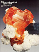
| Note our m ailing addressn P. (7 1 4 ) 494-7695 ... 494-5155 1 6 2 1 , Laguna Beach, CA 9 2 6 5 2 . ...Ann Arbor, Ml George W. Robinson Natl. Museums of Canada Ottawa, Ontario Abraham Rosenzweig Tampa, FL Associate...paragenesis of the Little Three mine pegmatites, Ramona district, San Diego County, California ..................Foord, L. B. Spaulding R. A. Mason & R. F. Martin , California locality index ........................129 by A. R. Kampf & the Southern California Chapter of the Friends of Mineralogy, Locality Index Committee |
 | | Report (issue) |
| No. 7 Woolman, Government Printer, South Australia, 1983 REF 349.994, N668c Noble, R. A. Catalogue...Bibliography. ISBN 0 7243 6247 9. ome Co \"] 1. Mineralogy—South Australia. |. Just, J. (Juri). Il...Handbook (South Australia. Dept. of Mines and Energy); 7) 549.99423 ISSN 0726-1519 Keywords: Mineralogy/C...chrysocolla. INTRODUCTION The original idea for a catalogue of South Australian minerals came from Johannes...attracting many migrants and in 1841 he published a booklet called The Mineral Kingdom of South Australia |
 | | Report (issue) |
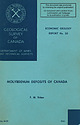
| DEPOSITS OF CANADA F. M. Vokes $4.50 1963 MOLYBDENUM DEPOSITS OF CANADA 2,500-1962-1992 56160-5-1 Plate...Molybdenite Corporation of Canada, Limited (June 1958). GEOLOGICAL SURVEY OF CANADA ECONOMIC GEOLOGY REPORT...MOLYBDENUM DEPOSITS OF CANADA By F. M. Vokes DEPARTMENT OF MINES AND TECHNICAL SURVEYS CANADA ROGER DUHAMEL...STATIONERY OTTAWA, 1963 Price $4.50 Cat. No. M43-2062 A French translation of this report is being prepared...most of the important molybdenum-bearing areas in Canada. Because of the growing interest in molybdenum |
 | | Book (edition) |
| publishers. XIII THE MAPLE PRESS COMPANY, YORK, PA. a PREFACE TO THE FOURTH EDITION The progress of the...it advisable While striving to keep to prepare a^ fourth edition of this textbook. thought and to...material and give the book the character of a handbook. With a view to its usefulness to the student temptation...and prices have been taken from two publications: (1) Mineral Resources of the United States, issued annually...end of a period in mineral production and activity and also of high prices. — Then began a period |
 | | Report (Issue volume) |
| MISCELLANEOUS REPORT 8 Issued by THE GEOLOGICAL SURVEY OF CANADA Department of Energy, Mines and Resources, Ottawa...mail from information Canada, Ottawa, and at the following information Canada bookshops: HALIFAX i 735...Ottawa, 1964 R evised 1972 Page I • INTRODUCTION 2 • A noie on Canadian gems 3 • Becoming acquainted with...Care of specimens 6 • Collecting in Canada 6 • Mineral and rock sets 7 • Abbreviations used in references...references 11 • NEW BRUNSWICK 31 • NOV A SCOTIA and PRINCE EDWARD ISLAND 67 • NEWFOUNDLAND 89 e APPENDICES 89 |
 | | Report (edition) |
| 00141189 1 v < 2 £ m- c oi; c» tt*s“S S Si! at tss^s isl^j ,4 g.sr « Zp *ogf <£ -2 a Ss E e-Sg...CT 1 ' s WJ= ~S 5! s „3 &«eq Sjg® . . PENNSYLVANIA 1 .8 ^2»SS 3 d 5-s &s z l|lt« 7* < ... OF MAP £-°§ ; ! 2-o-a GEOLOGIC A Cd ao S' G o ~ a c3A" a-S c o _>g-o ^ , Es"§-; < -£ 8 - S...RESOURCES TOPOGRAPHIC AND GEOLOGIC SURVEY Arthur A. Socolow, State Geologist II Copyrighted 1976 by...chalcopyrite crystals etched calcite, from French Creek mines, (courtesy of John S. White) Back cover: |
 | | Report (issue) |
| been found in the mining the nugget Jim, Placer County, California, in 1871 by a small girl in who...California's Golden Bear Nugg-et Frontispiece Preface 7 Introduction: Ian Campbell 13 Joseph Murdoch 20...in California 30 Crestmore 36 Pegmatite gem area of southern California 46 Cerro Gordo 49 History...Counties of California: Minerals and mineral lists Mining Districts of California Unvalidated entries in...make the Centennial volume an historical as well as a scientific record of California mineralogy. The interest |
 | | Book (edition) |
| 1825 mining opened the West- . —Charles W. Henderson, 1933 MINERALS of New Mexico STUART A. NORTHROP...PRINTING PLANT ALBUQUERQUE, NEW MEXICO, U. S. A. FOR IVAH 1 CONTENTS PREFACE ix Scope and plan of...INTRODUCTION 1 Previous work Highlights in the history of New Mexico mineralogy and mining 3 5 Prehistoric...Republic of Mexico American occupation— New Mexico a Territory of the United States Statehood Summary...SUBDISTRICTS, CAMPS, ETC. 569 BIBLIOGRAPHY 597 MAP: Mining Districts of New Mexico in pocket II. PREFACE |
 | | Report (issue) |
| to the Geological Survey at Washington and ask for a frank to return it UNITED STATES DEPARTMENT OF THE...________-___ Ruby district._______-___-____--._-_--.-__---_--__._______ Ruby area.______-_____--_---...area____-______.__--_-___--__-_-___-_________ 145 Long Creek and Bear Gulch..____________________ Fifth of July...______________________ Greenstone Creek.._______._________._._-_._.___._ Monument Creek.______________________________...Meketchum Creek._______________________________ Trail Creek____.________________________ Flint Creek and tributaries |
 | | Book (volume) |
| j /X XxT &A$f«.) ° S / A~C C\ A "\ i ?,_M •V?'. * 7 / ocl ^'V, V ^ yHr^s / \Tl\C0... y-GOLLE CENTERS 1^-v 1 \ \ \ \ \ \ \ >c *> TSpjl^'y 1 \ \\\\\ \\n. >. rs. \ \ \\\\\\\\/ \ 1 \ \ \ \ \ \...\ \ \ N. ^ *; jVV v' * "—"— IU / \ \ \ A,ri lrs\ r'xtf) / ~l Jr ^0 • ' -—-— The Geology...Geological Society of America Foundation. Following is a list of individuals, corporations, and government...bibliographical references and index. ISBN 0-8137-5219-1 All materials subject to this copyright and included |
 | | Report (issue) |
| figure follow. See U.S. Geological Survey (1996) for a description of the information content of each field...The data presented here are maintained as part of a statewide database on mines, prospects and mineral...BNOSS^ f^BN066 ^ BN059» ~y\ BN0607/ BN054 * Sg BN061 7 ?>.. BN029 BN118 BNOZ7 BN142 BN026 BN023 BN068 BN070'...Distribution of mineral occurrences in the Bendeleben 1:250,000-scale quadrangle, western Alaska This and...Resource Data File BN001 Site name(s): Idaho Creek Site type: Mine ARDFno.: BN001 Latitude: 65.241 |
 | | Report (issue) |
| to the Geological Survey at Washington and ask for a frank to return it UNITED STATES DEPARTMENT OF THE...847 C THE RIGHEY-LAMBERT GOAL FIELD HIGHLAND AND DAWSON COUNTIES MONTANA BY FRANK S. PARKER Contributions...coal beds_-.__.._____._____.______.______.___._. Mining.___________________.....__._...._._ ...____________...field, Richland and Dawson Counties, Mont__.-_-----_-_-____-__:-__._-__ In pocket 23. A, View looking southeast...Retah Table.________.____________..__;___.. 132 24. A, Exposures of Lebo shale member in badlands, T. 24 |
 | | Report (issue) |
| table Conclus ions References cited 1 2 3 4 6 ILLUSTRATION Plate 1. Preliminary metallogenic map of zinc...occurrences, east-central United States TABLE Table 1. Zinc, lead, and barite deposits and occurrences in... Introduction The accompanying metallogenic map and table are a compilation of information about zinc, lead, and barite...primarily as a basis for interpretation of distribution patterns as related to geologic features and as a regional...stages of exploration. The map is not intended to be a resource map. The preliminary map shows the deposits |
 | | Report (volume) |
| III. Lake Superior region _________________ Section 1. Michigan_____:_________________________ Summary of...Wisconsin___ Central and eastern Minnesota r Mesabi district _____________________-__ Vermilion district__...the Woods and Rainy Lake___________ Michipicoten district _,___________________ 108 108 108 178 ITS 196...series__________________________ 335 Marquette district _____________________ 335 Crystal Falls distr...Superior ____________________^_________ Michipicoten district _______________________ Keweeuawan series _________________ |
 | | Report (issue) |
| GEOLOGICAL SURVEY PROFESSIONAL PAPER 111()-A-L ON THE COVER Swamp-forest landscape at time of coal...Near the base of the largest Lepidodendron (left) is a large dragonfly (70-cm wingspread). (Reproduced from...Larese, Edward B. Nuhfer, Douglas G: Patchen, Richard A. Smosna, William H. Gillespie, Richard Lund, Warren...Sitterly, and Anthony T. Statler H. Georgia, by William A. Thomas and Howard R. Cramer I. Alabama and Mississippi...Mississippian stratigraphy of Alabama, by William A. Thomas Pennsylvanian stratigraphy of Alabama, by |
 | | Book |
| ARCTIC ISLANDS DURING THE PHANEROZOIC.E. Irving 1 GLOBAL TECTONICS AND THE CANADIAN ARCTIC CONTINENTAL...ASSO¬ CIATED SEDIMENTS, OFFSHORE BAFFIN ISLAND, CANADA .F. K. Wallace 81 THE TECTONO-SEDIMENTARY DEVELOPMENT...Geldsetzer 99 LATE PALEOZOIC OROGENY IN THE NORTHERN YUKON . STRATIGRAPHIC AND SEDIMENTARY HISTORY OF EARLY...STRATIGRAPHY, SOUTHERN EAGLE PLAIN, YUKON TERRITORY, CANADA . . . A. D. Graham 159 MESOZOIC EPICONTINENTAL...OF THE PERIAL FORMATION, NORTHWEST TERRITORIES, CANADA B. I. Chi and L. V. OF IM¬ Hills 241 MICROPLANKTON |
 | | Report (issue) |
| appreciated publications. Essentially a catalog of mineral species, the book is a basic reference for all persons...Division's series of lists of California minerals a series inaugurated in 1884 -with lo.'i minei-al species...of California, Santa Barbara College, as part of a continuing- cooperative laroject between tlie Division...Gabriel Motilin Studio. CONTENTS Page Preface 7 Introduction Historical 11 and geological sketches...California 16 Borax 18 Crestmore Pegmatite gem area of southern California Cerro Gordo The glaueophane |
 | | Report (volume) |
| SURVEY BULLETIN 1182-B A detailed estimate of the reserves of coal in Alabama and a description of the ~tratigraphy...field__________________________________________ Bear Creek coal bed___________________________________ J, K..._______ ___ ______ ___________ __ __________ Black Creek coal group_________________________________ Mary..._____________ --------------__________ m B1 2 4 4 7 7 8 8 10 11 12 13 13 14 15 15 16 20 21 22 22 29 31...ILLUSTRATIONS [All plates are in pocket] PLATE 1. Maps showing location of coal reserves and coal basins |


