 | | Book (chapter) | | Province C. H. Emeleus Reader in Geology, University of Durham and M. C. Gyopari Senior Hydrogeologist,... References Agrell, S.O. (1965) Polythermal metamorphism of limestones at Kilchoan, Ardnamurchan. Mineralogical...structure and petrology of the Tertiary volcanic rocks of Eigg. Muck and Canna, N.W. Scotland. Unpublished M.Sc...University of Durham. Allwright, A.E. and Hudson, J.D. (1982) The Sgurr of Eigg. Journal of the Geological...Society of London, 139, p. 215 (abstract). Almond, D.C. ( 1960) The Tertiary igneous geology of Strathaird | 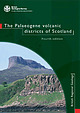 | | Report (edition) | | Regional Geology The Palaeogene volcanic districts of Scotland FOURTH EDITION CH Emeleus BR Bell Contributor:...regional geology: the Palaeogene volcanic districts of Scotland (Fourth edition). (British Geological Survey...Printed in the UK b>f Hawthornes, Nottingham C/0 7105 Authors CH Emeleus Department of Earth Sciences...University of Durham, Science Laboratories, South Road, Durham DH I 3LE BR Bell Division of Earth Sciences...Sciences, University of Glasgow, Gregory Building, Lilybank Gardens, Glasgow G 12 BQQ Contributor D Stephenson |  | | Book (chapter) | | Province C. H. Emeleus Reader in Geology, University of Durham and M. C. Gyopari Senior Hydrogeologist,... Chapter 2 The Isle of Skye Introduction INTRODUCTION Skye is one of the classic areas of Great Britain...Britain for the study of igneous geology. The sea cliffs and hills in the north of the island magnificently...succession of mainly basaltic lavas which overlie Mesozoic sediments intruded by a suite of dolerite sills...Basaltic dykes of the northwest-trending swarm cut all these rocks. The Cuillins and Red Hills of central Skye |  | | Report (issue) | | 2Itbratg BOUGHT W[TH THE INCOME OF THE SAGE ENDOWMENT FUND THE GIFT OF HENRY W. SAGE 1691 Cornell University...igneous rocl(S of Skye 3 1924 004 066 373 Cornell University Library The tine original of tiiis book...copyright restrictions in the United States on the use of the text. http://www.archive.org/details/cu31924004066373... MEMOIRS OF THE GEOLOGICAL SURVEY OF THE UNITED KINGDOM. THE TERTIARY IGNEOUS ROCKS OF SKYE. BY ALFRED...BT M.A., F.G.S. PUBLISHED BY ORDER OF THE LORDS COMMISSIONERS OF HIS MAJESTY'S TREASURY. GLASGOW : |  | | Book | | Sheth A Photographic Atlas of Flood Basalt Volcanism A Photographic Atlas of Flood Basalt Volcanism Hetu...Atlas of Flood Basalt Volcanism Hetu Sheth Department of Earth Sciences Indian Institute of Technology...https://doi.org/10.1007/978-3-319-67705-7 (eBook) Library of Congress Control Number: 2017958544 © Springer International...part of the material is concerned, specifically the rights of translation, reprinting, reuse of illustrations...methodology now known or hereafter developed. The use of general descriptive names, registered names, trademarks |  | | Report (issue) | | • \1ie,,r Llp Locl1 Corui k, sl10,,ri11g part of tl1c Ct1illi11 ra11gc. Tl1e mou11tai11s �ce11 a1·e...Sgi1rr Dt1bl1 Bl1eag i11 the foregrot111d; tl1e top of Sgi1rr Dearg (,\r jtl1 tl1e '' l11accessible l)i1111acle...tl1e brol,e11 rid 0·e of Sgi.1rr 11a l3cl11acl1dicl1; tl1e doL1ble sL11n111it of Sgi.11-r a' Gl1readaidl1...Gl1readaidl1 i11 t11e ce11tre; tl1e foL1r pc,ll'-:s of Sgt1rr a' l\111adaidl1; Bidei11 Druim r1a11 Raml1 (partl)r...\ra]le}'" 011 tl1e right. MEMOIRS OF THE GEOLOGICATj SURVEY OF THE UNITED I{INGDOll . ---=====· . |  | Bailey, E. B., Clough, C. T., Wright, W. B., Richey, J. E., Wilson, G. V. (1924) Tertiary and Post-Tertiary Geology of Mull, Loch Aline, and Oban. Memoirs of the Geological Survey. Geological Survey of Great Britain | Report (issue) | | """' ......_ - -:i .. Me1noirs of the Geological Survey, Scotland TERTIARY AND POST-TERTIARY GEOLOGY...OBAN (A DESCRIFTION OF PARTS OF SHEETS 43, • GEOLOGICAL MAP.) 44, 51, AND 52 OF THE BY E. B. B�.\...HOLTTUM, M.A. Pvblished by O,rder of the Lords Commiss·ione·rs of His Majesty's Treasury. Edinburgl1...Edinburgl1 Printed under tho Authority of H.l\iI. Stationery Office To be purchased from E. STANFORD, Ltd., 12...Cardiff & Belfast) ; or from any Agent for the sale of Ordnance Survey Maps ; or through any Bookseller |
|


