| Locality type: | Mine |
| Classification |
|---|
|
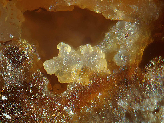
| Species: | Quartz var: Chalcedony |
| Formula: | SiO2 |
| Confirmation |
|---|
|
| Validity: | Confirmed |
| Confirmation Methods: | Visually Identified |
| Data |
|---|
|
| Mineral Data: | Click here to view Chalcedony data |
| Locality Data: | Click here to view St Georg Mine (Goslar'sche Gleie), Hasserode, Wernigerode, Harz, Saxony-Anhalt, Germany |
| Photo Gallery | View Gallery (3 photos) |
| Data Identifiers |
|---|
|
| Mindat Occurrence Record ID: | 921921 |
| Long-form Identifier: | 1:3:921921:2 |
| GUID (UUID V4): | 6acb2f7f-7d95-415e-acc6-b9e11cd7b736 |
| Nearest other occurrences of Chalcedony |
|---|
|
|
| 0.7km (0.4 miles) | ⓘSilberner Mann mine, Hasserode, Wernigerode, Harz, Saxony-Anhalt, Germany |
| 1.2km (0.8 miles) | ⓘQuartz occurrences, Hippeln, Hasserode, Wernigerode, Harz, Saxony-Anhalt, Germany |
| 7.3km (4.6 miles) | ⓘBüchenberg Mine, Elbingerode, Oberharz am Brocken, Harz, Saxony-Anhalt, Germany |
| 25.3km (15.8 miles) | ⓘNetzberg, Ilfeld, Harztor, Nordhausen District, Thuringia, Germany |
| 27.3km (17.0 miles) | ⓘKuckanstal, Bad Sachsa, Göttingen District, Lower Saxony, Germany |
| 30.7km (19.1 miles) | ⓘAllzunah Castle, Herrmannsacker, Harztor, Nordhausen District, Thuringia, Germany |
| 45.4km (28.2 miles) | ⓘTilkerode mining district, Mansfeld, Mansfeld-Südharz, Saxony-Anhalt, Germany |
| 63.0km (39.2 miles) | ⓘMammendorf Quarry, Mammendorf, Eichenbarleben, Hohe Börde, Börde, Saxony-Anhalt, Germany |
| 79.1km (49.2 miles) | ⓘAmsdorf lignite open pit, Röblingen am See, Seegebiet Mansfelder Land, Mansfeld-Südharz, Saxony-Anhalt, Germany |
| References |
|---|
|
|


St Georg Mine, Hasserode, Wernigerode, Harz, Saxony-Anhalt, Germany