| Locality type: | Area |
| Classification |
|---|
|
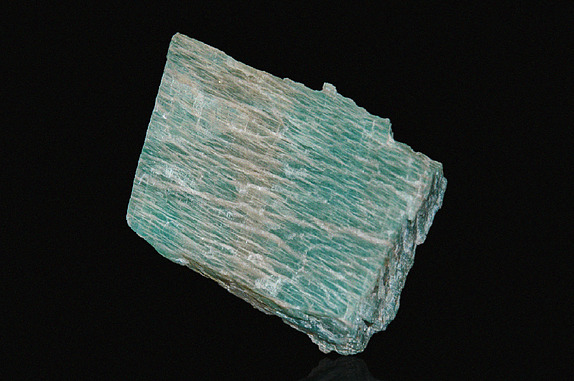
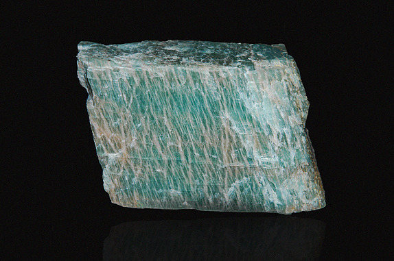
| Species: | Microcline |
| Formula: | K(AlSi3O8) |
| Comments: | Occurs in pegmatite, varies in colour from orange-red to white-beige |
| Confirmation |
|---|
|
| Validity: | Believed Valid |
| Associated Minerals Based on Photo Data: |
|---|
|
| Hematite | ⓘ3 photos of Microcline associated with Hematite at this locality. |
| Baryte | ⓘ2 photos of Microcline associated with Baryte at this locality. |
| Amazonite | ⓘ1 photo of Microcline associated with Amazonite at this locality. |
| Quartz | ⓘ1 photo of Microcline associated with Quartz at this locality. |
| Data |
|---|
|
| Mineral Data: | Click here to view Microcline data |
| Locality Data: | Click here to view Norland area (Shadow Lake area), Kawartha Lakes, Ontario, Canada |
| Data Identifiers |
|---|
|
| Mindat Occurrence Record ID: | 929557 |
| Long-form Identifier: | 1:3:929557:5 |
| GUID (UUID V4): | 00eee86b-9d67-46d2-bf5e-cb1fbde15737 |
| Nearest other occurrences of Microcline |
|---|
|
|
| 1.0km (0.6 miles) | ⓘHorscroft Mine, Laxton Township, Kawartha Lakes, Ontario, Canada |
| 1.1km (0.7 miles) | ⓘShadow Lake Occurrence, Laxton Township, Kawartha Lakes, Ontario, Canada |
| 3.1km (1.9 miles) | ⓘSouth Norland Occurrence, Laxton Township, Kawartha Lakes, Ontario, Canada |
| 10.7km (6.6 miles) | ⓘOutcrop, Clear Lake Road, Miners Bay area, Lutterworth Township, Minden Hills Township, Haliburton County, Ontario, Canada |
| 10.7km (6.6 miles) | ⓘMiners Bay area, Lutterworth Township, Minden Hills Township, Haliburton County, Ontario, Canada |
| 35.1km (21.8 miles) | ⓘHighway 18 roadcut, Dysart Township, Dysart et al, Haliburton County, Ontario, Canada |
| 47.1km (29.3 miles) | ⓘBear Lake diggings, Monmouth Township, Highlands East Township, Haliburton County, Ontario, Canada |
| 47.5km (29.5 miles) | ⓘTrappers Trail peristerite occurrence, Dudley Township, Dysart et al, Haliburton County, Ontario, Canada |
| 49.1km (30.5 miles) | ⓘMillar's Mine, Monmouth Township, Highlands East Township, Haliburton County, Ontario, Canada |
| 50.6km (31.4 miles) | ⓘTory Hill area, Monmouth Township, Highlands East Township, Haliburton County, Ontario, Canada |
| References |
|---|
|
|


Norland area, Kawartha Lakes, Ontario, Canada