| Locality type: | Valley |
| Classification |
|---|
|
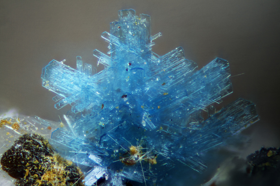
| Species: | Langite |
| Formula: | Cu4(SO4)(OH)6 · 2H2O |
| Confirmation |
|---|
|
| Validity: | Believed Valid |
| Data |
|---|
|
| Mineral Data: | Click here to view Langite data |
| Locality Data: | Click here to view Les Roches valley area (Bois de la Vèche area), Faymont, Le Val-d'Ajol, Épinal, Vosges, Grand Est, France |
| Data Identifiers |
|---|
|
| Mindat Occurrence Record ID: | 963143 |
| Long-form Identifier: | 1:3:963143:4 |
| GUID (UUID V4): | 8f03e6bf-ba83-473f-b5f5-e22edfd80578 |
| Localities for Langite in this Region |
|---|
|
| Vein No. 3 (Le bas Hérival), Les Roches valley area (Bois de la Vèche area), Faymont, Le Val-d'Ajol, Épinal, Vosges, Grand Est, France |
| Nearest other occurrences of Langite |
|---|
|
|
| 0.3km (0.2 miles) | ⓘVein No. 3 (Le bas Hérival), Les Roches valley area (Bois de la Vèche area), Faymont, Le Val-d'Ajol, Épinal, Vosges, Grand Est, France |
| 7.9km (4.9 miles) | ⓘMaxonchamp, Rupt-sur-Moselle, Épinal, Vosges, Grand Est, France |
| 19.5km (12.1 miles) | ⓘLe Thillot Quarry, Le Thillot, Épinal, Vosges, Grand Est, France |
| 52.9km (32.9 miles) | ⓘSankt Johann mine (Engelsbourg mine), Sankt Johann vein, Neuenberg, Sainte-Marie-aux-Mines, Colmar-Ribeauvillé, Haut-Rhin, Grand Est, France |
| 53.3km (33.1 miles) | ⓘl'Aphanèse mine, Sankt Johann vein, Neuenberg, Sainte-Marie-aux-Mines, Colmar-Ribeauvillé, Haut-Rhin, Grand Est, France |
| 65.9km (41.0 miles) | ⓘChamp Brècheté, Urbeis, Sélestat-Erstein, Bas-Rhin, Grand Est, France |
| 74.3km (46.1 miles) | ⓘGrandfontaine-les-Minières Mine, Grandfontaine, Molsheim, Bas-Rhin, Grand Est, France |
| 88.4km (54.9 miles) | ⓘHaus Baden Mine, Sehringen, Badenweiler Pb mining district, Badenweiler, Breisgau-Hochschwarzwald, Freiburg Region, Baden-Württemberg, Germany |
| 89.6km (55.7 miles) | ⓘAmalie Mine, Grunern, Staufen im Breisgau, Breisgau-Hochschwarzwald, Freiburg Region, Baden-Württemberg, Germany |
| 92.1km (57.2 miles) | ⓘSchlossberg Mine, Münstertal, Breisgau-Hochschwarzwald, Freiburg Region, Baden-Württemberg, Germany |
| References |
|---|
|
Escande, J.-C., Johan, Z., Lougnon, J., Picot, P., Pillard, F. (1973): Note sur la présence de minéraux de bismuth dans un filon de barytine et fluorine à Faymont, près Le Val-d'Ajol (Vosges). Bull. Soc. fr. Minéral. Cristallogr., 96, 398-399. |


Vein No. 3, Les Roches valley area, Faymont, Le Val-d'Ajol, Épinal, Vosges, Grand Est, France