 | | Journal (article/letter/editorial) | | Houston, Texas 77036 ROBERT 0. FAY Oklahoma Geological Survey Norman, Oklahoma 73019 Downloaded by [The Aga...713 15th Street NW Ardmore, Oklahoma 73401 OKLAHOMA Figure 1. Oklahoma counties. Mineral Locality...known for its gypsum crystals and barite roses, Oklahoma also boasts a variety of other species, including...unaware of the variety of minerals available from Oklahoma and think primarily of the prolific gypsum crystals...hundred years, extends into the northeast corner of Oklahoma and has produced notable specimens. Unfortunately | 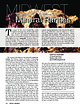 | | Journal (article/letter/editorial) | | “Midwest” states at its 2017 February show (add Oklahoma, Arkansas, Kentucky, and Tennessee); hence, they...four Midwestern states: North Dakota, Nebraska, Oklahoma, and Kentucky; these might still preserve the... Marion County, Tennessee Shepard 1835 1835 Nitromagnesite Nicajack Cave, Marion County, Tennessee...1835 1846 Schorlomite Magnet Cove, Hot Spring County, Arkansas Shepard 1846 1880/2002 Destinezite...distinguish from diadochite Alum Cave Bluff, Sevier County, Tennessee; cotype: Argenteau, Belgium Palache |  | | Book | | ROCKHOUND'S GUIDE TO THE GEMS & MINERALS OF OKLAHOMA © E.L.GILMORE 1992 No part of this book may...rockhounds to know where to look for minerals in Oklahoma. who would like This data has been drawn from...from many sources: The publications of the Oklahoma Geological Survey; Scientific publications; the observations...from the author’s own experience in rockhounding Oklahoma for the past 30 years. Some parts of this book...desire of the author to list all minerals found in Oklahoma. The work on this book has covered a period of |  | | Report (volume) | | Bayhorse Area, Custer County, Idaho Ordovician and Older Rocks of the Bayhorse Area, Custer County, Idaho...19110rdovician and older rocks of the Bayhorse area, Custer County, Idaho I by S.W. Hobbs and W.H. Hays. p. em...Stratigraphic-Ordovician. 2. Geology-Idaho-Custer County. I. Hays, William Henry, 1922II. Title. Ill...Quartzite 8 10 Distribution Character 10 Age 10 Ella Dolomite ll Distribution ll Character ll Age 13 Carbonate...27 Problems of correlation and age 28 Bayhorse Dolomite 28 Distribution and general features 28 Character |  | | Report (issue) | | Property in the Challis Area: Challis Area Group, Custer County, Idaho Virginia S. Gillerman Forrest S. Griggs...Property in the Challis Area: Challis Area Group, Custer County, Idaho Virginia S. Gillerman Forrest S. Griggs...Location map of the Challis Area mine sites, Custer County, Idaho. . . . . . . . . 6 HAZARD ASSESSMENT...Location map of the Challis Area mine sites, Custer County, Idaho. . . . . . . . . .6 Figure 01-1: Sketch...01-2: Site map of the Carrothers/Hines Mine, Custer County, Idaho (U.S. Geological Survey Clayton 7.5 minute |  | | Report (issue) | | IN OKLAHOMA By A. R. Leonard U. S. Geological Survey Prepared in Cooperation With The Oklahoma Water...Water Resources Board I960 GROUND WATER IN OKLAHOMA By A. R. Leonard One of the first requisites for...investigations was started in cooperation with the Oklahoma Geological Survey, and in 1949 this program was...with the Oklahoma Planning and Resources Board, In 1957 the State Legis ature created the Oklahoma Water...principally in the western half of the State, In Oklahoma current studies are directed toward determining |  | | Report (volume) | | Prof. G. D. Hubbard, Oberlin College, Oberlb Oklahoma........Prof. D. W. Ohern, Norman. Oregon........See Bauxite and Hallpysite. Asbestos. Tallapoosa County, with corundum deposits near Dudleyville; not found...commercial quantity or quality. Asphalt. Colbert County, small quantity has been shipped from near Leighton;...following localities: Bibb County, Pratts Ferry; Calhoun County, near Tampa; Clay County, T. 20, Pv. 7 E.; Jefferson...Jefferson County, at Elyton; Lee County, at Chewacla lime works; St. Clair County, at Gfeensport; Shelby |  | | Report (volume) | | district, Calhoun County: 2, 65, 102, 118. 2. r Beaver Creek Valley, St. Clair County and Greens Valley...Valley, Etowah County: 2, 102, 118. 3. r Leeds, Jefferson County: 2, 102. 4. r Longview-Saginaw district...district, Shelby County: 2, 102. 5. r Sinks district, Bibb County: 2, 28, 54, 67, 74, 102, 118, 143. 6. v Southeastern...Southeastern corner, Cherokee County: 1, 2, 54, 74, 102. 7. v Southern Cleburne County: 1, 2, 54, 74, 102. 8...Vincent-Harpersville-Wilsonville district, Shelby County: 2, 54, 102. ARIZONA General: 4, 8, 13, 43, 85 |  | | Report (issue) | | detrital zircon provenance of the Bayhorse anticline, Custer Country Idaho: Revised Neoproterozoic to lower...2020, Geologic map of the Bayhorse anticline, Custer County, Idaho: Idaho Geologic Survey Technical Report...Ordovician and older rocks of the Bayhorse area, Custer County, Idaho: U.S. Geological Survey Bulletin, v....Geologic map of the Bayhorse area, central Custer County, Idaho: U.S. Geological Survey Miscellaneous...southern portion of the Clayton quadrangle, Custer County, Idaho: M.S. thesis, Idaho State University |  | | Report (volume) | | ............................................. Oklahoma.................................................Mineral resources of Oklahoma and statistics of production from 1901 to 1914: Oklahoma Geol. Survey Bull...See Bauxite and Halloysite. Asbestos. Tallapoosa County, with corundum deposits near Dudleyville; not found...commercial quantity or quality. Asphalt. Colbert County, small quantity has been shipped from near Leighton;...following localities : Bibb County, Pratts Ferry; Calhoun County, near Tampa; Clay County, T. 20 S., R. 7 E.; |  | | Report (issue) | | ORG GEOLOGIC MAP OF THE BAYHORSE ANTICLINE, CUSTER COUNTY, IDAHO Daniel T. Brennan¹, David M. Pearson¹...detrital zircon provenance of the Bayhorse anticline, Custer Country Idaho: Revised Neoproterozoic to lower...Detrital Zircon Provenance of the Bayhorse Anticline, Custer Country Idaho: Revised Neoproterozoic to Lower...Ordovician and older rocks in the Bayhorse area, Custer County, Idaho: U.S. Geological Survey Bulletin 1891...Geologic map of the Bayhorse area, central Custer county, Idaho: U.S. Geological Survey Miscellaneous |  | | Report (volume) | | Middle Ordovician. The massive, commonly sandy, dolomite that unde·rlies the redefined Kinnikinic is 700...Ordovician fauna. This unit is named the Ella Dolomite. More than 2,000 feet of poorly sorted impure...and siltstone lies conformably below the ElHt Dolomite and is named the Clayton Mine Quartzite. The age...has distinctive lithology. Nearly 600 feet of dolomite, thin-bedded color-banded shaly limestone, and...l{innikinic Creek in the Bayhorse region, Custer . County, Idaho. He considered the :formation to be |  | | Journal (article/letter/editorial) | | FiridofGt~rnSphultirite ut IIIP Bulinut Zinc Mine, St. Luwrence County, tditor of NPW b r k ” unrl iipptwwl in the No~~er...and additions. Mlneral Index by Counties Brule County Elm Creek, IS mi. S. of Chamberlain, near junction...of Pierre Formation: barite (gray roses). Butte County Belle Fourche, 6 mi. W., secs. 23, 24, 25. and...Moreau River: barite* (similar to Elk Creek. Meade County, but smaller), calcite (yellow crystals), gypsum...Roberts 1987). Custer County General. There are many pegmatites. particularly in the Custer and Pringle |  | | Report (issue) | | Fork Mayfield Creek area............ 12 Challis-Custer Graben-East Fork-Jerry Peak area............. 18...meters each outside the cauldron complex and the Custer graben. Unit overlies the tuff of Ellis Creek and...Intrusive equivalent of unit Td, above CHALLIS-CUSTER GRABEN-EAST FORK-JERRY PEAK AREA RHYODACITE DOMES...VIEW DOLOMITE (UPPER DEVONIAN) Includes microgranular, medium dark- to medium light-gray dolomite that...light to very light gray, fine- to coarse-grained dolomite that weathers grayish orange or pale yellowish-brown |  | | Report (volume) | | Resources of the Borah Peak Wilderness Study Area, Custer County, Idaho U.S. GEOLOGICAL SURVEY BULLETIN 1718-E...Resources of the Borah Peak Wilderness Study Area, Custer County, Idaho By ANNA B.WILSON, SUSANNE U. JANECKE...for inclusion in the wilderness study area, Custer County, Idaho. CONTENTS Abstract El Summary El Character...Resources of the Borah Peak Wilderness Study Area, Custer County, Idaho By Anna B. Wilson, Susanne U. Janecke...(BLM) (fig. 1 and pi. 1). The study area is in Custer County, Idaho, between the towns of Mackay and Challis |  | | Report (volume) | | Related to Volcanic Subsidence in the Custer Graben, Custer County, Idaho, by D. H. Mclntyre and K. M....development of Van Horn Peak cauldron complex, Custer graben, and early stages of Thunder Mountain cauldron...ROCKS, UNDIVIDED Includes dolomite, siltstone, sandstone, and quartzite. Dolomite units moderately to highly...UNDIVIDED Includes shale, argillite, phyllite, dolomite, and quartzite. Locally deformed and recrystallized...probably more than 3,500 m INTERBEDDED QUARTZITE, DOLOMITE, AND ARGILLITE OF LEATON GULCH (ORDOVICIAN, CAMBRIAN |  | | Report (volume) | | Minnelusa Formation in Frannie Peak Canyon, Weston County, Wyo. 68. The breccia of the Minnelusa Formation...structure, and a breccia pipe in Redbird Canyon, Custer County, S. Dak___-____-_--____--_-_______ 69. A monolith...Gettys Canyon (sec. 16, T. 3 S., R. 1 E.), Custer County, S. Dak_..__._._._..-_._. 70. Diagram indicating...Chemical analyses of water from springs in Weston County, Wyo_______.___._._._____._.______-__-.-:.______----_-...of the Black Hills in parts of Weston County, Wyo., and Custer and Pennington Counties, S. Dak. A stratigraphic |  | | Journal (article/letter/editorial) | | LOUISIANA, MINNESOTA, MISSOURI, NEBRASKA NORTH DAKOTA, OKLAHOMA, SOUTH DAKOTA AND TEXAS BY MARGARET COOPER CONTENTS...Nebraska, North Dakota, 1, Part 2, and Part 3 258 Oklahoma, South Dakota, Texas and Section 2. Additional...North Dakota, Oklahoma, South Dakota, and Texas 262 souri, Nebraska, North Dakota, Oklahoma, South Dakota... Minnesota, Missouri, Nebraska, North Dakota, Oklahoma, South Dakota, and Texas. It is Part 4 of a comprehensive... Minnesota, Missouri, Nebraska, North Dakota, Oklahoma, South Dakota, and Texas; Index II, Geographical |  | | Report (issue) | | Malachite Strontianite Bismutite Cerussite Azurite Dolomite Hydromagnesite Ankerite SULFATES Chalcanthite...prospects in the lower Ludlow lignites. Harding County: 1. Abemathyite has been identified as a component...silica. Soluble In hydrochloric acid, yielding Custer County: 1. Allanite has been reported to occur as small...the Needles area. Runner (7) p 453. Pennington County: 1. Allanite occurs as microscopic inclusions in...9 H2O0.05 Insol. 1.12 Total 100.34± Occur. Custer County: 1. A greenish-black nodule of alluaudite 1 |  | | Report (issue) | | Ackerman, Walter, 1953, Louis Beryl Pegmatite, Custer County, South Dakota: Rapid City, South Dakota School...1952, Peerless Pegmatite, Keystone, Pennington County, South Dakota: Rapid City, South Dakota School...map and sections, Burnt [Burt?] Mica Mine, Custer County, South Dakota: U.S. Geological Survey Open-File...Report 49-18. Adams, J.W., 1953a, Aladin Mica Mine (Custer district), in Page, L.R., Norton, JJ., Stoll, W...60-61. Adams, J.W., 1953b, Big Spar No. 1 Mine (Custer district), 1953, in Page, L.R., Norton, JJ., Stoll |  | | Report (issue) | | History of the Clayton Mine and Smelter, Custer County, Idaho Victoria E. Mitchell Staff Report 10-8... History of the Clayton Mine and Smelter, Custer County, Idaho Victoria E. Mitchell Staff reports present...v History of the Clayton Mine and Smelter, Custer County, Idaho . . . . . . . . . . . . . . . . . . ... History of the Clayton Mine and Smelter, Custer County, Idaho Victoria E. Mitchell1 INTRODUCTION The...mine include the Clayton Mine Quartzite, the Ella Dolomite, the Kinnikinic Quartzite, and the Ramshorn Slate |  | | Journal (article/letter/editorial) | | rocks are represented by the Bayhorse Dolomite, Ella Dolomite, and Saturday Mountain Formation, and arenaceous... Ella Dolomite Bayhorse Dolomite Dolomite, limestone, siltstone Dolomite, quartzite Dolomite, siltstone...Garden Creek Phyllite Slate, sandstone Phyllite, dolomite Ramshorn, Skylark Hoodoo Quartzite Yellowjacket...(Atlanta lobe) of the Idaho batholith in Blaine, Custer, and Lemhi counties, and covers parts of the Hailey...Cambrian-Ordovician rocks of the Bayhorse area, Custer County, Idaho (from Hobbs and Hays, 1990). Locations |  | | Report (issue) | | deposits in the Wet Mountains area, Fremont and Custer Counties, Colorado By T. J. Armbrustmacher Open-File...deposits in the Wet Mountains area, Fremont and Custer Counties, Colorado 1 By T. J. Armbrustmacher Introduction...south-central Colorado in southern Fremont and Custer Counties. The thorium deposits occur in an area...by the Arkansas River on the north, the Custer-Huerfano County line on the south, the Use fault on the...the deposits in the area south of the Fremont-Custer County line generally trend northwest-southeast so |  | | Report (issue) | | GEOLOGIC LOGS PQR SELECTED DEEP WELLS IN PARTS OP OKLAHOMA, TEXAS, AND NEW MEXICO by Scott C. Christenson...GEOLOGICAL SURVEY Open-Pile Report 86-541 Oklahoma City, Oklahoma 1988 DEPARTMENT OF THE INTERIOR DONALD...Resources Division 215 Dean A. MoGee, Room 621 Oklahoma City, OK 73102 U.S. Geological Survey Books and... GEOLOGIC LOGS FOR SELECTED DEEP WELLS IN PARTS OF OKLAHOMA, TEXAS, AND NEW MEXICO By Scott C. Christenson...geologic logs for selected deep wells in parts of Oklahoma, Texas, and New Mexico was prepared by the U.S |  | | Report (issue) | | . • . . . . . . . . Section A. Beulah, Pueblo County, Colorado................................. Beulah...• • . Section B. South Hardscrabble Creek, Custer County, Colorado......................... Beulah limestone............... Section C. Specimen Hill, Fremont County, Colorado................................. Fremont...Section F. South Tunnel, Phantom Canyon, Fremont County, Colorado ....... ·.••..•••.• Fremont limestone...• Section F -1. Quarry, Phantom Canyon, Fremont County, Colorado................ Harding sandstone... |
|


