Log InRegister
Quick Links : The Mindat ManualThe Rock H. Currier Digital LibraryMindat Newsletter [Free Download]
Home PageAbout MindatThe Mindat ManualHistory of MindatCopyright StatusWho We AreContact UsAdvertise on Mindat
Donate to MindatCorporate SponsorshipSponsor a PageSponsored PagesMindat AdvertisersAdvertise on Mindat
Learning CenterWhat is a mineral?The most common minerals on earthInformation for EducatorsMindat ArticlesThe ElementsThe Rock H. Currier Digital LibraryGeologic Time
Minerals by PropertiesMinerals by ChemistryAdvanced Locality SearchRandom MineralRandom LocalitySearch by minIDLocalities Near MeSearch ArticlesSearch GlossaryMore Search Options
Search For:
Mineral Name:
Locality Name:
Keyword(s):
 
The Mindat ManualAdd a New PhotoRate PhotosLocality Edit ReportCoordinate Completion ReportAdd Glossary Item
Mining CompaniesStatisticsUsersMineral MuseumsClubs & OrganizationsMineral Shows & EventsThe Mindat DirectoryDevice SettingsThe Mineral Quiz
Photo SearchPhoto GalleriesSearch by ColorNew Photos TodayNew Photos YesterdayMembers' Photo GalleriesPast Photo of the Day GalleryPhotography

Nine Mile lode 1 (McCowans lode), Torrington district, Gough Co., New South Wales, Australia
This page is currently not sponsored. Click here to sponsor this page.
DisplayPhotosMapsSearch
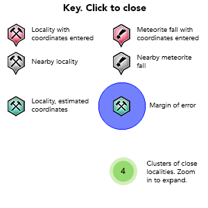
Key
Lock Map
Latitude & Longitude (WGS84): 29° 20' 13'' South , 151° 36' 20'' East
Latitude & Longitude (decimal): -29.33694,151.60556
GeoHash:G#: r6gc1g7gc
Locality type:Lode
KΓΆppen climate type:Cfb : Temperate oceanic climate


Located approximately 8kms Sout-West of Torrington and 12 km North of Emmaville
Operated as open cut and shallow pits.


Mineral List


10 valid minerals.

Rock Types Recorded

Note: this is a very new system on mindat.org and data is currently VERY limited. Please bear with us while we work towards adding this information!

Select Rock List Type

Alphabetical List Tree Diagram

Regional Geology

This geological map and associated information on rock units at or nearby to the coordinates given for this locality is based on relatively small scale geological maps provided by various national Geological Surveys. This does not necessarily represent the complete geology at this locality but it gives a background for the region in which it is found.

Click on geological units on the map for more information. Click here to view full-screen map on Macrostrat.org

Triassic
201.3 - 252.17 Ma


ID: 3191913
Mesozoic intrusive rocks

Age: Triassic (201.3 - 252.17 Ma)

Comments: New England Fold Belt

Lithology: Intrusive igneous rocks

Reference: Chorlton, L.B. Generalized geology of the world: bedrock domains and major faults in GIS format: a small-scale world geology map with an extended geological attribute database. doi: 10.4095/223767. Geological Survey of Canada, Open File 5529. [154]

Anisian - Induan
242 - 252.17 Ma


ID: 693070
Mole Granite

Age: Triassic (242 - 252.17 Ma)

Stratigraphic Name: Mole Granite

Description: Coarse to very coarse grained seriate leucocratic granite and minor microleucogranite. Marginal porphyritic leucogranite and microgranite; greisen.

Comments: igneous felsic intrusive; synthesis of multiple published descriptions

Lithology: Igneous felsic intrusive

Reference: Raymond, O.L., Liu, S., Gallagher, R., Zhang, W., Highet, L.M. Surface Geology of Australia 1:1 million scale dataset 2012 edition. Commonwealth of Australia (Geoscience Australia). [5]

Data and map coding provided by Macrostrat.org, used under Creative Commons Attribution 4.0 License


This page contains all mineral locality references listed on mindat.org. This does not claim to be a complete list. If you know of more minerals from this site, please register so you can add to our database. This locality information is for reference purposes only. You should never attempt to visit any sites listed in mindat.org without first ensuring that you have the permission of the land and/or mineral rights holders for access and that you are aware of all safety precautions necessary.

References

Sort by Year (asc) | by Year (desc) | by Author (A-Z) | by Author (Z-A)
Barnes R.G., Brown R.E., Brownlow J.W., Henley H.F., and Stroud W.J. (2001) Metallogenic Study and Mineral Deposit Data Sheets: Grafton-Maclean Metallogenic Map (SH/56-6, SH/56-7). Published by the Geological Survey of New South Wales.

 
Mineral and/or Locality  
Mindat Discussions Facebook Logo Instagram Logo Discord Logo
Mindat.org is an outreach project of the Hudson Institute of Mineralogy, a 501(c)(3) not-for-profit organization.
Copyright © mindat.org and the Hudson Institute of Mineralogy 1993-2024, except where stated. Most political location boundaries are Β© OpenStreetMap contributors. Mindat.org relies on the contributions of thousands of members and supporters. Founded in 2000 by Jolyon Ralph.
Privacy Policy - Terms & Conditions - Contact Us / DMCA issues - Report a bug/vulnerability Current server date and time: April 19, 2024 20:27:15 Page updated: June 19, 2018 12:21:08
Go to top of page