Queen Margaret Gold Mine, Bulong Goldfield, Kalgoorlie-Boulder Shire, Western Australia, Australia


| Latitude & Longitude (WGS84): | 30° 45' 9'' South , 121° 46' 28'' East |
|---|---|
| Latitude & Longitude (decimal): | -30.75272,121.77467 |
| GeoHash: | G#: qdw9519s7 |
| Locality type: | Mine |
| Köppen climate type: | BSh : Hot semi-arid (steppe) climate |
The Queen Margaret Gold Mine has produced 63 876.07 tonnes of ore at 32.59 g/t yielding 65 925.04 ounces of gold. It is estimated another 30 000 ounces was achieved before 1897, when official records were not kept. It accounts for 83% of the gold won from the Bulong Goldfield, therefore it can be said the Queen Margaret was the dominant mine in the area.
In 1896, the Queen Margaret Gold Mines Company was formed in Adelaide to operate the mine. A 20 head battery was erected in 1897. Water from the battery came from the nearby Princess Margaret lease which the company had taken over. A. Nicholas was mine manager till 1899, then W. Henderson took over. A.L. Hay was metallurgist. The company controlled 132 acres.
The main lode was 3 feet wide, with occasional rich gold patches wedged between the quartz and graphite. Unusually the oxidised ore reached the bottom of the workings at 600 feet, in the late 1890's the deepest shaft in Western Australia.
Trucker Michael Corbett was killed in the underground workings after being smothered in dust on January 6 1899.
The company closed the mine in 1903. Gold values had always been patchy with months of barren work, before a 1500 ounce patch would be un-covered. Two hundred men applied as tributers, and in 1905 it is reported 110 men were still working the mine.
In 1913, the mine is owned by Hudson, Brown, Cramp, and McFarland. Phillip William Nevill re-treated the tailings between 1931 to 1933. The mine was owned in 1933 by Wark, Kingsborough and Stevenson (surnames).
Modern exploration started in 1945. Pellew Harvey and Co, a London based engineering consultancy produced a report on the mine in 1946. Paringa Mining and Exploration drilled across 1947-48. The mine was owned in 1967 by F.K. Thompson (a licenced land surveyor) and T.N. O'Brien (former underground manager at Norseman Gold Mines NL). The had devoted much time to the lease, but failed to get approval from the Mines Department to start drilling.
Reports were produced about geology at the mine by G. Compton 1971, J.C. Lissiman 1972, G. Henderson 1973, and A. Watson in the late 1970's.
The Queen Margaret Gold Mines Limited was floated in 1980, and they refurbished the main shaft, conducted limited mapping, then the shaft re-flooded, and they abandoned the mine in 1983. Spargo Exploration conducted drilling on the lease from 1971-1981.
C. Giles produced a report on the mine in 1981, Munplex Resources PL 1980-84, R. Keele 1990, and AUR 1990 before the company collapsed. Mount Monger Gold Project Pty Ltd farmed into Spargo November 1991, then took over the entire lease in 1994. Later Anglo Gold Australia took over the lease in 2001, as a joint venture with Kairiki Energy.
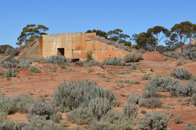
The mine is one kilometre west of the Bulong intersection, and just south of the Bulong Road. The site contains a large metal tank, metal headframe, various building foundations, and mining detritus, and battery sand remnants eroding into an ephemeral creek.
Commodity List
This is a list of exploitable or exploited mineral commodities recorded at this locality.Mineral List
6 valid minerals.
Rock Types Recorded
Select Rock List Type
Alphabetical List Tree DiagramRegional Geology
This geological map and associated information on rock units at or nearby to the coordinates given for this locality is based on relatively small scale geological maps provided by various national Geological Surveys. This does not necessarily represent the complete geology at this locality but it gives a background for the region in which it is found.
Click on geological units on the map for more information. Click here to view full-screen map on Macrostrat.org
| Archean 2500 - 4000 Ma ID: 833303 | ultramafic and minor mafic rocks 74475 Age: Archean (2500 - 4000 Ma) Description: Tremolite-chlorite-talc amphibolite, metapyroxenite, pyroxenite, peridotite, serpentinite, ultramafic schists, komatiite, high-Mg basalt; also chalcedony, silica, jasper, silcrete, silica cap rock on ultramafic rocks Comments: igneous ultramafic intrusive; meta-igneous ultramafic volcanic; synthesis of multiple published descriptions Lithology: Igneous ultramafic intrusive; meta-igneous ultramafic volcanic Reference: Raymond, O.L., Liu, S., Gallagher, R., Zhang, W., Highet, L.M. Surface Geology of Australia 1:1 million scale dataset 2012 edition. Commonwealth of Australia (Geoscience Australia). [5] |
| Neoarchean - Mesoarchean 2500 - 3200 Ma ID: 3187518 | Archean volcanic rocks Age: Archean (2500 - 3200 Ma) Comments: Yilgarn Craton Lithology: Greenstone belt; mafic-ultramafic volcanic rocks Reference: Chorlton, L.B. Generalized geology of the world: bedrock domains and major faults in GIS format: a small-scale world geology map with an extended geological attribute database. doi: 10.4095/223767. Geological Survey of Canada, Open File 5529. [154] |
Data and map coding provided by Macrostrat.org, used under Creative Commons Attribution 4.0 License
References


Queen Margaret Gold Mine, Bulong Goldfield, Kalgoorlie-Boulder Shire, Western Australia, Australia