Greasewood Draw Mining District, Emery County, Utah, USAi
| Regional Level Types | |
|---|---|
| Greasewood Draw Mining District | Mining District |
| Emery County | County |
| Utah | State |
| USA | Country |
This page is currently not sponsored. Click here to sponsor this page.


Type:
Mindat Locality ID:
37784
Long-form identifier:
mindat:1:2:37784:4
GUID (UUID V4):
2a9ca6f6-eee0-4f68-a1a4-a4af5a1400ca
The Greasewood Draw mining district of the San Rafael Swell U mining area is located 16 mi west of Green River in east-central Emery County. Mineralization was initially discovered in the mid-1950s and the district became an insignificant U-V producer. All the mines are small, but the largest producers were the Black Dragon, Uneva, and Cliff Dweller.
Greasewood Draw is geologically situated on the east flank of the San Rafael Swell of the Colorado Plateau. The Swell is an asymmetric, doubly plunging anticline, having a steeply dipping east limb. Mineralization in the San Rafael Swell district is predominantly hosted in the Upper Triassic Chinle Formation. The Chinle consists of three fining-upward, fluvial-lacustrine sandstone sequences. Sedimentological work on the Chinle suggests northwest-trending transport from a braided-stream environment in the southeast to floodplain and lacustrine environments progressively to the northwest.
The U ±V ores of the district are hosted in the moderately east-dipping (10° to 60°) Upper Triassic Chinle Formation (USGS Model 30c). The major host is the Moss Back Member, but U prospects are also found in the Temple Mountain and Monitor Butte Members. Orebodies in the Moss Back Member are hosted in tabular sandstones and conglomerates, typically within 40 ft of the base of the member and orebodies are typically less than 2000 tons. The principal ore minerals are uraninite and uranophane interstitial to sand grains and associated with bleaching. In addition to U-V, the ores may also be anomalous in As, Cu, and Mo (Mickle and others, 1977; Gloyn and others, 2003).
Select Mineral List Type
Standard Detailed Gallery Strunz Chemical ElementsCommodity List
This is a list of exploitable or exploited mineral commodities recorded from this region.Mineral List
Mineral list contains entries from the region specified including sub-localities10 valid minerals.
Rock Types Recorded
Note: data is currently VERY limited. Please bear with us while we work towards adding this information!
Rock list contains entries from the region specified including sub-localities
Select Rock List Type
Alphabetical List Tree DiagramDetailed Mineral List:
| ⓘ Baryte Formula: BaSO4 References: |
| ⓘ Celestine Formula: SrSO4 References: |
| ⓘ Fibroferrite Formula: Fe3+(SO4)(OH) · 5H2O |
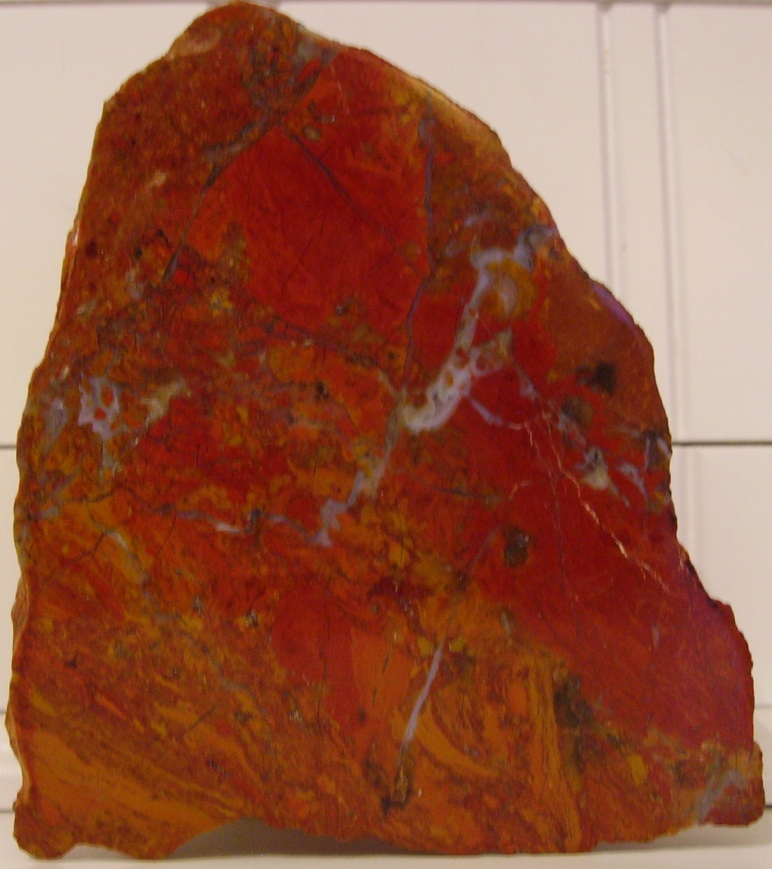
| ⓘ Hematite Formula: Fe2O3 References: |
| ⓘ 'Jasper' |
| ⓘ Malachite Formula: Cu2(CO3)(OH)2 Localities: |
| ⓘ Quartz Formula: SiO2 |
| ⓘ Quartz var. Agate |
| ⓘ Quartz var. Chalcedony Formula: SiO2 |
| ⓘ Strontianite Formula: SrCO3 References: |
| ⓘ Sulphur Formula: S8 |
| ⓘ Uraninite Formula: UO2 Localities: |
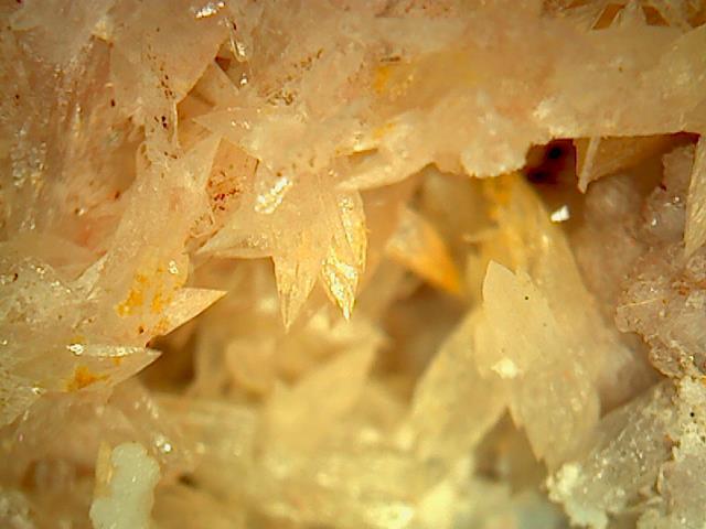
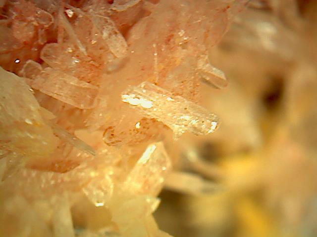
| ⓘ Uranophane Formula: Ca(UO2)2(SiO3OH)2 · 5H2O Localities: Black Dragon Mine, Greasewood Draw Mining District, Emery County, Utah, USA Cliff Dweller Prospect, Greasewood Draw Mining District, Emery County, Utah, USA Uneva Prospect, Greasewood Draw Mining District, Emery County, Utah, USA Unknown U Occurrence [1], Greasewood Draw Mining District, Emery County, Utah, USA |

List of minerals arranged by Strunz 10th Edition classification
| Group 1 - Elements | |||
|---|---|---|---|
| ⓘ | Sulphur | 1.CC.05 | S8 |
| Group 4 - Oxides and Hydroxides | |||
| ⓘ | Hematite | 4.CB.05 | Fe2O3 |
| ⓘ | Quartz var. Agate | 4.DA.05 | SiO2 |
| ⓘ | var. Chalcedony | 4.DA.05 | SiO2 |
| ⓘ | 4.DA.05 | SiO2 | |
| ⓘ | Uraninite | 4.DL.05 | UO2 |
| Group 5 - Nitrates and Carbonates | |||
| ⓘ | Strontianite | 5.AB.15 | SrCO3 |
| ⓘ | Malachite | 5.BA.10 | Cu2(CO3)(OH)2 |
| Group 7 - Sulphates, Chromates, Molybdates and Tungstates | |||
| ⓘ | Baryte | 7.AD.35 | BaSO4 |
| ⓘ | Celestine | 7.AD.35 | SrSO4 |
| ⓘ | Fibroferrite | 7.DC.15 | Fe3+(SO4)(OH) · 5H2O |
| Group 9 - Silicates | |||
| ⓘ | Uranophane | 9.AK.15 | Ca(UO2)2(SiO3OH)2 · 5H2O |
| Unclassified | |||
| ⓘ | 'Jasper' | - | |
List of minerals for each chemical element
| H | Hydrogen | |
|---|---|---|
| H | ⓘ Fibroferrite | Fe3+(SO4)(OH) · 5H2O |
| H | ⓘ Malachite | Cu2(CO3)(OH)2 |
| H | ⓘ Uranophane | Ca(UO2)2(SiO3OH)2 · 5H2O |
| C | Carbon | |
| C | ⓘ Malachite | Cu2(CO3)(OH)2 |
| C | ⓘ Strontianite | SrCO3 |
| O | Oxygen | |
| O | ⓘ Baryte | BaSO4 |
| O | ⓘ Celestine | SrSO4 |
| O | ⓘ Quartz var. Chalcedony | SiO2 |
| O | ⓘ Fibroferrite | Fe3+(SO4)(OH) · 5H2O |
| O | ⓘ Hematite | Fe2O3 |
| O | ⓘ Malachite | Cu2(CO3)(OH)2 |
| O | ⓘ Quartz | SiO2 |
| O | ⓘ Strontianite | SrCO3 |
| O | ⓘ Uraninite | UO2 |
| O | ⓘ Uranophane | Ca(UO2)2(SiO3OH)2 · 5H2O |
| Si | Silicon | |
| Si | ⓘ Quartz var. Chalcedony | SiO2 |
| Si | ⓘ Quartz | SiO2 |
| Si | ⓘ Uranophane | Ca(UO2)2(SiO3OH)2 · 5H2O |
| S | Sulfur | |
| S | ⓘ Baryte | BaSO4 |
| S | ⓘ Celestine | SrSO4 |
| S | ⓘ Fibroferrite | Fe3+(SO4)(OH) · 5H2O |
| S | ⓘ Sulphur | S8 |
| Ca | Calcium | |
| Ca | ⓘ Uranophane | Ca(UO2)2(SiO3OH)2 · 5H2O |
| Fe | Iron | |
| Fe | ⓘ Fibroferrite | Fe3+(SO4)(OH) · 5H2O |
| Fe | ⓘ Hematite | Fe2O3 |
| Cu | Copper | |
| Cu | ⓘ Malachite | Cu2(CO3)(OH)2 |
| Sr | Strontium | |
| Sr | ⓘ Celestine | SrSO4 |
| Sr | ⓘ Strontianite | SrCO3 |
| Ba | Barium | |
| Ba | ⓘ Baryte | BaSO4 |
| U | Uranium | |
| U | ⓘ Uraninite | UO2 |
| U | ⓘ Uranophane | Ca(UO2)2(SiO3OH)2 · 5H2O |
Fossils
There are 1 fossil localities from the PaleoBioDB database within this region.BETA TEST - These data are provided on an experimental basis and are taken from external databases. Mindat.org has no control currently over the accuracy of these data.
| Occurrences | 4 | ||||||
|---|---|---|---|---|---|---|---|
| Youngest Fossil Listed | 166 Ma (Middle Jurassic) | ||||||
| Oldest Fossil Listed | 170 Ma (Middle Jurassic) | ||||||
| Stratigraphic Units |
| ||||||
| Fossils from Region | Click here to show the list. | ||||||
| Fossil Localities | Click to show 1 fossil locality |
Localities in this Region
- Utah
- Emery County
- Greasewood Draw Mining District
- Emery County
- Utah
- Emery County
- Greasewood Draw Mining District
- Emery County
Other Regions, Features and Areas that Intersect
North America PlateTectonic Plate
- Chugar Group Area BasinBasin
- Great Plains DomainDomain
- Mojave DomainDomain
USA
- Colorado PlateauPlateau
This page contains all mineral locality references listed on mindat.org. This does not claim to be a complete list. If you know of more minerals from this site, please register so you can add to our database. This locality information is for reference purposes only. You should never attempt to
visit any sites listed in mindat.org without first ensuring that you have the permission of the land and/or mineral rights holders
for access and that you are aware of all safety precautions necessary.
References
services.arcgis.com (n.d.) https://services.arcgis.com/ZzrwjTRez6FJiOq4/arcgis/rest/services/Metal_Mineral_Resources_web_View/FeatureServer/6/41/attachments/41


Greasewood Draw Mining District, Emery County, Utah, USA