Home PageAbout MindatThe Mindat ManualHistory of MindatCopyright StatusWho We AreContact UsAdvertise on Mindat
Donate to MindatCorporate SponsorshipSponsor a PageSponsored PagesMindat AdvertisersAdvertise on Mindat
Learning CenterWhat is a mineral?The most common minerals on earthInformation for EducatorsMindat ArticlesThe ElementsThe Rock H. Currier Digital LibraryGeologic Time
Minerals by PropertiesMinerals by ChemistryAdvanced Locality SearchRandom MineralRandom LocalitySearch by minIDLocalities Near MeSearch ArticlesSearch GlossaryMore Search Options
The Mindat ManualAdd a New PhotoRate PhotosLocality Edit ReportCoordinate Completion ReportAdd Glossary Item
Mining CompaniesStatisticsUsersMineral MuseumsClubs & OrganizationsMineral Shows & EventsThe Mindat DirectoryDevice SettingsThe Mineral Quiz
Photo SearchPhoto GalleriesSearch by ColorNew Photos TodayNew Photos YesterdayMembers' Photo GalleriesPast Photo of the Day GalleryPhotography
╳Discussions
💬 Home🔎 Search📅 LatestGroups
EducationOpen discussion area.Fakes & FraudsOpen discussion area.Field CollectingOpen discussion area.FossilsOpen discussion area.Gems and GemologyOpen discussion area.GeneralOpen discussion area.How to ContributeOpen discussion area.Identity HelpOpen discussion area.Improving Mindat.orgOpen discussion area.LocalitiesOpen discussion area.Lost and Stolen SpecimensOpen discussion area.MarketplaceOpen discussion area.MeteoritesOpen discussion area.Mindat ProductsOpen discussion area.Mineral ExchangesOpen discussion area.Mineral PhotographyOpen discussion area.Mineral ShowsOpen discussion area.Mineralogical ClassificationOpen discussion area.Mineralogy CourseOpen discussion area.MineralsOpen discussion area.Minerals and MuseumsOpen discussion area.PhotosOpen discussion area.Techniques for CollectorsOpen discussion area.The Rock H. Currier Digital LibraryOpen discussion area.UV MineralsOpen discussion area.Recent Images in Discussions
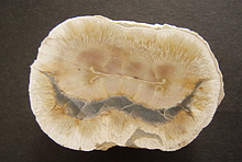

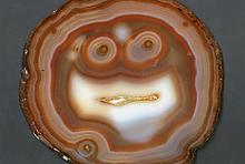


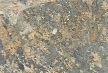


Field CollectingMontauk State park/Current river in Missouri

14th Jun 2018 20:22 UTCGreg Simmons
Thanks!
14th Jun 2018 21:24 UTCKen Doxsee

14th Jun 2018 22:18 UTCKevin Conroy Manager
If you want to do some "camera collecting" you're going to be close to the Viburnum Trend. From Eminence head east toward Ellington. Turn left on B (about 5 miles before Ellington). As you drive north Sweetwater Mine will be on your left. All of the mines are owned and operated by the Doe Run Company. They're well marked with signs, you can't miss the turn-offs! Highway B dead ends into 72. Turn left on TT (which turns into KK) and continue north toward Viburnum. Along the way you'll pass by Fletcher, West Fork, Brushy Creek and Buick mines. These are the majority of the mines still operating. If you want more info see https://www.mindat.org/lsearch.php?from=nsearch&loc=viburnum+trend
Highway KK will dead end into 32. Turn left, continue to Salem, turn right on 68, continue north until you reach I-44 in St James (there's a good winery there on the north outer road!), go east on I-44 to the Leasburg/Onandago Cave exit then follow the signs.
Have fun!
14th Jun 2018 22:37 UTCGreg Simmons
Thanks Kevin. I thought we'd be near Viburnum Trend. Great tip on keeping an eye out in the water. I hear it's really clear.
28th Jun 2018 21:08 UTCGreg Simmons
It seemed that most of what was in the river and along shore was karst bedrock, as it would be expected, but that made it hard to determine if any of what I was seeing would be considered agate. Admittedly, I'm not well versed in the different kinds of agates and this is my first venture to this region so I went into it a bit ignorant.
Look for pics soon.


Mindat.org is an outreach project of the Hudson Institute of Mineralogy, a 501(c)(3) not-for-profit organization.
Copyright © mindat.org and the Hudson Institute of Mineralogy 1993-2024, except where stated. Most political location boundaries are © OpenStreetMap contributors. Mindat.org relies on the contributions of thousands of members and supporters. Founded in 2000 by Jolyon Ralph.
Privacy Policy - Terms & Conditions - Contact Us / DMCA issues - Report a bug/vulnerability Current server date and time: April 23, 2024 15:25:27