Home PageAbout MindatThe Mindat ManualHistory of MindatCopyright StatusWho We AreContact UsAdvertise on Mindat
Donate to MindatCorporate SponsorshipSponsor a PageSponsored PagesMindat AdvertisersAdvertise on Mindat
Learning CenterWhat is a mineral?The most common minerals on earthInformation for EducatorsMindat ArticlesThe ElementsThe Rock H. Currier Digital LibraryGeologic Time
Minerals by PropertiesMinerals by ChemistryAdvanced Locality SearchRandom MineralRandom LocalitySearch by minIDLocalities Near MeSearch ArticlesSearch GlossaryMore Search Options
The Mindat ManualAdd a New PhotoRate PhotosLocality Edit ReportCoordinate Completion ReportAdd Glossary Item
Mining CompaniesStatisticsUsersMineral MuseumsClubs & OrganizationsMineral Shows & EventsThe Mindat DirectoryDevice SettingsThe Mineral Quiz
Photo SearchPhoto GalleriesSearch by ColorNew Photos TodayNew Photos YesterdayMembers' Photo GalleriesPast Photo of the Day GalleryPhotography
╳Discussions
💬 Home🔎 Search📅 LatestGroups
EducationOpen discussion area.Fakes & FraudsOpen discussion area.Field CollectingOpen discussion area.FossilsOpen discussion area.Gems and GemologyOpen discussion area.GeneralOpen discussion area.How to ContributeOpen discussion area.Identity HelpOpen discussion area.Improving Mindat.orgOpen discussion area.LocalitiesOpen discussion area.Lost and Stolen SpecimensOpen discussion area.MarketplaceOpen discussion area.MeteoritesOpen discussion area.Mindat ProductsOpen discussion area.Mineral ExchangesOpen discussion area.Mineral PhotographyOpen discussion area.Mineral ShowsOpen discussion area.Mineralogical ClassificationOpen discussion area.Mineralogy CourseOpen discussion area.MineralsOpen discussion area.Minerals and MuseumsOpen discussion area.PhotosOpen discussion area.Techniques for CollectorsOpen discussion area.The Rock H. Currier Digital LibraryOpen discussion area.UV MineralsOpen discussion area.Recent Images in Discussions


Improving Mindat.orgOxford and Watson Mine, Hardin County, Illinois, USA

24th Aug 2016 19:18 UTCJamison K. Brizendine 🌟 Expert
The Oxford and Watson mine is described on page 52 and 53 in Harry Foster Bain (1905):
General Statement – At a number of points throughout the county (Hardin) and outside of the areas specially mapped there are occurrences of spar and lead, and at a few places some mining has been carried on. As many of these places as possible were visited in 1903, and brief notes on a number of them are given below. The largest number of these mines is near Eichorn, which is located in sec. 11, T. 12 S., R. 7 E. . The Pell, Stewart, Cook, Oxford and Watson, Parkenson and Gordon are in this vicinity, the two last named being in Pope County. (Bain, 1905)
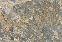
Oxford and Watson mine -- This property is near the Stewart (mine), in SW ¼, NE ¼ and NW ¼, SE ¼, sec. 13. A small prospect shaft has been sunk in the limestone, probably Ste. Genevieve, and near the sandstone. It has developed the presence of a breccia of which the fragments are limestone and the cementing material is mainly calcite. A few crystals of blende and galena were observed, but no considerable body of ore has been found. (Bain, 1905)
Edson Bastin (1931) did not mention the Oxford and Watson mine and most likely it was abandoned shortly after Bain’s writing.
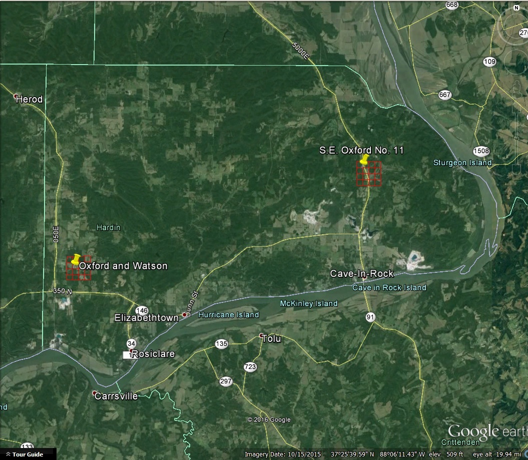
Denny et al. (2013) gave an approximate location for the S.E. Oxford No. 11 mine. It was located in Township 11 S, Range 9 E, NW ¼, NW ¼ . It was operated in the 1960s. Figure 1 in Lillie (1988) shows the general location of the mine.
Here is a screenshot of Hardin County, Illinois and the approximate locations of the two deposits using the Township, Ranges and Aliquots provided by the authors above. I drew in the baselines and meridians on Google Earth to better illustrate the locations of the two deposits. As you can see they are almost on the other side of the county.
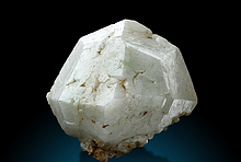
A new Mindat entry should be created for the Oxford and Watson Mine, with galena and sphalerite as two of the known minerals with Bain (1905) as the referenced source.
References Cited:
Bain, H.F., 1905, The fluorspar deposits of Southern Illinois: United States Geological Survey, Bulletin 255, 75 p.
Bastin, E.S., 1931, The fluorspar deposits of Hardin and Pope Counties, Illinois: State of Illinois, Illinois State Geological Survey, Bulletin 58, 116 p.
Denny, F.B, Devera, J.A., and Kittler, A., 2013, Bedrock Geology of Saline Mines Quadrangle, Gallatin and Hardin Counties, Illinois: Illinois State Geological
Survey, Illinois Geologic Quadrangle Map, IGQ Saline Mines-BG, 12 p.
Lillie, R.C., 1988, Minerals of the Harris Creek Fluorspar District, Hardin County, Illinois: Rocks and Minerals, v. 3, p. 210-226.
October 15, 2015, Hardin County, Illinois, United States: Google Earth Images, Landsat, last accessed August 24, 2016
29th Sep 2016 16:54 UTCJamison K. Brizendine 🌟 Expert
http://www.mindat.org/loc-274408.html


Mindat.org is an outreach project of the Hudson Institute of Mineralogy, a 501(c)(3) not-for-profit organization.
Copyright © mindat.org and the Hudson Institute of Mineralogy 1993-2024, except where stated. Most political location boundaries are © OpenStreetMap contributors. Mindat.org relies on the contributions of thousands of members and supporters. Founded in 2000 by Jolyon Ralph.
Privacy Policy - Terms & Conditions - Contact Us / DMCA issues - Report a bug/vulnerability Current server date and time: April 23, 2024 13:54:11