| Locality | Latitude | Longitude | Distance | Bearing |
|---|
| Nyakabingo Mine, Rulindo District, Northern Province, Rwanda | 1° 51' 47" S | 29° 58' 38" E | 0.0km (0.0 miles) | |
| Rutongo, Rulindo District, Northern Province, Rwanda | 1° 48' 36" S | 30° 3' 0" E | 10.0km (6.2 miles) | |
| Nyamiumba Mine, Rulindo District, Northern Province, Rwanda | 1° 49' 9" S | 30° 3' 28" E | 10.2km (6.3 miles) | |
| Ruli pegmatite, Gakenke District, Northern Province, Rwanda | 1° 51' 0" S | 29° 51' 35" E | 13.2km (8.2 miles) | |
| Gihira, Gacurabwenge, Kamonyi District, Southern Province, Rwanda | 1° 58' 46" S | 29° 52' 33" E | 17.2km (10.7 miles) | |
| Rushashi, Gakenke District, Northern Province, Rwanda | 1° 42' 0" S | 29° 50' 22" E | 23.8km (14.8 miles) | |
| Gitagata, Rulindo District, Northern Province, Rwanda | 1° 38' 1" S | 29° 52' 18" E | 28.1km (17.5 miles) | |
| Miyove, Gicumbi District, Northern Province, Rwanda | 1° 36' 34" S | 29° 58' 32" E | 28.2km (17.5 miles) | |
| Muhanga, Nyamabuye, Muhanga District, Southern Province, Rwanda | 2° 4' 48" S | 29° 45' 16" E | 34.6km (21.5 miles) | |
| Rusororo pegmatite, Muhororo, Ngororero District, Western Province, Rwanda | 1° 53' 59" S | 29° 40' 0" E | 34.8km (21.6 miles) | |
| Rongi Amblygonite Pegmatite, Muhororo, Ngororero District, Western Province, Rwanda | 1° 54' 19" S | 29° 40' 1" E | 34.9km (21.7 miles) | |
| Gatumba pegmatite, Gatumba, Ngororero District, Western Province, Rwanda | 1° 56' 13" S | 29° 39' 30" E | 36.4km (22.6 miles) | |
| Buranga pegmatite, Muhororo, Ngororero District, Western Province, Rwanda | 1° 55' 17" S | 29° 39' 15" E | 36.5km (22.7 miles) | |
| Nyamata pegmatite, Bugesera District, Eastern Province, Rwanda | 2° 10' 48" S | 30° 4' 12" E | 36.7km (22.8 miles) | |
| Kirengo pegmatite, Gatumba, Ngororero District, Western Province, Rwanda | 1° 57' 19" S | 29° 38' 34" E | 38.6km (24.0 miles) | |
| Gifurwe Mines, Gifurwe, Rusarabuge, Burera District, Northern Province, Rwanda | 1° 33' 20" S | 29° 48' 46" E | 38.8km (24.1 miles) | |
| Gifurwe, Rusarabuge, Burera District, Northern Province, Rwanda | 1° 33' 24" S | 29° 48' 35" E | 38.9km (24.1 miles) | |
| Kizibere, Mbuye, Ruhango District, Southern Province, Rwanda | 2° 10' 6" S | 29° 48' 22" E | 38.9km (24.2 miles) | |
| Musha-Ntunga, Rwamagana District, Eastern Province, Rwanda | 1° 55' 45" S | 30° 20' 32" E | 41.2km (25.6 miles) | |
| Rubindi pegmatite (Kabilizi), Bwira, Ngororero District, Western Province, Rwanda | 1° 55' 41" S | 29° 36' 20" E | 42.0km (26.1 miles) | |
| Bijyojyo, Ndaro, Ngororero District, Western Province, Rwanda | 1° 59' 30" S | 29° 37' 0" E | 42.6km (26.5 miles) | |
| Muhurgwe deposit, Cyabingo, Gakenke District, Northern Province, Rwanda | 1° 37' 0" S | 29° 40' 59" E | 42.7km (26.5 miles) | |
| Ntunga, Rwamagana District, Eastern Province, Rwanda | 1° 58' 0" S | 30° 21' 34" E | 44.0km (27.3 miles) | |
| Nyarusange pegmatite, Nyarusange, Muhanga District, Southern Province, Rwanda | 2° 6' 0" S | 29° 38' 59" E | 44.9km (27.9 miles) | |
| Kibingo pegmatite, Nyarusange, Muhanga District, Southern Province, Rwanda | 2° 4' 59" S | 29° 37' 59" E | 45.4km (28.2 miles) | |
| Rwaza, Musanze District, Northern Province, Rwanda | 1° 33' 4" S | 29° 40' 30" E | 48.3km (30.0 miles) | |
| Cyiri, Kinoni, Burera District, Northern Province, Rwanda | 1° 28' 33" S | 29° 43' 3" E | 51.9km (32.2 miles) | |
| Kigombe, Musanze District, Northern Province, Rwanda | 1° 31' 12" S | 29° 38' 47" E | 53.0km (32.9 miles) | |
| Rwamagana pegmatite, Rwamagana District, Eastern Province, Rwanda | 2° 0' 35" S | 30° 26' 59" E | 55.0km (34.1 miles) | |
| Ruhengeri, Northern Province, Rwanda | 1° 30' 32" S | 29° 37' 53" E | 55.1km (34.2 miles) | |
| Region | GADM number |
|---|
| Rwanda, Amajyaruguru | 189.1.0.0.0.0 |
| Rwanda, Amajyaruguru, Rulindo | 189.1.5.0.0.0 |
| Rwanda, Amajyaruguru, Rulindo, Shyorongi | 189.1.5.88.0.0 |
| Rwanda, Amajyaruguru, Rulindo, Shyorongi, Bugaragara | 189.1.5.88.405.0 |
| Rwanda, Amajyaruguru, Rulindo, Shyorongi, Bugaragara, Kabaraza | 189.1.5.88.405.2677 |
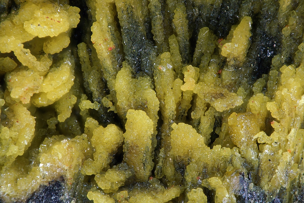

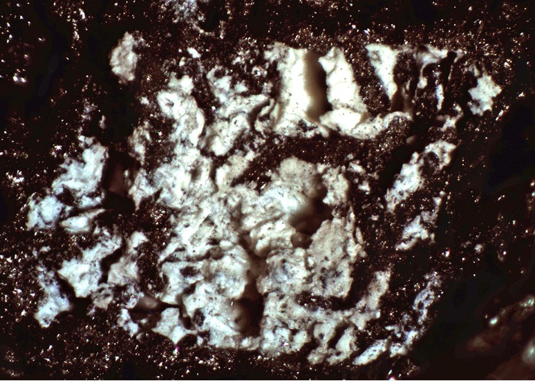

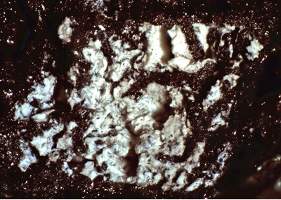


Nyakabingo Mine, Rulindo District, Northern Province, Rwanda