| Locality | Latitude | Longitude | Distance | Bearing |
|---|
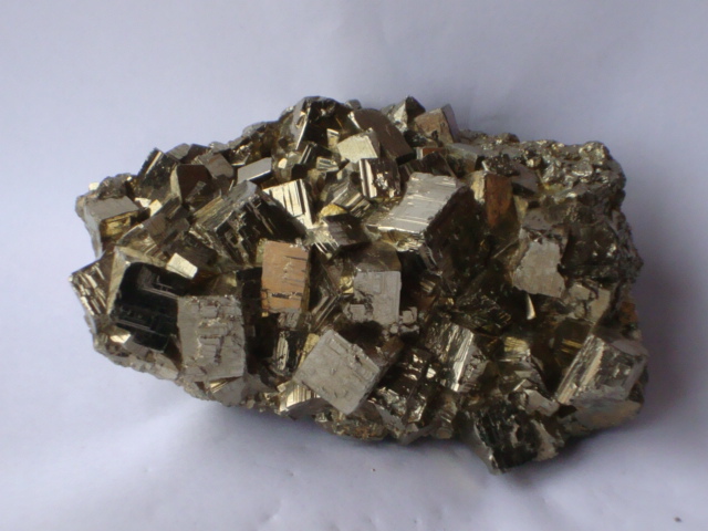
| Salvador Mine (Damiana mine), El Salvador mining district, Diego de Almagro, Chañaral Province, Atacama, Chile | 26° 14' 20" S | 69° 33' 34" W | 0.0km (0.0 miles) | |
| El Salvador Mine, El Salvador mining district, Diego de Almagro, Chañaral Province, Atacama, Chile | 26° 14' 39" S | 69° 33' 27" W | 0.6km (0.4 miles) | |
| El Salvador mining district, Diego de Almagro, Chañaral Province, Atacama, Chile | 26° 14' 44" S | 69° 37' 34" W | 6.7km (4.2 miles) | |
| Zafiro prospect, Mirasol Rubi Project, Diego de Almagro, Chañaral Province, Atacama, Chile | 26° 24' 45" S | 69° 39' 1" W | 21.3km (13.3 miles) | |
| Lithocap prospect, Mirasol Rubi Project, Diego de Almagro, Chañaral Province, Atacama, Chile | 26° 23' 42" S | 69° 41' 57" W | 22.2km (13.8 miles) | |
| Potrerillos, Chañaral Province, Atacama, Chile | 26° 26' 3" S | 69° 28' 59" W | 23.0km (14.3 miles) | |
| Mirasol Rubi Project, Diego de Almagro, Chañaral Province, Atacama, Chile | 26° 26' 18" S | 69° 39' 18" W | 24.1km (15.0 miles) | |
| Portezuelo prospect, Mirasol Rubi Project, Diego de Almagro, Chañaral Province, Atacama, Chile | 26° 27' 31" S | 69° 34' 29" W | 24.5km (15.2 miles) | |
| Caballo Muerto prospect, Caballo Muerto mining district, Chañaral Province, Atacama, Chile | 26° 21' 56" S | 69° 47' 1" W | 26.4km (16.4 miles) | |
| La Negra, Diego de Almagro, Chañaral Province, Atacama, Chile | 26° 21' 49" S | 69° 47' 18" W | 26.7km (16.6 miles) | |
| Sin Nombre, Diego de Almagro, Chañaral Province, Atacama, Chile | 26° 22' 9" S | 69° 47' 20" W | 27.1km (16.8 miles) | |
| Blanca, Diego de Almagro, Chañaral Province, Atacama, Chile | 26° 22' 19" S | 69° 47' 18" W | 27.2km (16.9 miles) | |
| No Estoy Solo, Diego de Almagro, Chañaral Province, Atacama, Chile | 26° 22' 38" S | 69° 47' 26" W | 27.7km (17.2 miles) | |
| Potrerillos Mine, Potrerillos, Chañaral Province, Atacama, Chile | 26° 29' 53" S | 69° 23' 57" W | 32.9km (20.5 miles) | |
| El Hueso Mine, Potrerillos, Chañaral Province, Atacama, Chile | 26° 29' 59" S | 69° 21' 47" W | 35.0km (21.7 miles) | |
| Jerónimo Mine, Potrerillos, Chañaral Province, Atacama, Chile | 26° 30' 6" S | 69° 20' 52" W | 36.0km (22.4 miles) | |
| Germania mine, Diego de Almagro, Chañaral Province, Atacama, Chile | 26° 22' 13" S | 69° 59' 56" W | 46.2km (28.7 miles) | |
| Resguardo Mine, Diego de Almagro, Chañaral Province, Atacama, Chile | 26° 21' 39" S | 70° 0' 57" W | 47.5km (29.5 miles) | |
| Iris Norte pit, Diego de Almagro, Chañaral Province, Atacama, Chile | 26° 26' 3" S | 70° 0' 30" W | 49.7km (30.9 miles) | |
| Iris pit, Diego de Almagro, Chañaral Province, Atacama, Chile | 26° 27' 17" S | 69° 59' 58" W | 50.0km (31.1 miles) | |
| Limón Mine, Diego de Almagro, Chañaral Province, Atacama, Chile | 26° 21' 30" S | 70° 2' 43" W | 50.2km (31.2 miles) | |
| Santo Domingo Mine, Chañaral Province, Atacama, Chile | 26° 27' 35" S | 70° 0' 18" W | 50.7km (31.5 miles) | |
| Santo Domingo Sur pit, Diego de Almagro, Chañaral Province, Atacama, Chile | 26° 27' 55" S | 70° 0' 37" W | 51.5km (32.0 miles) | |
| La Coipa mine, Diego de Almagro, Chañaral Province, Atacama, Chile | 26° 41' 59" S | 69° 30' 0" W | 51.6km (32.1 miles) | |
| Estrellita deposit, Diego de Almagro, Chañaral Province, Atacama, Chile | 26° 26' 57" S | 70° 1' 22" W | 51.7km (32.2 miles) | |
| Manto Tres Gracias Mine, Diego de Almagro, Chañaral Province, Atacama, Chile | 26° 23' 23" S | 70° 3' 33" W | 52.6km (32.7 miles) | |
| Salvadora mine, Taltal, Antofagasta Province, Antofagasta, Chile | 25° 47' 49" S | 69° 17' 16" W | 56.1km (34.9 miles) | |
| Franke mine, Taltal, Antofagasta Province, Antofagasta, Chile | 25° 49' 56" S | 69° 53' 51" W | 56.4km (35.1 miles) | |
| Rosario del llano Mine, Diego de Almagro, Chañaral Province, Atacama, Chile | 26° 21' 0" S | 70° 7' 0" W | 56.9km (35.3 miles) | |
| El Carmen mine, Diego de Almagro, Chañaral Province, Atacama, Chile | 26° 19' 59" S | 70° 9' 36" W | 60.8km (37.8 miles) | |


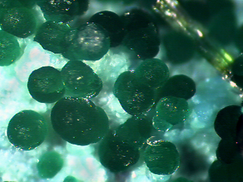


El Salvador Mine, El Salvador mining district, Diego de Almagro, Chañaral Province, Atacama, Chile