| Locality | Latitude | Longitude | Distance | Bearing |
|---|
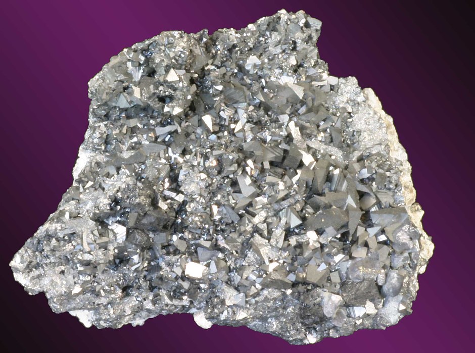
| Wycliffe deposit, Emmaville, Gough Co., New South Wales, Australia | 29° 27' 38" S | 151° 41' 44" E | 0.0km (0.0 miles) | |
| Tent Hill Creek, Tent Hill, Gough Co., New South Wales, Australia | 29° 27' 1" S | 151° 40' 23" E | 2.5km (1.5 miles) | |
| Little Ben alluvials, Emmaville, Gough Co., New South Wales, Australia | 29° 28' 48" S | 151° 40' 50" E | 2.6km (1.6 miles) | |
| Rangers Valley lead, Emmaville, Gough Co., New South Wales, Australia | 29° 29' 2" S | 151° 42' 5" E | 2.7km (1.6 miles) | |
| Scherfs Creek, Emmaville, Gough Co., New South Wales, Australia | 29° 29' 48" S | 151° 40' 50" E | 4.3km (2.7 miles) | |
| Scherps Creek (Scherps Creek alluvial tin), Emmaville, Gough Co., New South Wales, Australia | 29° 29' 57" S | 151° 40' 45" E | 4.6km (2.9 miles) | |
| Shadlers alluvials, Emmaville, Gough Co., New South Wales, Australia | 29° 29' 49" S | 151° 40' 21" E | 4.6km (2.9 miles) | |
| Big Ben Creek, Emmaville, Gough Co., New South Wales, Australia | 29° 29' 36" S | 151° 39' 47" E | 4.8km (3.0 miles) | |
| Tent Hill Swamp (Badgey Creek; Green Swamp Creek), Tent Hill, Gough Co., New South Wales, Australia | 29° 25' 33" S | 151° 39' 39" E | 5.1km (3.2 miles) | |
| Ben View Creek, Emmaville, Gough Co., New South Wales, Australia | 29° 26' 21" S | 151° 38' 53" E | 5.2km (3.2 miles) | |
| Glen Leigh alluvials, Gough Co., New South Wales, Australia | 29° 24' 53" S | 151° 42' 32" E | 5.2km (3.2 miles) | |
| Raphaels deposit, Emmaville, Gough Co., New South Wales, Australia | 29° 28' 27" S | 151° 38' 31" E | 5.4km (3.3 miles) | |
| Bourkes Hill, Emmaville, Gough Co., New South Wales, Australia | 29° 27' 44" S | 151° 38' 12" E | 5.7km (3.5 miles) | |
| Bouverets Gully (Boubett Gully), Tent Hill, Gough Co., New South Wales, Australia | 29° 24' 52" S | 151° 40' 1" E | 5.8km (3.6 miles) | |
| McMasters surfacing, Tent Hill, Gough Co., New South Wales, Australia | 29° 25' 28" S | 151° 39' 2" E | 5.9km (3.7 miles) | |
| Lewes loades, Tent Hill, Gough Co., New South Wales, Australia | 29° 24' 29" S | 151° 41' 0" E | 5.9km (3.7 miles) | |
| McMasters lode 1, Tent Hill, Gough Co., New South Wales, Australia | 29° 25' 24" S | 151° 38' 58" E | 6.1km (3.8 miles) | |
| McMasters lode 3 (McMasters prospect), Tent Hill, Gough Co., New South Wales, Australia | 29° 25' 13" S | 151° 39' 10" E | 6.1km (3.8 miles) | |
| McMasters lode 5, Tent Hill, Gough Co., New South Wales, Australia | 29° 25' 12" S | 151° 39' 8" E | 6.2km (3.8 miles) | |
| McMasters lode 4, Tent Hill, Gough Co., New South Wales, Australia | 29° 25' 12" S | 151° 39' 3" E | 6.2km (3.9 miles) | |
| McMasters lode 2 (McMasters prospect), Tent Hill, Gough Co., New South Wales, Australia | 29° 25' 16" S | 151° 38' 58" E | 6.2km (3.9 miles) | |
| McMasters lode 6, Tent Hill, Gough Co., New South Wales, Australia | 29° 25' 8" S | 151° 39' 7" E | 6.2km (3.9 miles) | |
| Wilson & Co prospect, Tent Hill, Gough Co., New South Wales, Australia | 29° 25' 45" S | 151° 38' 23" E | 6.4km (4.0 miles) | |
| CMC prospect, Tent Hill, Gough Co., New South Wales, Australia | 29° 24' 30" S | 151° 39' 55" E | 6.5km (4.0 miles) | |
| Kilmaurs alluvials, Tent Hill, Gough Co., New South Wales, Australia | 29° 24' 45" S | 151° 44' 1" E | 6.5km (4.0 miles) | |
| Portion 84, Tent Hill, Gough Co., New South Wales, Australia | 29° 26' 11" S | 151° 38' 0" E | 6.6km (4.1 miles) | |
| Ottery Mine (Ottery lodes), Tent Hill, Gough Co., New South Wales, Australia | 29° 24' 29" S | 151° 39' 39" E | 6.7km (4.2 miles) | |
| Thomsons prospect, Tent Hill, Gough Co., New South Wales, Australia | 29° 25' 45" S | 151° 38' 8" E | 6.8km (4.2 miles) | |
| East Britain prospect, Emmaville, Gough Co., New South Wales, Australia | 29° 26' 13" S | 151° 37' 50" E | 6.8km (4.2 miles) | |
| Pandapaws Gully, Tent Hill, Gough Co., New South Wales, Australia | 29° 25' 42" S | 151° 38' 8" E | 6.8km (4.2 miles) | |


Ottery Mine, Tent Hill, Gough Co., New South Wales, Australia