| Locality | Latitude | Longitude | Distance | Bearing |
|---|
| Spotted Leopard Mine, Cobar, Robinson Co., New South Wales, Australia | 31° 26' 42" S | 145° 48' 27" E | 0.0km (0.0 miles) | |
| Ringneck prospect, Cobar, Robinson Co., New South Wales, Australia | 31° 26' 38" S | 145° 50' 3" E | 2.5km (1.6 miles) | |
| Ringneck East prospect, Cobar, Robinson Co., New South Wales, Australia | 31° 26' 35" S | 145° 50' 18" E | 2.9km (1.8 miles) | |
| Bluebelle West prospect, Cobar, Robinson Co., New South Wales, Australia | 31° 27' 50" S | 145° 49' 46" E | 3.0km (1.8 miles) | |
| Powerline prospect (Knight shaft), Cobar, Robinson Co., New South Wales, Australia | 31° 28' 16" S | 145° 50' 9" E | 4.0km (2.5 miles) | |
| Bluebell Prospect, Cobar, Robinson Co., New South Wales, Australia | 31° 28' 3" S | 145° 50' 27" E | 4.1km (2.5 miles) | |
| CSA Mine (Old CSA mine; Tinto mine; QTS prospect), Cobar, Robinson Co., New South Wales, Australia | 31° 24' 29" S | 145° 47' 56" E | 4.2km (2.6 miles) | |
| Stoney Tank prospect, Cobar, Robinson Co., New South Wales, Australia | 31° 25' 8" S | 145° 50' 36" E | 4.5km (2.8 miles) | |
| Endeavor Mine (Elura Mine), Cobar, Robinson Co., New South Wales, Australia | 31° 24' 19" S | 145° 47' 49" E | 4.5km (2.8 miles) | |
| Mopone South prospect, Cobar, Robinson Co., New South Wales, Australia | 31° 26' 13" S | 145° 51' 15" E | 4.5km (2.8 miles) | |
| Water Tower workings, Cobar, Robinson Co., New South Wales, Australia | 31° 29' 14" S | 145° 48' 54" E | 4.8km (3.0 miles) | |
| Red Tank Prospect, Cobar, Robinson Co., New South Wales, Australia | 31° 24' 39" S | 145° 50' 17" E | 4.8km (3.0 miles) | |
| Mopone prospect, Cobar, Robinson Co., New South Wales, Australia | 31° 25' 18" S | 145° 51' 15" E | 5.1km (3.2 miles) | |
| Burns Prospect, Cobar, Robinson Co., New South Wales, Australia | 31° 28' 42" S | 145° 50' 58" E | 5.5km (3.4 miles) | |
| Old Reservoir Pits, Cobar, Robinson Co., New South Wales, Australia | 31° 28' 30" S | 145° 51' 21" E | 5.7km (3.5 miles) | |
| Tharsis Mine (Cobar Tharsis mine; King Edward mine; Ivanhoe mine; East Cobar copper mine; Extended mine; Phoenix mine; Diane Mine), Cobar, Robinson Co., New South Wales, Australia | 31° 29' 7" S | 145° 50' 50" E | 5.9km (3.6 miles) | |
| Royal George, Cobar, Robinson Co., New South Wales, Australia | 31° 26' 46" S | 145° 52' 34" E | 6.5km (4.0 miles) | |
| Marshe prospect, Cobar, Robinson Co., New South Wales, Australia | 31° 24' 3" S | 145° 45' 32" E | 6.7km (4.2 miles) | |
| Great Cobar North Mine (North Cobar mine), Cobar, Robinson Co., New South Wales, Australia | 31° 29' 54" S | 145° 50' 34" E | 6.8km (4.2 miles) | |
| Great Cobar Mine (Cobar copper mine), Cobar, Robinson Co., New South Wales, Australia | 31° 30' 0" S | 145° 50' 25" E | 6.9km (4.3 miles) | |
| Quandong prospect, Cobar, Robinson Co., New South Wales, Australia | 31° 23' 34" S | 145° 45' 58" E | 7.0km (4.4 miles) | |
| Leslie Mine, Cobar, Robinson Co., New South Wales, Australia | 31° 23' 1" S | 145° 49' 36" E | 7.0km (4.4 miles) | |
| Kendi prospect, Cobar, Robinson Co., New South Wales, Australia | 31° 22' 53" S | 145° 48' 15" E | 7.1km (4.4 miles) | |
| East Cobar Freehold Mine (The Freehold Mine), Cobar, Robinson Co., New South Wales, Australia | 31° 29' 54" S | 145° 51' 12" E | 7.4km (4.6 miles) | |
| East Cobar Mine, Cobar, Robinson Co., New South Wales, Australia | 31° 30' 3" S | 145° 51' 6" E | 7.5km (4.7 miles) | |
| Mopone grid, Cobar, Robinson Co., New South Wales, Australia | 31° 22' 21" S | 145° 47' 42" E | 8.1km (5.1 miles) | |
| Louth Road ironstones, Cobar, Robinson Co., New South Wales, Australia | 31° 24' 38" S | 145° 43' 41" E | 8.4km (5.2 miles) | |
| Dapville mine (Great Cobar Extended), Cobar, Robinson Co., New South Wales, Australia | 31° 30' 50" S | 145° 50' 42" E | 8.5km (5.3 miles) | |
| Fort Bourke prospect (Fort Bourke copper prospect), Cobar, Robinson Co., New South Wales, Australia | 31° 30' 39" S | 145° 51' 13" E | 8.5km (5.3 miles) | |
| New Cobar Mine (Cobar gold mine; Jubilee), Cobar, Robinson Co., New South Wales, Australia | 31° 31' 2" S | 145° 51' 15" E | 9.2km (5.7 miles) | |

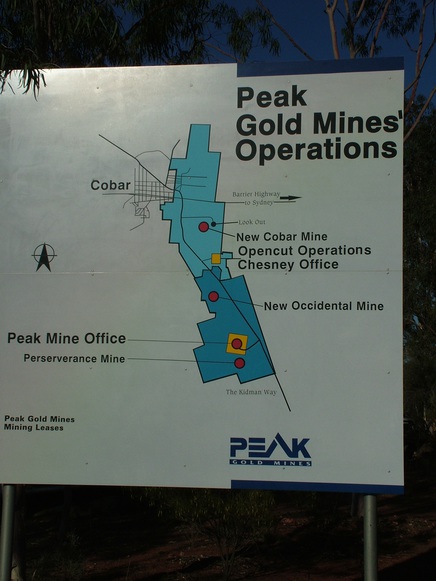


New Cobar Mine, Cobar, Robinson Co., New South Wales, Australia