| Locality | Latitude | Longitude | Distance | Bearing |
|---|
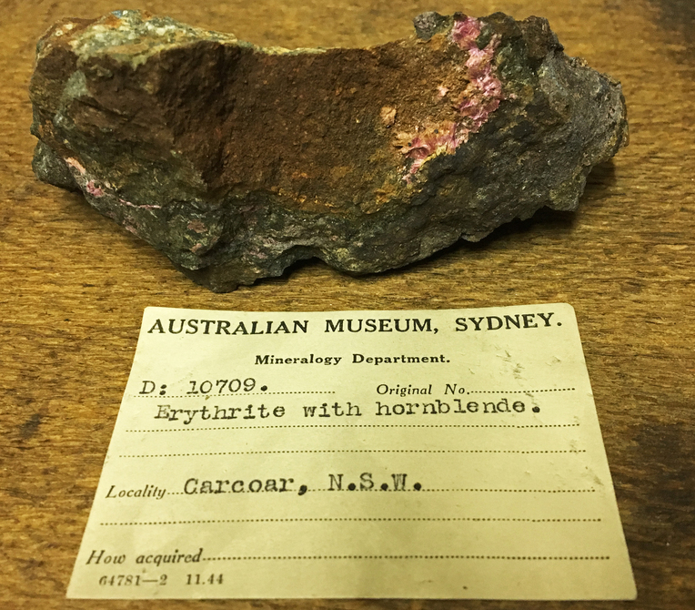
| Carcoar Mine (Carcoar cobalt mine; Wilsons mine; Wilsons quarry), Carcoar, Bathurst Co., New South Wales, Australia | 33° 37' 23" S | 149° 8' 54" E | 0.0km (0.0 miles) | |
| Stokes Hill (Stoke Hill; Stokehill Prospect), Carcoar, Bathurst Co., New South Wales, Australia | 33° 36' 27" S | 149° 7' 47" E | 2.4km (1.5 miles) | |
| Carcoar Iron Mine (Coombing Park Iron Mine), Carcoar, Bathurst Co., New South Wales, Australia | 33° 38' 28" S | 149° 7' 50" E | 2.6km (1.6 miles) | |
| Coombing Copper Mine, Carcoar, Bathurst Co., New South Wales, Australia | 33° 37' 53" S | 149° 7' 13" E | 2.8km (1.7 miles) | |
| Summers Copper Mine (Bald Hill Mine), Carcoar, Bathurst Co., New South Wales, Australia | 33° 39' 35" S | 149° 8' 33" E | 4.1km (2.6 miles) | |
| Three Mile diggings, Carcoar, Bathurst Co., New South Wales, Australia | 33° 37' 1" S | 149° 4' 15" E | 7.2km (4.5 miles) | |
| Mandurama, Bathurst Co., New South Wales, Australia | 33° 38' 58" S | 149° 4' 29" E | 7.4km (4.6 miles) | |
| Blayney Iron Mine, Blayney, Bathurst Co., New South Wales, Australia | 33° 33' 48" S | 149° 13' 23" E | 9.6km (6.0 miles) | |
| Brown's Creek Gold Mine, Blayney, Bathurst Co., New South Wales, Australia | 33° 31' 34" S | 149° 9' 22" E | 10.8km (6.7 miles) | |
| Browns Creek Gold Mine, Browns Creek, Bathurst Co., New South Wales, Australia | 33° 31' 31" S | 149° 9' 26" E | 10.9km (6.8 miles) | |
| Quigley's Hill Copper Mine (Osborn's Copper Mine), Blayney, Bathurst Co., New South Wales, Australia | 33° 34' 54" S | 149° 15' 40" E | 11.4km (7.1 miles) | |
| Sunnyridge Hills Prospect, Burnt Yards, Bathurst Co., New South Wales, Australia | 33° 36' 42" S | 149° 1' 15" E | 11.9km (7.4 miles) | |
| Neville, Bathurst Co., New South Wales, Australia | 33° 42' 48" S | 149° 13' 4" E | 11.9km (7.4 miles) | |
| Somers Trig Prospect (Black Hill Reef), Gallymont, Bathurst Co., New South Wales, Australia | 33° 44' 15" S | 149° 8' 34" E | 12.7km (7.9 miles) | |
| Gallymont, Bathurst Co., New South Wales, Australia | 33° 43' 54" S | 149° 6' 3" E | 12.8km (8.0 miles) | |
| Bakers Shaft, Burnt Yards, Bathurst Co., New South Wales, Australia | 33° 36' 43" S | 149° 0' 25" E | 13.1km (8.2 miles) | |
| Gallymont Mines (Gally Swamp Mines), Gallymont, Bathurst Co., New South Wales, Australia | 33° 44' 7" S | 149° 6' 14" E | 13.1km (8.2 miles) | |
| Blue Bird Mine (Bluebird Prospect), Blayney, Bathurst Co., New South Wales, Australia | 33° 34' 4" S | 149° 16' 32" E | 13.3km (8.3 miles) | |
| Prince of Wales Mine, Burnt Yards, Bathurst Co., New South Wales, Australia | 33° 34' 48" S | 149° 0' 34" E | 13.7km (8.5 miles) | |
| Burnt Yards, Bathurst Co., New South Wales, Australia | 33° 33' 53" S | 149° 1' 4" E | 13.7km (8.5 miles) | |
| Blayney, Bathurst Co., New South Wales, Australia | 33° 31' 59" S | 149° 15' 0" E | 13.7km (8.5 miles) | |
| Glendale North alluvials (Glendale Pit), Mandurama, Bathurst Co., New South Wales, Australia | 33° 35' 1" S | 149° 0' 27" E | 13.8km (8.5 miles) | |
| Crows Hill Mine (Mt Shorter Mine; Little Jessie Gold Mine; Gooleys Grid), Burnt Yards, Bathurst Co., New South Wales, Australia | 33° 30' 57" S | 149° 4' 22" E | 13.8km (8.6 miles) | |
| Glendale deposit, Mandurama, Bathurst Co., New South Wales, Australia | 33° 35' 11" S | 149° 0' 17" E | 13.9km (8.6 miles) | |
| Glendale North deposit, Mandurama, Bathurst Co., New South Wales, Australia | 33° 35' 1" S | 149° 0' 17" E | 14.0km (8.7 miles) | |
| Frenchman's workings, Junction Reefs, Mandurama, Bathurst Co., New South Wales, Australia | 33° 37' 9" S | 148° 59' 43" E | 14.2km (8.8 miles) | |
| Junction Reefs, Mandurama, Bathurst Co., New South Wales, Australia | 33° 37' 24" S | 148° 59' 28" E | 14.6km (9.0 miles) | |
| Sheahan-Grants Mine, Junction Reefs, Mandurama, Bathurst Co., New South Wales, Australia | 33° 37' 24" S | 148° 59' 28" E | 14.6km (9.0 miles) | |
| O'D Mine, Browns Creek, Bathurst Co., New South Wales, Australia | 33° 31' 11" S | 149° 3' 0" E | 14.6km (9.1 miles) | |
| Cornishmens workings, Junction Reefs, Mandurama, Bathurst Co., New South Wales, Australia | 33° 37' 6" S | 148° 59' 18" E | 14.8km (9.2 miles) | |


Carcoar Mine, Carcoar, Bathurst Co., New South Wales, Australia