| Locality | Latitude | Longitude | Distance | Bearing |
|---|
| St John's Quarry, Kapunda, North Mt Lofty Ranges, Mt Lofty Ranges, South Australia, Australia | 34° 22' 9" S | 138° 57' 47" E | 0.0km (0.0 miles) | |
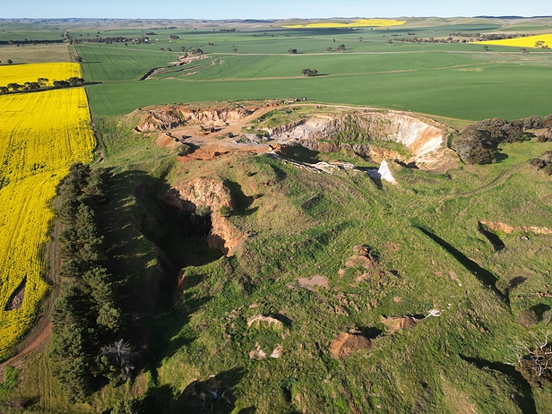
| Tom's Quarry, Kapunda, North Mt Lofty Ranges, Mt Lofty Ranges, South Australia, Australia | 34° 21' 36" S | 138° 59' 13" E | 2.4km (1.5 miles) | |
| Sobeys Mine, Tom's Quarry, Kapunda, North Mt Lofty Ranges, Mt Lofty Ranges, South Australia, Australia | 34° 21' 32" S | 138° 59' 15" E | 2.5km (1.6 miles) | |
| Mantina Quarry, Kapunda, North Mt Lofty Ranges, Mt Lofty Ranges, South Australia, Australia | 34° 21' 23" S | 138° 55' 54" E | 3.2km (2.0 miles) | |
| Koonunga Quarry, Kapunda, North Mt Lofty Ranges, Mt Lofty Ranges, South Australia, Australia | 34° 22' 38" S | 139° 0' 29" E | 4.2km (2.6 miles) | |
| Hillside Mine, Kapunda, North Mt Lofty Ranges, Mt Lofty Ranges, South Australia, Australia | 34° 21' 10" S | 138° 55' 6" E | 4.5km (2.8 miles) | |
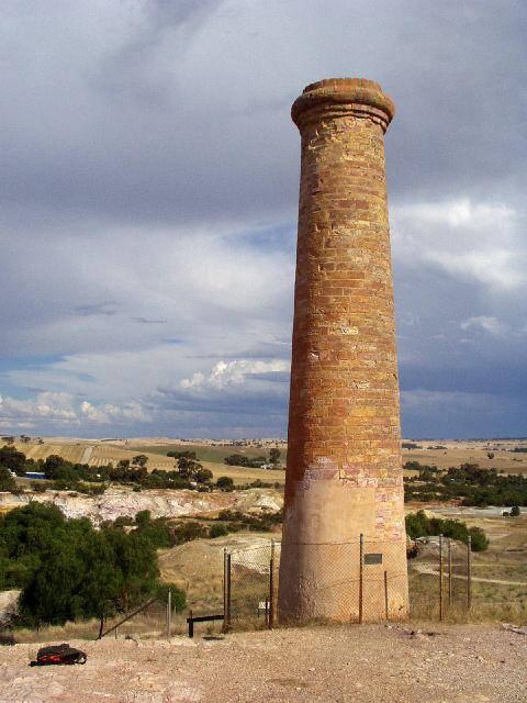
| Kapunda Copper Mine, Kapunda, North Mt Lofty Ranges, Mt Lofty Ranges, South Australia, Australia | 34° 20' 49" S | 138° 55' 4" E | 4.9km (3.0 miles) | |
| Main open cut, Kapunda Copper Mine, Kapunda, North Mt Lofty Ranges, Mt Lofty Ranges, South Australia, Australia | 34° 20' 50" S | 138° 55' 3" E | 4.9km (3.0 miles) | |
| Dutton open cut, Kapunda Copper Mine, Kapunda, North Mt Lofty Ranges, Mt Lofty Ranges, South Australia, Australia | 34° 20' 43" S | 138° 54' 53" E | 5.2km (3.2 miles) | |
| Charlotte open cut, Kapunda Copper Mine, Kapunda, North Mt Lofty Ranges, Mt Lofty Ranges, South Australia, Australia | 34° 20' 40" S | 138° 54' 52" E | 5.3km (3.3 miles) | |
| Matthews quarry, Kapunda, North Mt Lofty Ranges, Mt Lofty Ranges, South Australia, Australia | 34° 20' 34" S | 138° 54' 53" E | 5.3km (3.3 miles) | |
| Moppa Hill, Moppa Goldfield, Moppa, North Mt Lofty Ranges, Mt Lofty Ranges, South Australia, Australia | 34° 25' 27" S | 138° 57' 42" E | 6.1km (3.8 miles) | |
| Heggie's, Moppa Goldfield, Moppa, North Mt Lofty Ranges, Mt Lofty Ranges, South Australia, Australia | 34° 25' 37" S | 138° 57' 50" E | 6.4km (4.0 miles) | |
| Moppa Goldfield, Moppa, North Mt Lofty Ranges, Mt Lofty Ranges, South Australia, Australia | 34° 25' 54" S | 138° 57' 51" E | 7.0km (4.3 miles) | |
| St Kitts Phosphate Quarry, Truro, North Mt Lofty Ranges, Mt Lofty Ranges, South Australia, Australia | 34° 22' 38" S | 139° 5' 18" E | 11.5km (7.2 miles) | |
| Howards Quarry, Angaston, Barossa Valley, North Mt Lofty Ranges, Mt Lofty Ranges, South Australia, Australia | 34° 30' 0" S | 139° 1' 59" E | 15.9km (9.9 miles) | |
| Angas Property, Angaston, Barossa Valley, North Mt Lofty Ranges, Mt Lofty Ranges, South Australia, Australia | 34° 30' 0" S | 139° 1' 59" E | 15.9km (9.9 miles) | |
| Adelaide Brighton Cement Dolomite Quarry, Truro, North Mt Lofty Ranges, Mt Lofty Ranges, South Australia, Australia | 34° 25' 19" S | 139° 7' 39" E | 16.2km (10.0 miles) | |
| Walton Hill, Seppeltsfield, Barossa Valley, North Mt Lofty Ranges, Mt Lofty Ranges, South Australia, Australia | 34° 30' 2" S | 138° 52' 38" E | 16.6km (10.3 miles) | |
| Moculta Phosphate Quarry, Penrice, Barossa Valley, North Mt Lofty Ranges, Mt Lofty Ranges, South Australia, Australia | 34° 28' 46" S | 139° 5' 20" E | 16.8km (10.5 miles) | |
| Benita, Eudunda, North Mt Lofty Ranges, Mt Lofty Ranges, South Australia, Australia | 34° 14' 48" S | 139° 4' 27" E | 17.0km (10.6 miles) | |
| Crinnis Copper Mine, Angaston, Barossa Valley, North Mt Lofty Ranges, Mt Lofty Ranges, South Australia, Australia | 34° 30' 42" S | 139° 2' 8" E | 17.2km (10.7 miles) | |
| Wheal Barton, Truro, North Mt Lofty Ranges, Mt Lofty Ranges, South Australia, Australia | 34° 25' 6" S | 139° 8' 56" E | 17.9km (11.1 miles) | |
| Barossa Valley, North Mt Lofty Ranges, Mt Lofty Ranges, South Australia, Australia | 34° 31' 59" S | 138° 56' 59" E | 18.3km (11.3 miles) | |
| Gomersal Mine, Gomersal, Barossa Valley, North Mt Lofty Ranges, Mt Lofty Ranges, South Australia, Australia | 34° 31' 49" S | 138° 55' 19" E | 18.3km (11.4 miles) | |
| Smith Talc Asbestos Mine, Lyndoch, Barossa Valley, North Mt Lofty Ranges, Mt Lofty Ranges, South Australia, Australia | 34° 34' 10" S | 138° 54' 11" E | 22.9km (14.3 miles) | |
| Belvidere, Riverton, North Mt Lofty Ranges, Mt Lofty Ranges, South Australia, Australia | 34° 9' 5" S | 138° 49' 57" E | 27.1km (16.8 miles) | |
| New Hope, Riverton, North Mt Lofty Ranges, Mt Lofty Ranges, South Australia, Australia | 34° 7' 55" S | 138° 50' 7" E | 28.9km (17.9 miles) | |
| Emerald Hill, Keyneton, North Mt Lofty Ranges, Mt Lofty Ranges, South Australia, Australia | 34° 35' 37" S | 139° 8' 42" E | 30.0km (18.6 miles) | |
| Keyneton Proprietary mine, Towitta, North Mt Lofty Ranges, Mt Lofty Ranges, South Australia, Australia | 34° 32' 13" S | 139° 13' 48" E | 30.7km (19.1 miles) | |


Tom's Quarry, Kapunda, North Mt Lofty Ranges, Mt Lofty Ranges, South Australia, Australia