| Locality | Latitude | Longitude | Distance | Bearing |
|---|
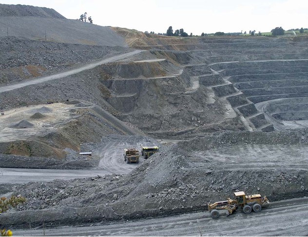
| Macraes Mine, Macraes (Macraes Flat), Otago Region, New Zealand | 45° 22' 34" S | 170° 27' 1" E | 0.0km (0.0 miles) | |
| Frasers pit, Macraes Mine, Macraes (Macraes Flat), Otago Region, New Zealand | 45° 22' 41" S | 170° 27' 27" E | 0.6km (0.4 miles) | |
| Southern pit, Macraes Mine, Macraes (Macraes Flat), Otago Region, New Zealand | 45° 22' 3" S | 170° 26' 35" E | 1.1km (0.7 miles) | |
| Innes Mills pit, Macraes Mine, Macraes (Macraes Flat), Otago Region, New Zealand | 45° 22' 9" S | 170° 26' 6" E | 1.4km (0.9 miles) | |
| Macraes (Macraes Flat), Otago Region, New Zealand | 45° 22' 54" S | 170° 25' 44" E | 1.8km (1.1 miles) | |
| Golden Ridge pit, Macraes Mine, Macraes (Macraes Flat), Otago Region, New Zealand | 45° 23' 8" S | 170° 28' 11" E | 1.9km (1.2 miles) | |
| Round Hill pit, Macraes Mine, Macraes (Macraes Flat), Otago Region, New Zealand | 45° 21' 25" S | 170° 25' 53" E | 2.6km (1.6 miles) | |
| Golden Point Mine, Macraes Mine, Macraes (Macraes Flat), Otago Region, New Zealand | 45° 21' 3" S | 170° 25' 37" E | 3.4km (2.1 miles) | |
| Deepdell pit (Maritana; Golden Bell), Macraes Mine, Macraes (Macraes Flat), Otago Region, New Zealand | 45° 20' 49" S | 170° 25' 35" E | 3.7km (2.3 miles) | |
| Coronation pit, Macraes Mine, Macraes (Macraes Flat), Otago Region, New Zealand | 45° 20' 4" S | 170° 23' 27" E | 6.6km (4.1 miles) | |
| Golden Bar pit, Macraes Mine, Macraes (Macraes Flat), Otago Region, New Zealand | 45° 24' 44" S | 170° 31' 47" E | 7.4km (4.6 miles) | |
| Coronation North pit, Macraes Mine, Macraes (Macraes Flat), Otago Region, New Zealand | 45° 19' 30" S | 170° 22' 55" E | 7.8km (4.8 miles) | |
| Bonanza Mine (Lot's Wife), Otago Region, New Zealand | 45° 28' 29" S | 170° 27' 42" E | 11.0km (6.8 miles) | |
| Nenthorn Consolidated Mine, Nenthorn Goldfields, Otago Region, New Zealand | 45° 28' 9" S | 170° 23' 21" E | 11.4km (7.1 miles) | |
| Prospectors Mine, Nenthorn Goldfields, Otago Region, New Zealand | 45° 28' 4" S | 170° 23' 3" E | 11.4km (7.1 miles) | |
| Taylors prospect (Home Reef), Macraes Mine, Macraes (Macraes Flat), Otago Region, New Zealand | 45° 25' 51" S | 170° 34' 33" E | 11.6km (7.2 miles) | |
| Victoria Mine, Nenthorn Goldfields, Otago Region, New Zealand | 45° 28' 26" S | 170° 22' 51" E | 12.1km (7.5 miles) | |
| Break O' Day Mine, Nenthorn Goldfields, Otago Region, New Zealand | 45° 28' 31" S | 170° 22' 58" E | 12.2km (7.6 miles) | |
| Croesus Mine, Nenthorn Goldfields, Otago Region, New Zealand | 45° 28' 34" S | 170° 23' 3" E | 12.3km (7.6 miles) | |
| Eureka Mine, Nenthorn Goldfields, Otago Region, New Zealand | 45° 28' 24" S | 170° 22' 35" E | 12.3km (7.6 miles) | |
| Homeward Bound Mine, Nenthorn Goldfields, Otago Region, New Zealand | 45° 28' 37" S | 170° 23' 11" E | 12.3km (7.6 miles) | |
| Nenthorn Goldfields, Otago Region, New Zealand | 45° 28' 26" S | 170° 22' 4" E | 12.6km (7.8 miles) | |
| Surprise Mine, Nenthorn Goldfields, Otago Region, New Zealand | 45° 28' 45" S | 170° 22' 28" E | 12.9km (8.0 miles) | |
| Fullarton diggings (Deep Sinking; Four Mile), Hyde, Dunedin City, Otago Region, New Zealand | 45° 20' 23" S | 170° 16' 58" E | 13.7km (8.5 miles) | |
| Dunback, Otago Region, New Zealand | 45° 23' 3" S | 170° 37' 44" E | 14.0km (8.7 miles) | |
| Mount Highlay Mine, Hyde, Dunedin City, Otago Region, New Zealand | 45° 16' 43" S | 170° 18' 46" E | 15.3km (9.5 miles) | |
| Makareao quarry, Dunback, Otago Region, New Zealand | 45° 23' 43" S | 170° 39' 26" E | 16.3km (10.1 miles) | |
| Hyde, Dunedin City, Otago Region, New Zealand | 45° 17' 49" S | 170° 15' 25" E | 17.5km (10.9 miles) | |
| Hyde diggings, Hyde, Dunedin City, Otago Region, New Zealand | 45° 17' 37" S | 170° 15' 8" E | 18.0km (11.2 miles) | |
| Ram Rock Quarry, Otago Region, New Zealand | 45° 34' 0" S | 170° 30' 2" E | 21.6km (13.4 miles) | |
Minerals recorded nearby (within 20 km)
Rock types recorded nearby (within 20 km)
Entries shown in red are rocks recorded for this region.


Macraes Mine, Macraes, Otago Region, New Zealand