| Locality | Latitude | Longitude | Distance | Bearing |
|---|
| Um Gheig Lead-Zinc Mine, Red Sea Governorate, Egypt | 25° 43' 0" N | 34° 28' 0" E | 0.0km (0.0 miles) | |
| Um Rus Mine, Red Sea Governorate, Egypt | 25° 28' 0" N | 34° 34' 59" E | 30.2km (18.7 miles) | |
| Um Naggat, Red Sea Governorate, Egypt | 25° 31' 0" N | 34° 13' 0" E | 33.5km (20.8 miles) | |
| El Atshan mine, Red Sea Governorate, Egypt | 25° 50' 11" N | 34° 6' 33" E | 38.2km (23.7 miles) | |
| Um Guruf, Red Sea Governorate, Egypt | 25° 48' 0" N | 34° 4' 59" E | 39.5km (24.5 miles) | |
| Mubarak Tin deposit, Abu Dabbab Massif, Red Sea Governorate, Egypt | 25° 21' 0" N | 34° 31' 45" E | 41.2km (25.6 miles) | |
| Abu Dabbab Ta-Sn deposit, Abu Dabbab Massif, Red Sea Governorate, Egypt | 25° 20' 45" N | 34° 32' 39" E | 42.0km (26.1 miles) | |
| Quaria Tin deposit, Abu Dabbab Massif, Red Sea Governorate, Egypt | 25° 20' 7" N | 34° 32' 36" E | 43.1km (26.8 miles) | |
| Abu Dabbab Massif, Red Sea Governorate, Egypt | 25° 19' 1" N | 34° 28' 8" E | 44.4km (27.6 miles) | |
| Unnamed quarry no. 1, Red Sea Governorate, Egypt | 25° 21' 7" N | 34° 13' 27" E | 47.3km (29.4 miles) | |
| Al Bahr al Ahmar, Red Sea Governorate, Egypt | 26° 6' 45" N | 34° 16' 36" E | 47.9km (29.8 miles) | |
| Wadi Kariem, Red Sea Governorate, Egypt | 25° 58' 0" N | 34° 1' 59" E | 51.5km (32.0 miles) | |
| Nuweibi Complex, Red Sea Governorate, Egypt | 25° 11' 59" N | 34° 30' 0" E | 57.5km (35.8 miles) | |
| Wadi Abu Dabbab, Red Sea Governorate, Egypt | 25° 21' 8" N | 34° 3' 29" E | 57.6km (35.8 miles) | |
| Um Samra-Um Bakra shear zone, Red Sea Governorate, Egypt | 25° 16' 29" N | 34° 8' 59" E | 58.5km (36.3 miles) | |
| Gabal El-Ineigi, Red Sea Governorate, Egypt | 25° 13' 19" N | 34° 7' 30" E | 64.8km (40.3 miles) | |
| Kadabora-Abu Dob alkali-feldspar granite, Red Sea Governorate, Egypt | 25° 10' 0" N | 34° 15' 0" E | 64.9km (40.3 miles) | |
| Wadi Bezah, Red Sea Governorate, Egypt | 25° 10' 59" N | 34° 7' 19" E | 68.7km (42.7 miles) | |
| Bezah, Red Sea Governorate, Egypt | 25° 10' 22" N | 34° 4' 40" E | 72.0km (44.7 miles) | |
| Daghbag deposit (El-Daghbag-I gold mine), Red Sea Governorate, Egypt | 25° 25' 0" N | 33° 49' 0" E | 73.2km (45.5 miles) | |
| Rod Umm El-Farag, Red Sea Governorate, Egypt | 25° 3' 29" N | 34° 25' 35" E | 73.3km (45.6 miles) | |
| Wadi Um Huitate, Red Sea Governorate, Egypt | 25° 4' 23" N | 34° 37' 59" E | 73.5km (45.7 miles) | |
| Atud mine, Red Sea Governorate, Egypt | 25° 0' 10" N | 34° 24' 10" E | 79.6km (49.5 miles) | |
| Umm Salatit-El Hisinat Area, Red Sea Governorate, Egypt | 25° 10' 0" N | 33° 57' 0" E | 80.2km (49.8 miles) | |
| Umm Selim, Red Sea Governorate, Egypt | 25° 8' 24" N | 33° 57' 39" E | 81.8km (50.8 miles) | |
| Marsa Alam, Red Sea Governorate, Egypt | 25° 3' 58" N | 34° 53' 21" E | 83.9km (52.1 miles) | |
| Urf El Fahid, Red Sea Governorate, Egypt | 25° 0' 6" N | 34° 12' 1" E | 83.9km (52.1 miles) | |
| Sukari North 2, Sukari gold mine, Marsa Alam, Red Sea Governorate, Egypt | 24° 59' 49" N | 34° 44' 15" E | 84.5km (52.5 miles) | |
| Sukari North Extension, Sukari gold mine, Marsa Alam, Red Sea Governorate, Egypt | 24° 59' 54" N | 34° 45' 0" E | 84.8km (52.7 miles) | |
| Sukari North, Sukari gold mine, Marsa Alam, Red Sea Governorate, Egypt | 24° 59' 29" N | 34° 45' 3" E | 85.5km (53.1 miles) | |
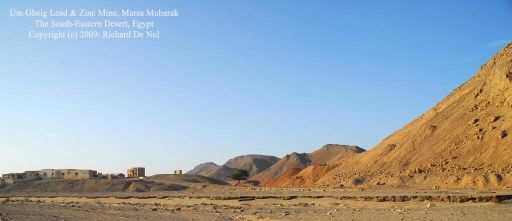
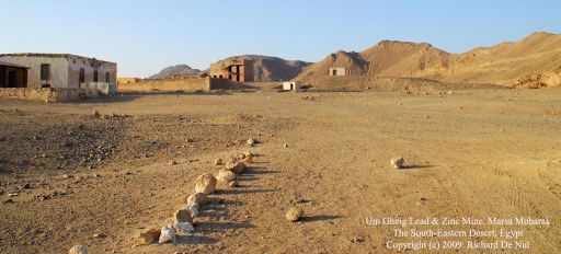


Um Gheig Lead-Zinc Mine, Red Sea Governorate, Egypt