| Locality | Latitude | Longitude | Distance | Bearing |
|---|
| Unnamed Gypsum mine [3] (Woodruff Gypsum), Woodruff, Petrified Forest Mining District, Navajo County, Arizona, USA | 34° 47' 5" N | 110° 1' 12" W | 0.0km (0.0 miles) | |
| Woodruff, Petrified Forest Mining District, Navajo County, Arizona, USA | 34° 46' 52" N | 110° 2' 34" W | 2.1km (1.3 miles) | |
| Rainbow Smith No. 1 & 2, Woodruff, Petrified Forest Mining District, Navajo County, Arizona, USA | 34° 44' 31" N | 109° 58' 7" W | 6.7km (4.1 miles) | |
| Unnamed U prospect [15] (Unnamed A), Woodruff, Petrified Forest Mining District, Navajo County, Arizona, USA | 34° 45' 20" N | 109° 57' 12" W | 6.9km (4.3 miles) | |
| Dutton pit, Woodruff, Petrified Forest Mining District, Navajo County, Arizona, USA | 34° 44' 50" N | 110° 5' 42" W | 8.0km (5.0 miles) | |
| Unnamed U deposit [4], Woodruff, Petrified Forest Mining District, Navajo County, Arizona, USA | 34° 44' 5" N | 109° 55' 47" W | 9.9km (6.2 miles) | |
| Unnamed U occurrence [17] (Unnamed D), Woodruff, Petrified Forest Mining District, Navajo County, Arizona, USA | 34° 47' 9" N | 109° 53' 44" W | 11.4km (7.1 miles) | |
| Tract No. 2, Woodruff, Petrified Forest Mining District, Navajo County, Arizona, USA | 34° 44' 22" N | 109° 54' 24" W | 11.5km (7.2 miles) | |
| Ark La 20 NMA well, Woodruff, Petrified Forest Mining District, Navajo County, Arizona, USA | 34° 45' 10" N | 109° 53' 42" W | 12.0km (7.4 miles) | |
| Sharon Lynn Mine, Woodruff, Petrified Forest Mining District, Navajo County, Arizona, USA | 34° 44' 31" N | 109° 53' 42" W | 12.4km (7.7 miles) | |
| Unnamed U occurrence [16] (Unnamed C), Woodruff, Petrified Forest Mining District, Navajo County, Arizona, USA | 34° 48' 54" N | 109° 52' 42" W | 13.4km (8.3 miles) | |
| Mac No. 3 prospect (Mac #3), Sun Valley, Petrified Forest Mining District, Navajo County, Arizona, USA | 34° 54' 8" N | 109° 55' 27" W | 15.7km (9.8 miles) | |
| Sunrise Mine, Sun Valley, Petrified Forest Mining District, Navajo County, Arizona, USA | 34° 54' 8" N | 109° 54' 24" W | 16.7km (10.4 miles) | |
| Hay Hollow, Snowflake, Navajo County, Arizona, USA | 34° 41' 35" N | 109° 52' 12" W | 17.1km (10.6 miles) | |
| Goof locality, Sun Valley, Petrified Forest Mining District, Navajo County, Arizona, USA | 34° 55' 1" N | 109° 54' 56" W | 17.5km (10.9 miles) | |
| Margarite lease, Sun Valley, Petrified Forest Mining District, Navajo County, Arizona, USA | 34° 54' 9" N | 109° 53' 21" W | 17.7km (11.0 miles) | |
| Section 33 lease (Bill Gill; New Mexico-Arizona lease; Goof), Sun Valley, Petrified Forest Mining District, Navajo County, Arizona, USA | 34° 54' 35" N | 109° 53' 52" W | 17.8km (11.1 miles) | |
| Unnamed U deposit [11], Woodruff, Petrified Forest Mining District, Navajo County, Arizona, USA | 34° 52' 30" N | 109° 51' 12" W | 18.2km (11.3 miles) | |
| Ruth group of claims (Ruth deposit; Bayshore #3), Sun Valley, Petrified Forest Mining District, Navajo County, Arizona, USA | 34° 54' 28" N | 109° 52' 55" W | 18.6km (11.6 miles) | |
| Brigham deposit, Sun Valley, Petrified Forest Mining District, Navajo County, Arizona, USA | 34° 52' 50" N | 109° 51' 6" W | 18.7km (11.6 miles) | |
| Little John & Ruth Mine (Little John Mine; Ruth Mine), Sun Valley, Petrified Forest Mining District, Navajo County, Arizona, USA | 34° 54' 25" N | 109° 52' 42" W | 18.8km (11.7 miles) | |
| Holbrook, Navajo County, Arizona, USA | 34° 54' 15" N | 110° 10' 2" W | 18.9km (11.7 miles) | |
| M. Young et al prospects (Young-Owens-Skeldon-Hunt prospects), Petrified Forest Mining District, Navajo County, Arizona, USA | 34° 53' 27" N | 109° 50' 57" W | 19.5km (12.1 miles) | |
| Holbrook meteorite, Holbrook, Navajo County, Arizona, USA | 34° 53' 59" N | 110° 10' 59" W | 19.7km (12.2 miles) | |
| Tract No. 1, Sun Valley, Petrified Forest Mining District, Navajo County, Arizona, USA | 34° 53' 55" N | 109° 51' 9" W | 19.9km (12.3 miles) | |
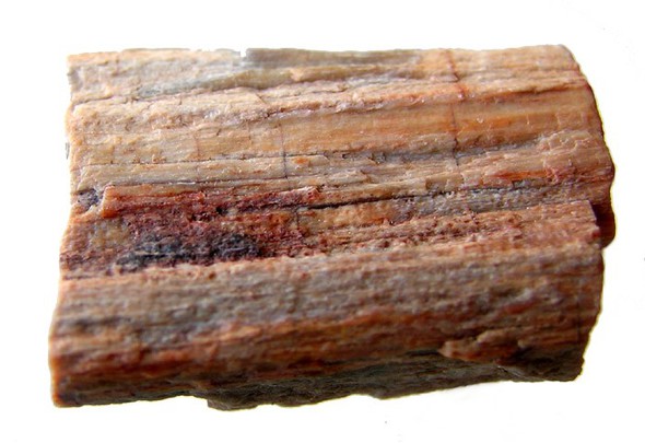
| Petrified Forest, Petrified Forest National Park, Apache County, Arizona, USA | 34° 51' 0" N | 109° 49' 0" W | 19.9km (12.4 miles) | |
| Cabien prospect, Sun Valley, Petrified Forest Mining District, Navajo County, Arizona, USA | 34° 54' 8" N | 109° 51' 13" W | 20.0km (12.4 miles) | |
| Franklin-Aston-Fair A-1 NMA well, Sun Valley, Petrified Forest Mining District, Navajo County, Arizona, USA | 34° 54' 20" N | 109° 51' 7" W | 20.4km (12.7 miles) | |
| Franklin; Aston & Fair C-1 NMA well, Sun Valley, Petrified Forest Mining District, Navajo County, Arizona, USA | 34° 56' 0" N | 109° 53' 7" W | 20.6km (12.8 miles) | |
| Pinedale Coal Helium operation, Holbrook, Navajo County, Arizona, USA | 34° 48' 55" N | 110° 14' 37" W | 20.7km (12.9 miles) | |
Minerals recorded nearby (within 20 km)
Rock types recorded nearby (within 20 km)
Entries shown in red are rocks recorded for this region.


Woodruff, Petrified Forest Mining District, Navajo County, Arizona, USA