| Locality | Latitude | Longitude | Distance | Bearing |
|---|
| Feldspar/Mica Mine (MRDS - 10249216), Mitchell County, North Carolina, USA | 35° 54' 29" N | 82° 6' 38" W | 0.0km (0.0 miles) | |
| Feldspar/Mica Mine (MRDS - 10224109), Mitchell County, North Carolina, USA | 35° 54' 11" N | 82° 6' 31" W | 0.6km (0.4 miles) | |
| Poteat Mine, Mitchell County, North Carolina, USA | 35° 54' 28" N | 82° 6' 11" W | 0.7km (0.4 miles) | |
| Feldspar Mine (MRDS - 10272681), Mitchell County, North Carolina, USA | 35° 54' 9" N | 82° 6' 46" W | 0.7km (0.4 miles) | |
| Feldspar Mine (MRDS - 10223784), Mitchell County, North Carolina, USA | 35° 54' 27" N | 82° 6' 2" W | 0.9km (0.5 miles) | |
| Feldspar/Mica Mine (MRDS - 10272316), Mitchell County, North Carolina, USA | 35° 54' 50" N | 82° 7' 2" W | 0.9km (0.5 miles) | |
| Hoppus Mine, Mitchell County, North Carolina, USA | 35° 54' 44" N | 82° 7' 10" W | 0.9km (0.6 miles) | |
| Mica Mine (MRDS - 10152120), Mitchell County, North Carolina, USA | 35° 54' 9" N | 82° 6' 11" W | 0.9km (0.6 miles) | |
| Feldspar Mine (MRDS - 10176295), Mitchell County, North Carolina, USA | 35° 54' 32" N | 82° 7' 15" W | 1.0km (0.6 miles) | |
| Feldspar/Mica Mine (MRDS - 10248899), Mitchell County, North Carolina, USA | 35° 54' 18" N | 82° 7' 17" W | 1.0km (0.6 miles) | |
| Feldspar/Mica Mine (MRDS - 10175975), Mitchell County, North Carolina, USA | 35° 53' 59" N | 82° 6' 55" W | 1.0km (0.7 miles) | |
| Childers Mine, Mitchell County, North Carolina, USA | 35° 54' 1" N | 82° 6' 14" W | 1.1km (0.7 miles) | |
| Feldspar Mine (MRDS - 10152241), Mitchell County, North Carolina, USA | 35° 54' 27" N | 82° 7' 20" W | 1.1km (0.7 miles) | |
| Calhoun Smith Mine, Mitchell County, North Carolina, USA | 35° 54' 31" N | 82° 5' 54" W | 1.1km (0.7 miles) | |
| Feldspar/Mica Mine (MRDS - 10232316), Mitchell County, North Carolina, USA | 35° 54' 12" N | 82° 7' 17" W | 1.1km (0.7 miles) | |
| Feldspar/Mica Mine (MRDS - 10176026), Mitchell County, North Carolina, USA | 35° 54' 11" N | 82° 5' 59" W | 1.1km (0.7 miles) | |
| Chalk Mountain Mine, Spruce Pine, Mitchell County, North Carolina, USA | 35° 53' 56" N | 82° 6' 19" W | 1.1km (0.7 miles) | |
| Feldspar/Mica Mine (MRDS - 10151950), Mitchell County, North Carolina, USA | 35° 54' 4" N | 82° 6' 4" W | 1.2km (0.7 miles) | |
| Mica Mine (MRDS - 10296575), Mitchell County, North Carolina, USA | 35° 53' 55" N | 82° 6' 19" W | 1.2km (0.7 miles) | |
| Guy Mine, Mitchell County, North Carolina, USA | 35° 54' 46" N | 82° 5' 52" W | 1.2km (0.8 miles) | |
| Drawbarr Mine, Mitchell County, North Carolina, USA | 35° 54' 37" N | 82° 5' 45" W | 1.3km (0.8 miles) | |
| Estatoe Mine, Mitchell County, North Carolina, USA | 35° 54' 15" N | 82° 7' 28" W | 1.4km (0.8 miles) | |
| Luke Lewis Mine, Mitchell County, North Carolina, USA | 35° 54' 44" N | 82° 5' 47" W | 1.4km (0.8 miles) | |
| Feldspar/Mica Mine (MRDS - 10223894), Mitchell County, North Carolina, USA | 35° 54' 10" N | 82° 5' 44" W | 1.5km (0.9 miles) | |
| Feldspar/Mica Mine (MRDS - 10152024), Mitchell County, North Carolina, USA | 35° 54' 7" N | 82° 7' 32" W | 1.5km (1.0 miles) | |
| Bloodworth Mine, Mitchell County, North Carolina, USA | 35° 54' 55" N | 82° 5' 42" W | 1.6km (1.0 miles) | |
| Renfro Mine, Mitchell County, North Carolina, USA | 35° 54' 56" N | 82° 5' 42" W | 1.6km (1.0 miles) | |
| Bear Creek Quarry, Mitchell County, North Carolina, USA | 35° 55' 0" N | 82° 5' 44" W | 1.6km (1.0 miles) | |
| Feldspar/Mica Mine (MRDS - 10223681), Mitchell County, North Carolina, USA | 35° 55' 22" N | 82° 6' 23" W | 1.6km (1.0 miles) | |
| Feldspar Mine (MRDS - 10296666), Mitchell County, North Carolina, USA | 35° 55' 1" N | 82° 5' 44" W | 1.7km (1.0 miles) | |


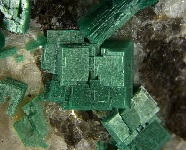


Chalk Mountain Mine, Spruce Pine, Mitchell County, North Carolina, USA