| Locality | Latitude | Longitude | Distance | Bearing |
|---|
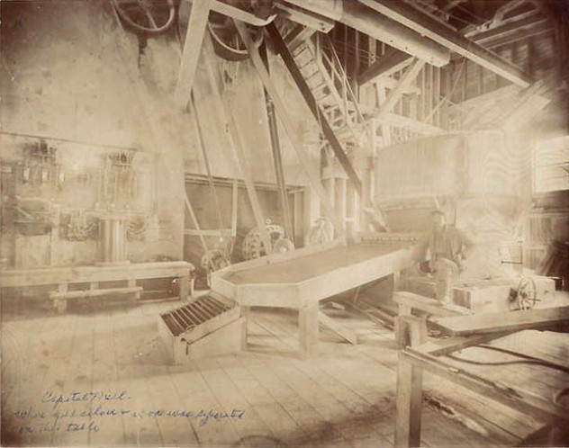
| Buxton, Georgetown District, Clear Creek County, Colorado, USA | 39° 41' 44" N | 105° 43' 22" W | 0.0km (0.0 miles) | |
| Star of the West, Georgetown District, Clear Creek County, Colorado, USA | 39° 41' 44" N | 105° 43' 22" W | 0.0km (0.0 miles) | |
| East Butte, Georgetown District, Clear Creek County, Colorado, USA | 39° 41' 44" N | 105° 43' 22" W | 0.0km (0.0 miles) | |
| Cora, Georgetown District, Clear Creek County, Colorado, USA | 39° 41' 44" N | 105° 43' 22" W | 0.0km (0.0 miles) | |
| Azeda, Georgetown District, Clear Creek County, Colorado, USA | 39° 41' 44" N | 105° 43' 22" W | 0.0km (0.0 miles) | |
| Reindeer, Georgetown District, Clear Creek County, Colorado, USA | 39° 41' 44" N | 105° 43' 22" W | 0.0km (0.0 miles) | |
| Croesus, Georgetown District, Clear Creek County, Colorado, USA | 39° 41' 44" N | 105° 43' 22" W | 0.0km (0.0 miles) | |
| Brown Reindeer, Georgetown District, Clear Creek County, Colorado, USA | 39° 41' 44" N | 105° 43' 22" W | 0.0km (0.0 miles) | |
| Ricci Winze, Georgetown District, Clear Creek County, Colorado, USA | 39° 41' 44" N | 105° 43' 22" W | 0.0km (0.0 miles) | |
| Duncan, Georgetown District, Clear Creek County, Colorado, USA | 39° 41' 44" N | 105° 43' 22" W | 0.0km (0.0 miles) | |
| Diamond Mill (Ashby tunnel; Baxter lode), Georgetown District, Clear Creek County, Colorado, USA | 39° 41' 44" N | 105° 43' 23" W | 0.0km (0.0 miles) | |
| Silver Plume, Georgetown District, Clear Creek County, Colorado, USA | 39° 41' 45" N | 105° 43' 33" W | 0.2km (0.2 miles) | |
| Silver Plume, Clear Creek County, Colorado, USA | 39° 41' 46" N | 105° 43' 35" W | 0.3km (0.2 miles) | |
| Diamond Mine (Diamond Tunnel), Illinois Mine, Georgetown District, Clear Creek County, Colorado, USA | 39° 41' 53" N | 105° 43' 36" W | 0.4km (0.3 miles) | |
| Dunkirk, Georgetown District, Clear Creek County, Colorado, USA | 39° 42' 0" N | 105° 43' 31" W | 0.5km (0.3 miles) | |
| Diamond mine, Georgetown District, Clear Creek County, Colorado, USA | 39° 41' 54" N | 105° 43' 42" W | 0.6km (0.4 miles) | |
| Payrock Mine, Illinois Mine, Georgetown District, Clear Creek County, Colorado, USA | 39° 42' 4" N | 105° 43' 29" W | 0.6km (0.4 miles) | |
| Antelope, Georgetown District, Clear Creek County, Colorado, USA | 39° 41' 56" N | 105° 43' 46" W | 0.7km (0.4 miles) | |
| Rio Grande Occurrence, Georgetown District, Clear Creek County, Colorado, USA | 39° 41' 23" N | 105° 43' 0" W | 0.8km (0.5 miles) | |
| Helmick (Aliunde), Georgetown District, Clear Creek County, Colorado, USA | 39° 41' 23" N | 105° 43' 0" W | 0.8km (0.5 miles) | |
| Snowdrift, Georgetown District, Clear Creek County, Colorado, USA | 39° 42' 10" N | 105° 43' 12" W | 0.8km (0.5 miles) | |
| Everett & Lebanon, Georgetown District, Clear Creek County, Colorado, USA | 39° 41' 54" N | 105° 42' 50" W | 0.8km (0.5 miles) | |
| Zero Mine, Georgetown District, Clear Creek County, Colorado, USA | 39° 42' 5" N | 105° 43' 48" W | 0.9km (0.5 miles) | |
| Pulaski - Upper & Lower, Georgetown District, Clear Creek County, Colorado, USA | 39° 41' 34" N | 105° 42' 47" W | 0.9km (0.6 miles) | |
| Georgetown-Silver Plume Mining District (Griffith Mining District; Silver Plume Mining District), Clear Creek County, Colorado, USA | 39° 41' 58" N | 105° 42' 45" W | 1.0km (0.6 miles) | |
| Bismark Pelican (Pelican - Dives Mine), Georgetown District, Clear Creek County, Colorado, USA | 39° 42' 0" N | 105° 43' 59" W | 1.0km (0.6 miles) | |
| Hall Tunnel, Georgetown District, Clear Creek County, Colorado, USA | 39° 41' 48" N | 105° 42' 40" W | 1.0km (0.6 miles) | |
| Gabanta (Ashby; Colorado Central; Everett; Snow Drift; Silver Plume; Hall; Iris; Scott; Peru; Lebanon), Georgetown District, Clear Creek County, Colorado, USA | 39° 42' 15" N | 105° 43' 0" W | 1.1km (0.7 miles) | |
| Back Bone Upper & Lower, Georgetown District, Clear Creek County, Colorado, USA | 39° 42' 6" N | 105° 44' 1" W | 1.1km (0.7 miles) | |
| Mendota Mine - Victoria Tunnel & Shaft, Georgetown District, Clear Creek County, Colorado, USA | 39° 41' 48" N | 105° 44' 11" W | 1.1km (0.7 miles) | |


Georgetown-Silver Plume Mining District, Clear Creek County, Colorado, USA