| Locality | Latitude | Longitude | Distance | Bearing |
|---|
| Rockville, Stearns County, Minnesota, USA | 45° 28' 18" N | 94° 20' 24" W | 1.5km (0.9 miles) | |
| Rockville Quarry No. 1, Stearns County, Minnesota, USA | 45° 28' 28" N | 94° 20' 0" W | 1.9km (1.2 miles) | |
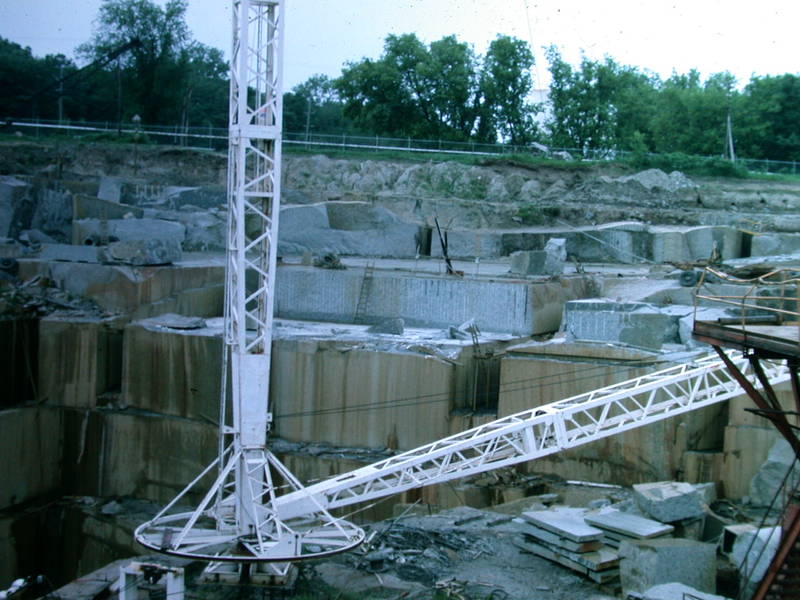
| Clark and McCormack Quarry, Rockville, Stearns County, Minnesota, USA | 45° 28' 28" N | 94° 20' 0" W | 1.9km (1.2 miles) | |
| Rockville Quarry No. 2, Stearns County, Minnesota, USA | 45° 28' 5" N | 94° 20' 2" W | 2.1km (1.3 miles) | |
| Opalescent Quarry (Cold Spring Granite Co), Stearns County, Minnesota, USA | 45° 27' 6" N | 94° 25' 8" W | 5.6km (3.4 miles) | |
| Crystal Gray Quarry (Cold Spring Granite Co; MRDS - 10121896), Stearns County, Minnesota, USA | 45° 31' 29" N | 94° 19' 0" W | 6.2km (3.9 miles) | |
| Diamond Pink Quarry (Cold Spring Granite Co), Stearns County, Minnesota, USA | 45° 31' 36" N | 94° 17' 48" W | 7.3km (4.5 miles) | |
| Gertkin Marl Pits, Stearns County, Minnesota, USA | 45° 25' 36" N | 94° 26' 20" W | 8.5km (5.3 miles) | |
| Big Watab Lake, Stearns County, Minnesota, USA | 45° 33' 4" N | 94° 27' 9" W | 11.1km (6.9 miles) | |
| Charcoal Gray Quarry (Cold Spring Granite Co; MRDS - 10219580), Stearns County, Minnesota, USA | 45° 30' 37" N | 94° 11' 48" W | 13.1km (8.1 miles) | |
| J L Shiely Company Quarry & Mill, Stearns County, Minnesota, USA | 45° 33' 14" N | 94° 13' 24" W | 13.5km (8.4 miles) | |
| Sauk River Area Clays Occurrence, Stearns County, Minnesota, USA | 45° 23' 59" N | 94° 31' 5" W | 15.2km (9.4 miles) | |
| Benton County Marl Bed Occurrence, Benton County, Minnesota, USA | 45° 42' 54" N | 94° 11' 15" W | 29.6km (18.4 miles) | |
| Gravel Pit, Holding Township, Stearns County, Minnesota, USA | 45° 46' 24" N | 94° 24' 59" W | 33.3km (20.7 miles) | |
| Blanchard dam, Royalton, Morrison County, Minnesota, USA | 45° 51' 37" N | 94° 21' 29" W | 42.6km (26.5 miles) | |
| Mississippi River Area Clays Occurrence, Morrison County, Minnesota, USA | 45° 57' 51" N | 94° 21' 9" W | 54.2km (33.7 miles) | |
| Pierz, Morrison County, Minnesota, USA | 45° 58' 38" N | 94° 6' 13" W | 59.0km (36.7 miles) | |
| Myers Quarry, Pierz, Morrison County, Minnesota, USA | 45° 58' 50" N | 94° 5' 27" W | 59.7km (37.1 miles) | |
| Gorman Mine (Lydia M Gorman), Cuyuna Range, Morrison County, Minnesota, USA | 46° 6' 38" N | 94° 30' 2" W | 71.3km (44.3 miles) | |
| Crow Wing County Marl Beds No. 21 Occurrence, Crow Wing County, Minnesota, USA | 46° 12' 5" N | 94° 19' 22" W | 80.6km (50.1 miles) | |
| Willcuts Reserve H-47 Prospect (Hanna Mining Company Agt), Cuyuna North Range, Crow Wing County, Minnesota, USA | 46° 13' 40" N | 94° 19' 6" W | 83.5km (51.9 miles) | |
| Anoka County Marl Beds No. 2 Occurrence, Anoka County, Minnesota, USA | 45° 10' 47" N | 93° 18' 53" W | 87.9km (54.6 miles) | |
| N.W.I. Reserve X-51 Prospect (Glacier Park Company), Cuyuna North Range, Crow Wing County, Minnesota, USA | 46° 16' 35" N | 94° 14' 43" W | 89.3km (55.5 miles) | |
| Anoka County Marl Beds No. 1 Occurrence, Anoka County, Minnesota, USA | 45° 14' 57" N | 93° 14' 4" W | 91.3km (56.7 miles) | |
| Barrows Reserve H-1, Cuyuna North Range, Crow Wing County, Minnesota, USA | 46° 17' 58" N | 94° 14' 43" W | 91.9km (57.1 miles) | |
| Hanna Iron Ore Divn Prospect (Hanna Mining Company Agt; Barrows Reserve H-1), Cuyuna North Range, Crow Wing County, Minnesota, USA | 46° 17' 58" N | 94° 14' 43" W | 91.9km (57.1 miles) | |
| Barrows Mine (Hanna Iron Ore Divn; Hanna Mining Company Agt), Cuyuna North Range, Crow Wing County, Minnesota, USA | 46° 18' 29" N | 94° 14' 3" W | 92.9km (57.7 miles) | |
| North Central Aggregate Pit, Hennepin County, Minnesota, USA | 45° 0' 23" N | 93° 21' 19" W | 94.3km (58.6 miles) | |
| N.W.I. Reserve X-52 Prospect (Glacier Park Company), Cuyuna North Range, Crow Wing County, Minnesota, USA | 46° 19' 8" N | 94° 10' 54" W | 94.6km (58.8 miles) | |
| Crow Wing County Clay Deposit, Crow Wing County, Minnesota, USA | 46° 19' 23" N | 94° 13' 11" W | 94.7km (58.9 miles) | |
Minerals recorded nearby (within 20 km)
No mineral species recorded.
Rock types recorded nearby (within 20 km)
Entries shown in red are rocks recorded for this region.


Clark and McCormack Quarry, Rockville, Stearns County, Minnesota, USA