| Locality | Latitude | Longitude | Distance | Bearing |
|---|
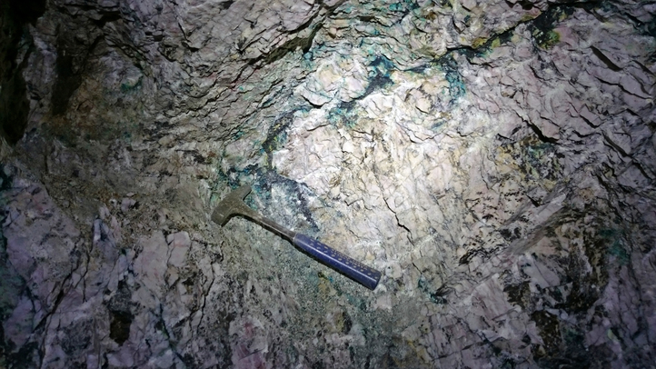
| Silberberg adit, Unterstein, Reith im Alpbachtal, Brixlegg, Kufstein District, Tyrol, Austria | 47° 25' 24" N | 11° 55' 6" E | 0.0km (0.0 miles) | |
| Matzenköpfl (Madersbacher Köpfl), Reith im Alpbachtal, Brixlegg, Kufstein District, Tyrol, Austria | 47° 25' 23" N | 11° 55' 5" E | 0.0km (0.0 miles) | |
| Unterstein, Reith im Alpbachtal, Brixlegg, Kufstein District, Tyrol, Austria | 47° 25' 20" N | 11° 54' 47" E | 0.4km (0.3 miles) | |
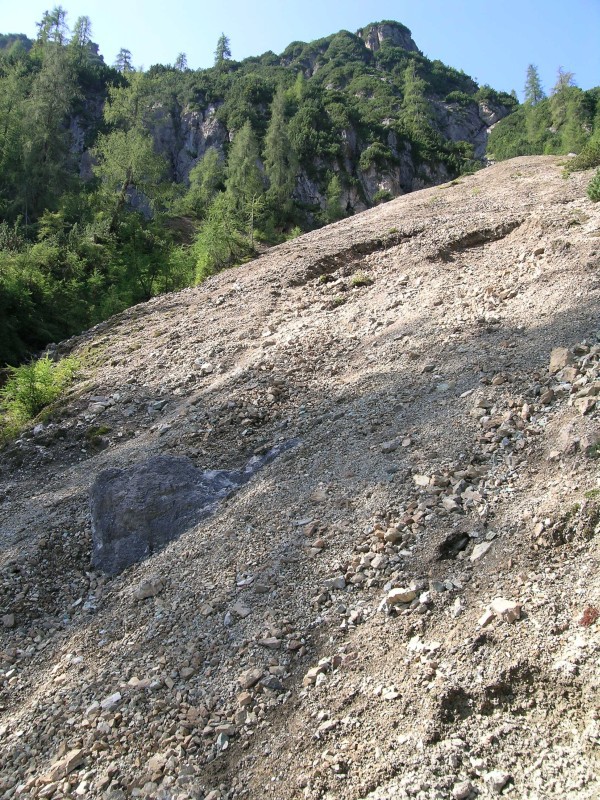
| West slope ("Am Geyer"), Silberberg, Geyer - Silberberg District, Brixlegg, Kufstein District, Tyrol, Austria | 47° 25' 12" N | 11° 55' 15" E | 0.4km (0.3 miles) | |
| Fuchsloch, Brixlegg, Kufstein District, Tyrol, Austria | 47° 25' 8" N | 11° 55' 6" E | 0.5km (0.3 miles) | |
| Stocker adit, Silberberg, Geyer - Silberberg District, Brixlegg, Kufstein District, Tyrol, Austria | 47° 25' 1" N | 11° 54' 58" E | 0.7km (0.4 miles) | |
| Hof, Brixlegg, Kufstein District, Tyrol, Austria | 47° 25' 51" N | 11° 54' 56" E | 0.9km (0.5 miles) | |
| Einberg, Scheffach, Brixlegg, Kufstein District, Tyrol, Austria | 47° 25' 14" N | 11° 54' 2" E | 1.4km (0.8 miles) | |
| Hauskogel, Brixlegg, Kufstein District, Tyrol, Austria | 47° 26' 2" N | 11° 54' 32" E | 1.4km (0.9 miles) | |
| Maukenstadl adit, Maukenötz District (Mauken), Brixlegg, Kufstein District, Tyrol, Austria | 47° 25' 50" N | 11° 56' 15" E | 1.7km (1.0 miles) | |
| Kram adit, Maukenötz District (Mauken), Brixlegg, Kufstein District, Tyrol, Austria | 47° 25' 47" N | 11° 56' 36" E | 2.0km (1.3 miles) | |
| Scheffach, Brixlegg, Kufstein District, Tyrol, Austria | 47° 24' 42" N | 11° 53' 51" E | 2.0km (1.3 miles) | |
| Holz Alp, Gratlspitz, Brixlegg, Kufstein District, Tyrol, Austria | 47° 25' 18" N | 11° 56' 49" E | 2.2km (1.4 miles) | |
| Gratlspitz, Brixlegg, Kufstein District, Tyrol, Austria | 47° 24' 52" N | 11° 56' 50" E | 2.4km (1.5 miles) | |
| Sommerau Mining District, Brixlegg, Kufstein District, Tyrol, Austria | 47° 25' 44" N | 11° 57' 10" E | 2.7km (1.7 miles) | |
| Reith im Alpbachtal, Brixlegg, Kufstein District, Tyrol, Austria | 47° 25' 0" N | 11° 52' 41" E | 3.1km (1.9 miles) | |
| Montanwerke Brixlegg slag locality, Brixlegg, Kufstein District, Tyrol, Austria | 47° 25' 59" N | 11° 52' 30" E | 3.4km (2.1 miles) | |
| Hösljoch, Gratlspitz, Brixlegg, Kufstein District, Tyrol, Austria | 47° 24' 45" N | 11° 58' 5" E | 4.0km (2.5 miles) | |
| Lehenhof, Grassbergjöchl, Thierbach, Wildschönau, Kufstein District, Tyrol, Austria | 47° 25' 41" N | 11° 58' 14" E | 4.0km (2.5 miles) | |
| Silver mine, Lehenlahn, Grassbergjöchl, Thierbach, Wildschönau, Kufstein District, Tyrol, Austria | 47° 25' 51" N | 11° 58' 23" E | 4.2km (2.6 miles) | |
| Lehenlahn, Grassbergjöchl, Thierbach, Wildschönau, Kufstein District, Tyrol, Austria | 47° 25' 50" N | 11° 58' 24" E | 4.2km (2.6 miles) | |
| Gertraud adit, Großkogel (Reither Kogel), St Gertraudi, Brixlegg, Kufstein District, Tyrol, Austria | 47° 24' 35" N | 11° 51' 30" E | 4.8km (3.0 miles) | |
| Großkogel (Reither Kogel), St Gertraudi, Brixlegg, Kufstein District, Tyrol, Austria | 47° 24' 1" N | 11° 51' 36" E | 5.1km (3.1 miles) | |
| Thierbach, Wildschönau, Kufstein District, Tyrol, Austria | 47° 25' 21" N | 11° 59' 23" E | 5.4km (3.3 miles) | |
| St Gertraudi, Brixlegg, Kufstein District, Tyrol, Austria | 47° 24' 38" N | 11° 50' 55" E | 5.4km (3.4 miles) | |
| Kleinkogel, St Gertraudi, Brixlegg, Kufstein District, Tyrol, Austria | 47° 24' 6" N | 11° 50' 52" E | 5.8km (3.6 miles) | |
| Unnamed quarry, St Gertraudi, Brixlegg, Kufstein District, Tyrol, Austria | 47° 24' 19" N | 11° 50' 35" E | 6.0km (3.7 miles) | |
| Inneralpbach, Alpbach, Kufstein District, Tyrol, Austria | 47° 22' 31" N | 11° 57' 31" E | 6.1km (3.8 miles) | |
| Lueg mine (Luegergraben), Inneralpbach, Alpbach, Kufstein District, Tyrol, Austria | 47° 21' 58" N | 11° 59' 8" E | 8.1km (5.1 miles) | |
| Weißer Schrofen, Ringenwechsel mining district, Schwaz District, Tyrol, Austria | 47° 22' 50" N | 11° 48' 47" E | 9.2km (5.7 miles) | |


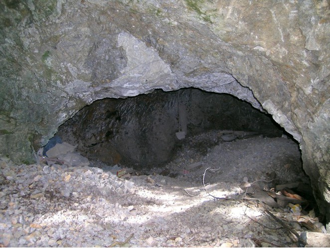


Maukenstadl adit, Maukenötz District, Brixlegg, Kufstein District, Tyrol, Austria