| Locality | Latitude | Longitude | Distance | Bearing |
|---|
| Ontario Gem Mine, McTavish Township, Thunder Bay District, Ontario, Canada | 48° 41' 40" N | 88° 35' 0" W | 0.0km (0.0 miles) | |
| Dorion Amethyst Mine, Mineral Lot A, McTavish Township, Thunder Bay District, Ontario, Canada | 48° 41' 58" N | 88° 36' 34" W | 2.0km (1.2 miles) | |
| Dzuba Ancliff occurrence, McTavish Township, Thunder Bay District, Ontario, Canada | 48° 42' 41" N | 88° 33' 43" W | 2.4km (1.5 miles) | |
| Boulder Creek Amethyst quarry, Pearl Station area, Thunder Bay District, Ontario, Canada | 48° 40' 56" N | 88° 36' 50" W | 2.6km (1.6 miles) | |
| Enterprise Mine, McTavish Township, Thunder Bay District, Ontario, Canada | 48° 40' 41" N | 88° 37' 32" W | 3.6km (2.2 miles) | |
| Moon Light Mine, Pearl Station area, Thunder Bay District, Ontario, Canada | 48° 41' 59" N | 88° 39' 23" W | 5.4km (3.3 miles) | |
| Bill's Old Amethyst Mine, Pearl Station area, Thunder Bay District, Ontario, Canada | 48° 41' 48" N | 88° 39' 30" W | 5.5km (3.4 miles) | |
| Blue Point Amethyst Mine, McTavish Township, Thunder Bay District, Ontario, Canada | 48° 41' 11" N | 88° 39' 50" W | 6.0km (3.7 miles) | |
| Diamond Willow Mine, McTavish Township, Thunder Bay District, Ontario, Canada | 48° 41' 9" N | 88° 39' 56" W | 6.1km (3.8 miles) | |
| Pearl Lake Amethyst quarry, Pearl Station area, Thunder Bay District, Ontario, Canada | 48° 40' 14" N | 88° 39' 52" W | 6.5km (4.0 miles) | |
| Pearl Station area, Thunder Bay District, Ontario, Canada | 48° 39' 55" N | 88° 39' 37" W | 6.5km (4.0 miles) | |
| Detroit-Algoma Mine, McTavish Township, Thunder Bay District, Ontario, Canada | 48° 40' 50" N | 88° 40' 22" W | 6.7km (4.2 miles) | |
| Barrett Mine (Noyes South mine; Breezy Mountain mine), McTavish Township, Thunder Bay District, Ontario, Canada | 48° 40' 41" N | 88° 40' 35" W | 7.1km (4.4 miles) | |
| Gagnon Falls occurrence (Noyes North occurrence), McTavish Township, Thunder Bay District, Ontario, Canada | 48° 41' 29" N | 88° 41' 35" W | 8.0km (5.0 miles) | |
| Thunder Bay Amethyst Mine, McTavish Township, Thunder Bay District, Ontario, Canada | 48° 41' 27" N | 88° 43' 33" W | 10.5km (6.5 miles) | |
| Silver Lake occurrence, McTavish Township, Thunder Bay District, Ontario, Canada | 48° 37' 44" N | 88° 42' 47" W | 12.0km (7.5 miles) | |
| Anderson Lake prospect, McTavish Township, Thunder Bay District, Ontario, Canada | 48° 40' 36" N | 88° 45' 47" W | 13.3km (8.3 miles) | |
| Pass Lake Road quarry, MacGregor Township, Thunder Bay District, Ontario, Canada | 48° 34' 45" N | 88° 44' 40" W | 17.4km (10.8 miles) | |
| Blende Lake Iron occurrence, MacGregor Township, Thunder Bay District, Ontario, Canada | 48° 35' 39" N | 88° 46' 9" W | 17.6km (10.9 miles) | |
| Pass Lake area, Thunder Bay District, Ontario, Canada | 48° 33' 51" N | 88° 43' 44" W | 18.0km (11.2 miles) | |
| Thunder Bay North deposit (Current Lake zone), Greenwich Lake Area, Thunder Bay District, Ontario, Canada | 48° 45' 56" N | 88° 56' 35" W | 27.5km (17.1 miles) | |
| 7Z Mine, MacGregor Township, Thunder Bay District, Ontario, Canada | 48° 32' 52" N | 88° 54' 57" W | 29.4km (18.3 miles) | |
| Purple Haze Amethyst Mine, Tartan Lake area, Thunder Bay District, Ontario, Canada | 48° 37' 14" N | 88° 58' 18" W | 29.7km (18.4 miles) | |
| MacKenzie River Locality, MacGregor Township, Thunder Bay District, Ontario, Canada | 48° 31' 37" N | 88° 56' 33" W | 32.3km (20.1 miles) | |
| Edward Island, Porphyry Island Township, Thunder Bay District, Ontario, Canada | 48° 23' 12" N | 88° 37' 45" W | 34.4km (21.4 miles) | |
| Unnamed prospect, MacGregor Township, Thunder Bay District, Ontario, Canada | 48° 31' 20" N | 88° 59' 9" W | 35.3km (21.9 miles) | |
| Silver Harbour Mine (Beck Mine; Three A Mine; 3 A), MacGregor Township, Thunder Bay District, Ontario, Canada | 48° 30' 51" N | 88° 58' 41" W | 35.3km (21.9 miles) | |
| Current River Mines, McIntyre Township, Thunder Bay District, Ontario, Canada | 48° 42' 58" N | 89° 5' 12" W | 37.0km (23.0 miles) | |
| Red Rock Railway Adit (Bowermann Location), Thunder Bay District, Ontario, Canada | 48° 57' 25" N | 88° 15' 36" W | 37.6km (23.3 miles) | |
| Barite Occurrence, Porphyry Island, Porphyry Island Township, Thunder Bay District, Ontario, Canada | 48° 21' 20" N | 88° 37' 36" W | 37.8km (23.5 miles) | |


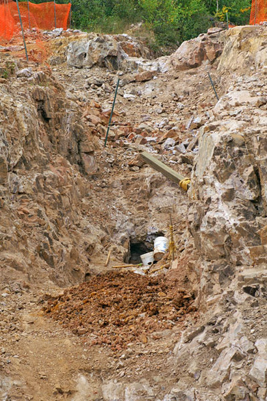


Ontario Gem Mine, McTavish Township, Thunder Bay District, Ontario, Canada