| Locality | Latitude | Longitude | Distance | Bearing |
|---|
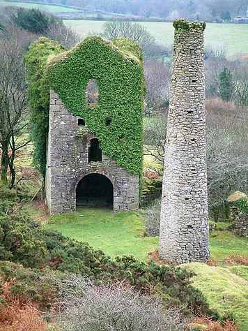
| Penhawger Mine, Menheniot, Cornwall, England, UK | 50° 28' 45" N | 4° 24' 32" W | 0.0km (0.0 miles) | |
| Wheal Gill (Hayford Mine), Cutkive Wood, St Cleer, Cornwall, England, UK | 50° 28' 57" N | 4° 24' 22" W | 0.4km (0.3 miles) | |
| Cutkive Wood, St Cleer, Cornwall, England, UK | 50° 28' 59" N | 4° 24' 36" W | 0.4km (0.3 miles) | |
| Wheal Wrey, Wrey and Ludcott United Mines, St Ive, Cornwall, England, UK | 50° 28' 22" N | 4° 23' 54" W | 1.0km (0.6 miles) | |
| Trebeigh Consols (Trebeigh Mine), Gang, St Ive, Cornwall, England, UK | 50° 29' 8" N | 4° 23' 37" W | 1.3km (0.8 miles) | |
| Wheal Ludcott, Wrey and Ludcott United Mines, St Ive, Cornwall, England, UK | 50° 28' 9" N | 4° 23' 55" W | 1.3km (0.8 miles) | |
| Wheal Treweatha, Menheniot, Cornwall, England, UK | 50° 27' 55" N | 4° 24' 31" W | 1.6km (1.0 miles) | |
| North Trelawny Mine, Wrey and Ludcott United Mines, St Ive, Cornwall, England, UK | 50° 27' 56" N | 4° 24' 4" W | 1.6km (1.0 miles) | |
| North Wheal Wrey and Julia, Trebeigh Consols (Trebeigh Mine), Gang, St Ive, Cornwall, England, UK | 50° 29' 18" N | 4° 23' 28" W | 1.6km (1.0 miles) | |
| Gang, St Ive, Cornwall, England, UK | 50° 29' 23" N | 4° 23' 10" W | 2.0km (1.2 miles) | |
| New Trelawny Mine (Gang Mine), Gang, St Ive, Cornwall, England, UK | 50° 29' 25" N | 4° 22' 58" W | 2.2km (1.4 miles) | |
| Pensilva, St Ive, Cornwall, England, UK | 50° 30' 7" N | 4° 24' 49" W | 2.6km (1.6 miles) | |
| New South Caradon Mine, St Cleer, Cornwall, England, UK | 50° 29' 39" N | 4° 26' 15" W | 2.6km (1.6 miles) | |
| Penharget, St Ive, Cornwall, England, UK | 50° 30' 20" N | 4° 24' 46" W | 2.9km (1.8 miles) | |
| Wheal Hooper (South Caradon Wheal Hooper), Caradon Hill, St Cleer, Cornwall, England, UK | 50° 30' 2" N | 4° 26' 7" W | 3.0km (1.9 miles) | |
| Slade Mine (Wheal Caradon), Pensilva, St Ive, Cornwall, England, UK | 50° 30' 22" N | 4° 24' 1" W | 3.0km (1.9 miles) | |
| Glasgow Caradon Consols, Pensilva, St Ive, Cornwall, England, UK | 50° 30' 20" N | 4° 25' 17" W | 3.1km (1.9 miles) | |
| Hendra Bridge Mine, Hendra Bridge, Liskeard, Cornwall, England, UK | 50° 28' 0" N | 4° 26' 53" W | 3.1km (1.9 miles) | |
| Wheal Trehane, Menheniot, Cornwall, England, UK | 50° 27' 1" N | 4° 24' 47" W | 3.2km (2.0 miles) | |
| East Caradon Mine, Linkinhorne, Cornwall, England, UK | 50° 30' 20" N | 4° 25' 45" W | 3.3km (2.0 miles) | |
| Tokenbury Mine (Yolland Consols; Yeoland Consols), Glasgow Caradon Consols, Pensilva, St Ive, Cornwall, England, UK | 50° 30' 23" N | 4° 25' 48" W | 3.4km (2.1 miles) | |
| South Caradon Mine, Caradon Hill, St Cleer, Cornwall, England, UK | 50° 30' 8" N | 4° 26' 27" W | 3.4km (2.1 miles) | |
| Great Caradon Consols (Penharget Mine), Penharget, St Ive, Cornwall, England, UK | 50° 30' 38" N | 4° 24' 2" W | 3.5km (2.2 miles) | |
| Crow's Nest, St Cleer, Cornwall, England, UK | 50° 29' 53" N | 4° 26' 57" W | 3.5km (2.2 miles) | |
| Wheal Trelawny (incl. Wheal Honey), Menheniot, Cornwall, England, UK | 50° 26' 44" N | 4° 24' 41" W | 3.7km (2.3 miles) | |
| Wheal Sedley, Cargibbitt Mine (Cargibbet Mine; Caradon Vale Mine), Penharget, St Ive, Cornwall, England, UK | 50° 30' 47" N | 4° 24' 33" W | 3.8km (2.3 miles) | |
| Cargibbitt Mine (Cargibbet Mine; Caradon Vale Mine), Penharget, St Ive, Cornwall, England, UK | 50° 30' 47" N | 4° 24' 23" W | 3.8km (2.3 miles) | |
| East Wheal Agar, Crow's Nest, St Cleer, Cornwall, England, UK | 50° 29' 59" N | 4° 27' 8" W | 3.8km (2.4 miles) | |
| Wheal Venland, Tremar, St Cleer, Cornwall, England, UK | 50° 29' 13" N | 4° 27' 41" W | 3.8km (2.4 miles) | |
| West Wheal Mary Ann (West Mary Ann Mine), Roseland, Menheniot, Cornwall, England, UK | 50° 26' 49" N | 4° 25' 42" W | 3.8km (2.4 miles) | |


West Caradon Mine, Crow's Nest, St Cleer, Cornwall, England, UK