| Locality | Latitude | Longitude | Distance | Bearing |
|---|
| Sosnowica Mountain, Strachowice, Gmina Legnickie Pole, Legnica County, Lower Silesian Voivodeship, Poland | 51° 8' 8" N | 16° 15' 24" E | 0.0km (0.0 miles) | |
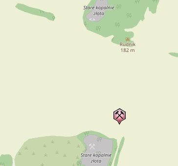
| Złoty Las Gold Mines, Sosnowica Mountain, Strachowice, Gmina Legnickie Pole, Legnica County, Lower Silesian Voivodeship, Poland | 51° 7' 55" N | 16° 15' 36" E | 0.5km (0.3 miles) | |
| Rudnik basalt quarry, Mikołajowice, Gmina Legnickie Pole, Legnica County, Lower Silesian Voivodeship, Poland | 51° 8' 14" N | 16° 16' 19" E | 1.1km (0.7 miles) | |
| Lubień quarry, Lubień, Gmina Legnickie Pole, Legnica County, Lower Silesian Voivodeship, Poland | 51° 7' 40" N | 16° 13' 26" E | 2.4km (1.5 miles) | |
| Mikołajowice quarry, Mikołajowice, Gmina Legnickie Pole, Legnica County, Lower Silesian Voivodeship, Poland | 51° 7' 1" N | 16° 16' 51" E | 2.7km (1.7 miles) | |
| Pawłowice Wielkie basalt quarry, Gmina Wądroże Wielkie, Jawor County, Lower Silesian Voivodeship, Poland | 51° 6' 17" N | 16° 16' 24" E | 3.6km (2.3 miles) | |
| "Taczalin" Quartz Mine, Taczalin, Gmina Legnickie Pole, Legnica County, Lower Silesian Voivodeship, Poland | 51° 9' 11" N | 16° 18' 57" E | 4.6km (2.8 miles) | |
| Gravel pit, Nowa Wieś Legnicka, Gmina Legnickie Pole, Legnica County, Lower Silesian Voivodeship, Poland | 51° 9' 24" N | 16° 11' 12" E | 5.4km (3.4 miles) | |
| "Bartnica" mine (Brachów), Gmina Męcinka, Jawor County, Lower Silesian Voivodeship, Poland | 51° 6' 2" N | 16° 8' 51" E | 8.5km (5.3 miles) | |
| Janowice quarry, Gmina Ruja, Legnica County, Lower Silesian Voivodeship, Poland | 51° 7' 37" N | 16° 24' 20" E | 10.4km (6.5 miles) | |
| Żarecka Góra basalt quarry, Słup, Gmina Męcinka, Jawor County, Lower Silesian Voivodeship, Poland | 51° 5' 5" N | 16° 7' 25" E | 10.9km (6.8 miles) | |
| Męcinka basalt quarry, Męcinka, Gmina Męcinka, Jawor County, Lower Silesian Voivodeship, Poland | 51° 4' 47" N | 16° 7' 5" E | 11.5km (7.1 miles) | |
| Słup basalt quarry, Słup, Gmina Męcinka, Jawor County, Lower Silesian Voivodeship, Poland | 51° 5' 50" N | 16° 6' 11" E | 11.5km (7.2 miles) | |
| Jenków slates quarry, Gmina Wądroże Wielkie, Jawor County, Lower Silesian Voivodeship, Poland | 51° 4' 25" N | 16° 23' 37" E | 11.8km (7.3 miles) | |
| Winna Góra quarry, Piotrowice, Gmina Męcinka, Jawor County, Lower Silesian Voivodeship, Poland | 51° 3' 37" N | 16° 7' 13" E | 12.7km (7.9 miles) | |
| Dunino halloysite quarry, Gmina Krotoszyce, Legnica County, Lower Silesian Voivodeship, Poland | 51° 8' 43" N | 16° 4' 31" E | 12.7km (7.9 miles) | |
| Mecinka II basalt quarry, Męcinka, Gmina Męcinka, Jawor County, Lower Silesian Voivodeship, Poland | 51° 5' 0" N | 16° 5' 41" E | 12.7km (7.9 miles) | |
| Zimnik II quarry, Zimnik, Gmina Mściwojów, Jawor County, Lower Silesian Voivodeship, Poland | 51° 0' 38" N | 16° 14' 16" E | 14.0km (8.7 miles) | |
| Czernica II quarry, Czernica, Gmina Dobromierz, Świdnica County, Lower Silesian Voivodeship, Poland | 51° 0' 41" N | 16° 13' 30" E | 14.0km (8.7 miles) | |
| Rogoźnica II quarry, Rogoźnica, Gmina Strzegom, Świdnica County, Lower Silesian Voivodeship, Poland | 51° 0' 33" N | 16° 16' 32" E | 14.1km (8.8 miles) | |
| Czernica I quarry, Czernica, Gmina Dobromierz, Świdnica County, Lower Silesian Voivodeship, Poland | 51° 0' 34" N | 16° 13' 17" E | 14.2km (8.8 miles) | |
| Zimnik I quarry, Zimnik, Gmina Mściwojów, Jawor County, Lower Silesian Voivodeship, Poland | 51° 0' 25" N | 16° 15' 21" E | 14.3km (8.9 miles) | |
| Paszowice quarry, Gmina Paszowice, Jawor County, Lower Silesian Voivodeship, Poland | 51° 0' 43" N | 16° 11' 38" E | 14.4km (9.0 miles) | |
| Rogoźnica-Las quarry, Rogoźnica, Gmina Strzegom, Świdnica County, Lower Silesian Voivodeship, Poland | 51° 0' 21" N | 16° 16' 28" E | 14.5km (9.0 miles) | |
| Rudolf adit, Męcinka, Gmina Męcinka, Jawor County, Lower Silesian Voivodeship, Poland | 51° 3' 44" N | 16° 4' 53" E | 14.7km (9.1 miles) | |
| Bogaczowice, Gmina Męcinka, Jawor County, Lower Silesian Voivodeship, Poland | 51° 4' 20" N | 16° 3' 59" E | 15.0km (9.3 miles) | |
| Rogoźnica III quarry, Rogoźnica, Gmina Strzegom, Świdnica County, Lower Silesian Voivodeship, Poland | 51° 0' 14" N | 16° 18' 27" E | 15.1km (9.4 miles) | |
| Hintermühlergang vein, Chełmiec, Gmina Męcinka, Jawor County, Lower Silesian Voivodeship, Poland | 51° 3' 14" N | 16° 4' 54" E | 15.2km (9.5 miles) | |
| "Gross Rosen" quarry, Rogoźnica, Gmina Strzegom, Świdnica County, Lower Silesian Voivodeship, Poland | 50° 59' 57" N | 16° 16' 49" E | 15.3km (9.5 miles) | |
| Chełmiec mine, Chełmiec, Gmina Męcinka, Jawor County, Lower Silesian Voivodeship, Poland | 50° 46' 29" N | 16° 13' 0" E | 15.3km (9.5 miles) | |
Minerals recorded nearby (within 15.3 km)
Rock types recorded nearby (within 15.3 km)
Entries shown in red are rocks recorded for this region.


Rudnik basalt quarry, Mikołajowice, Gmina Legnickie Pole, Legnica County, Lower Silesian Voivodeship, Poland