| Locality | Latitude | Longitude | Distance | Bearing |
|---|
| Jędrzychowice succession, Gmina Zgorzelec, Zgorzelec County, Lower Silesian Voivodeship, Poland | 51° 10' 50" N | 15° 1' 23" E | 0.0km (0.0 miles) | |
| Goldgrube mine, Görlitz, Görlitz District, Saxony, Germany | 51° 9' 48" N | 14° 59' 39" E | 2.8km (1.7 miles) | |
| Ludwigsdorf, Görlitz, Görlitz District, Saxony, Germany | 51° 12' 17" N | 15° 0' 1" E | 3.1km (1.9 miles) | |
| Limestone works, Ludwigsdorf, Görlitz District, Saxony, Germany | 51° 12' 23" N | 14° 59' 35" E | 3.6km (2.2 miles) | |
| Maximilian mine, Ludwigsdorf, Görlitz, Görlitz District, Saxony, Germany | 51° 12' 13" N | 14° 58' 35" E | 4.2km (2.6 miles) | |
| Emmerichswalde, Neißeaue, Görlitz District, Saxony, Germany | 51° 13' 18" N | 14° 57' 28" E | 6.5km (4.0 miles) | |
| Gronów IG-1 borehole, Gronów, Gmina Zgorzelec, Zgorzelec County, Lower Silesian Voivodeship, Poland | 51° 11' 48" N | 15° 7' 2" E | 6.8km (4.2 miles) | |
| Tylice quarry, Gmina Zgorzelec, Zgorzelec County, Lower Silesian Voivodeship, Poland | 51° 6' 59" N | 15° 1' 51" E | 7.1km (4.4 miles) | |
| Gronowskie Wzgórza quarry, Gronów, Gmina Zgorzelec, Zgorzelec County, Lower Silesian Voivodeship, Poland | 51° 10' 27" N | 15° 7' 34" E | 7.2km (4.5 miles) | |
| Liebstein, Schöpstal, Görlitz District, Saxony, Germany | 51° 11' 48" N | 14° 54' 16" E | 8.5km (5.3 miles) | |
| Liebsteiner mountain (Limasberg), Liebstein, Schöpstal, Görlitz District, Saxony, Germany | 51° 11' 55" N | 14° 53' 16" E | 9.6km (6.0 miles) | |
| Editha Mine, Heideberg, Rengersdorf, Görlitz District, Saxony, Germany | 51° 13' 41" N | 14° 52' 45" E | 11.3km (7.0 miles) | |
| Sulików quarry, Gmina Sulików, Zgorzelec County, Lower Silesian Voivodeship, Poland | 51° 4' 53" N | 15° 4' 32" E | 11.6km (7.2 miles) | |
| Schwalbenberg, Königshain, Görlitz District, Saxony, Germany | 51° 11' 40" N | 14° 51' 27" E | 11.6km (7.2 miles) | |
| Rubel Quarry, Königshain, Görlitz District, Saxony, Germany | 51° 11' 38" N | 14° 51' 19" E | 11.8km (7.3 miles) | |
| Müller Quarry, Königshain, Görlitz District, Saxony, Germany | 51° 11' 34" N | 14° 50' 58" E | 12.2km (7.6 miles) | |
| Thaden Quarry, Königshain, Görlitz District, Saxony, Germany | 51° 11' 43" N | 14° 50' 51" E | 12.4km (7.7 miles) | |
| Firstenstein (Scheffelstein), Königshain, Görlitz District, Saxony, Germany | 51° 11' 38" N | 14° 50' 48" E | 12.4km (7.7 miles) | |
| Quarry No. 1, Königshain, Görlitz District, Saxony, Germany | 51° 11' 39" N | 14° 50' 44" E | 12.5km (7.7 miles) | |
| Hamann quarry, Königshain, Görlitz District, Saxony, Germany | 51° 11' 49" N | 14° 50' 47" E | 12.5km (7.7 miles) | |
| Schoorstein Quarry, Thiemendorf, Görlitz District, Saxony, Germany | 51° 12' 42" N | 14° 50' 59" E | 12.6km (7.8 miles) | |
| Quarry No. 3, Königshain, Görlitz District, Saxony, Germany | 51° 11' 38" N | 14° 50' 26" E | 12.8km (8.0 miles) | |
| Jenichen Quarry (Jehnichen Quarry; Jähnichen Quarry), Königshain, Görlitz District, Saxony, Germany | 51° 11' 33" N | 14° 50' 23" E | 12.8km (8.0 miles) | |
| Quarry 150 m south of the Hochstein, Königshain, Görlitz District, Saxony, Germany | 51° 11' 34" N | 14° 50' 8" E | 13.2km (8.2 miles) | |
| Rygle Pierwsze mine, Gmina Węgliniec, Zgorzelec County, Lower Silesian Voivodeship, Poland | 51° 17' 27" N | 15° 6' 9" E | 13.5km (8.4 miles) | |
| Tagebau Berzdorf, Schönau-Berzdorf auf dem Eigen, Görlitz District, Saxony, Germany | 51° 4' 13" N | 14° 55' 30" E | 14.0km (8.7 miles) | |
| CzerwonaWoda, Czerwona Woda, Gmina Węgliniec, Zgorzelec County, Lower Silesian Voivodeship, Poland | 51° 15' 2" N | 15° 11' 56" E | 14.5km (9.0 miles) | |
| Quarry at the western portal of the A4 Highway tunnel, Thiemendorf, Görlitz District, Saxony, Germany | 51° 12' 55" N | 14° 48' 45" E | 15.2km (9.4 miles) | |
| A4 Highway tunnel, Thiemendorf, Görlitz District, Saxony, Germany | 51° 12' 54" N | 14° 48' 39" E | 15.3km (9.5 miles) | |
| Quarry 500 m N of the western portal of the A4 Highway tunnel, Thiemendorf, Görlitz District, Saxony, Germany | 51° 13' 9" N | 14° 48' 42" E | 15.4km (9.5 miles) | |


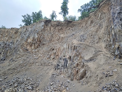


Gronowskie Wzgórza quarry, Gronów, Gmina Zgorzelec, Zgorzelec County, Lower Silesian Voivodeship, Poland