| Locality | Latitude | Longitude | Distance | Bearing |
|---|
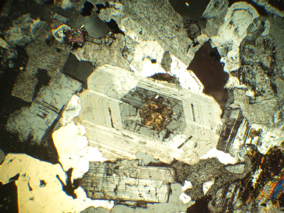
| Pebble Copper prospect, Bristol Bay Mining District, Lake and Peninsula Borough, Alaska, USA | 59° 53' 48" N | 155° 17' 40" W | 0.0km (0.0 miles) | |
| Frying Pan Lake Prospect, Bristol Bay Mining District, Lake and Peninsula Borough, Alaska, USA | 59° 51' 33" N | 155° 19' 29" W | 4.5km (2.8 miles) | |
| 25 Gold Prospect (Sill?), Bristol Bay Mining District, Lake and Peninsula Borough, Alaska, USA | 59° 51' 11" N | 155° 19' 22" W | 5.1km (3.2 miles) | |
| 38 Porphyry prospect, Bristol Bay Mining District, Lake and Peninsula Borough, Alaska, USA | 59° 47' 45" N | 155° 25' 8" W | 13.2km (8.2 miles) | |
| Unnamed Occurrence (ARDF - IL003; near hill 1759), Bristol Bay Mining District, Lake and Peninsula Borough, Alaska, USA | 59° 48' 50" N | 155° 30' 24" W | 15.0km (9.3 miles) | |
| 37 Skarn Prospect, Bristol Bay Mining District, Lake and Peninsula Borough, Alaska, USA | 59° 47' 11" N | 155° 30' 32" W | 17.2km (10.7 miles) | |
| Big Chunk; White Sox, Lake and Peninsula Borough, Alaska, USA | 60° 0' 47" N | 155° 31' 58" W | 18.5km (11.5 miles) | |
| Finnbear Occurrence, Bristol Bay Mining District, Lake and Peninsula Borough, Alaska, USA | 60° 7' 10" N | 155° 5' 24" W | 27.3km (16.9 miles) | |
| Unnamed Prospect (ARDF - LC048), Bristol Bay Mining District, Lake and Peninsula Borough, Alaska, USA | 60° 8' 8" N | 155° 8' 8" W | 28.0km (17.4 miles) | |
| Koktuli River; Koktalee; Kakhtul Occurrences, Bristol Bay Mining District, Lake and Peninsula Borough, Alaska, USA | 59° 52' 50" N | 155° 50' 30" W | 30.6km (19.0 miles) | |
| Unnamed Occurrence (ARDF - IL008; southwest of Newhalen), Bristol Bay Mining District, Lake and Peninsula Borough, Alaska, USA | 59° 40' 36" N | 154° 57' 28" W | 30.9km (19.2 miles) | |
| Millet; Copper King Ledge; Millet Point Prospect, Bristol Bay Mining District, Lake and Peninsula Borough, Alaska, USA | 59° 47' 5" N | 154° 30' 50" W | 45.4km (28.2 miles) | |
| Koktalee River occurrence (Koktuli), Bristol Bay Region District, Dillingham Census Area, Alaska, USA | 59° 58' 46" N | 156° 7' 10" W | 46.9km (29.1 miles) | |
| Unnamed Occurrence (ARDF - IL010; west of Chekok), Bristol Bay Mining District, Lake and Peninsula Borough, Alaska, USA | 59° 48' 29" N | 154° 21' 50" W | 52.9km (32.9 miles) | |
| Aukney Prospect, Bristol Bay Mining District, Lake and Peninsula Borough, Alaska, USA | 59° 25' 6" N | 155° 13' 10" W | 53.4km (33.2 miles) | |
| Unnamed Prospect (ARDF - IL032; northwest slope of Big Mountain), Bristol Bay Mining District, Lake and Peninsula Borough, Alaska, USA | 59° 24' 21" N | 155° 14' 2" W | 54.7km (34.0 miles) | |
| Caribou Creek; Koksetna River Prospect, Bristol Bay Mining District, Lake and Peninsula Borough, Alaska, USA | 60° 12' 0" N | 154° 30' 0" W | 55.5km (34.5 miles) | |
| Knutson; Knudsen Prospect, Bristol Bay Mining District, Lake and Peninsula Borough, Alaska, USA | 59° 50' 3" N | 154° 16' 50" W | 57.0km (35.4 miles) | |
| Charlie Creek Prospect, Bristol Bay Mining District, Lake and Peninsula Borough, Alaska, USA | 60° 27' 0" N | 155° 9' 35" W | 61.9km (38.5 miles) | |
| Keefer Creek Occurrence, Bristol Bay Region Mining District, Dillingham Census Area, Alaska, USA | 60° 17' 59" N | 156° 5' 59" W | 63.3km (39.3 miles) | |
| Mulchatna River Occurrence, Bristol Bay Region Mining District, Dillingham Census Area, Alaska, USA | 60° 17' 59" N | 156° 5' 59" W | 63.3km (39.3 miles) | |
| Unnamed Prospect (ARDF - LC027), Bristol Bay Mining District, Lake and Peninsula Borough, Alaska, USA | 60° 23' 22" N | 155° 54' 0" W | 64.2km (39.9 miles) | |
| Mulchatna Occurrence, Bristol Bay Mining District, Lake and Peninsula Borough, Alaska, USA | 60° 28' 14" N | 155° 41' 34" W | 67.5km (41.9 miles) | |
| Fog Lake Prospect, Bristol Bay Mining District, Lake and Peninsula Borough, Alaska, USA | 59° 30' 41" N | 154° 21' 50" W | 67.6km (42.0 miles) | |
| Tak II Occurrences, Bristol Bay Mining District, Lake and Peninsula Borough, Alaska, USA | 60° 7' 48" N | 154° 9' 0" W | 68.7km (42.7 miles) | |
| Pass Lake West occurrence, Bristol Bay Mining District, Lake and Peninsula Borough, Alaska, USA | 60° 24' 34" N | 154° 33' 0" W | 70.4km (43.7 miles) | |
| Pass Prospect, Bristol Bay Mining District, Lake and Peninsula Borough, Alaska, USA | 60° 22' 48" N | 154° 28' 10" W | 70.5km (43.8 miles) | |
| Kijik Lake (Thompson occurrence), Bristol Bay Mining District, Lake and Peninsula Borough, Alaska, USA | 60° 20' 24" N | 154° 22' 47" W | 70.7km (43.9 miles) | |
| Stuyahok River Occurrence, Bristol Bay Region Mining District, Dillingham Census Area, Alaska, USA | 59° 42' 0" N | 156° 30' 0" W | 70.9km (44.0 miles) | |
| Bertha M. Prospect, Bristol Bay Mining District, Lake and Peninsula Borough, Alaska, USA | 60° 16' 48" N | 154° 15' 0" W | 71.9km (44.7 miles) | |


Pebble Copper prospect, Bristol Bay Mining District, Lake and Peninsula Borough, Alaska, USA