| Locality | Latitude | Longitude | Distance | Bearing |
|---|
| Leucophanite occurrence, Kangerluarsuk Fjord, Ilímaussaq complex, Kujalleq, Greenland | 60° 51' 50" N | 45° 52' 50" W | 0.0km (0.0 miles) | |
| Kangerluarsuk Fjord, Ilímaussaq complex, Kujalleq, Greenland | 60° 52' 33" N | 45° 52' 25" W | 1.4km (0.9 miles) | |
| Kringlerne, Kangerluarsuk Fjord, Ilímaussaq complex, Kujalleq, Greenland | 60° 52' 18" N | 45° 50' 50" W | 2.0km (1.2 miles) | |
| South Coast Pegmatite, Qeqertaussaq Island, Kangerluarsuk Fjord, Ilímaussaq complex, Kujalleq, Greenland | 60° 52' 50" N | 45° 51' 52" W | 2.1km (1.3 miles) | |
| East Coast Pegmatite, Qeqertaussaq Island, Kangerluarsuk Fjord, Ilímaussaq complex, Kujalleq, Greenland | 60° 52' 53" N | 45° 51' 51" W | 2.1km (1.3 miles) | |
| Head of Kangerluarsuk, Kangerluarsuk Fjord, Ilímaussaq complex, Kujalleq, Greenland | 60° 53' 22" N | 45° 50' 35" W | 3.5km (2.2 miles) | |
| Laksetværelv Plateau, Ilímaussaq complex, Kujalleq, Greenland | 60° 52' 30" N | 45° 49' 11" W | 3.5km (2.2 miles) | |
| Lilleelv, Head of Kangerluarsuk, Kangerluarsuk Fjord, Ilímaussaq complex, Kujalleq, Greenland | 60° 53' 30" N | 45° 50' 32" W | 3.7km (2.3 miles) | |
| Naujakasik (Naajakasik), Tunulliarfik Fjord, Ilímaussaq complex, Kujalleq, Greenland | 60° 54' 57" N | 45° 53' 59" W | 5.9km (3.7 miles) | |
| Tuperssuatsiat Bay, Tunulliarfik Fjord, Ilímaussaq complex, Kujalleq, Greenland | 60° 55' 19" N | 45° 50' 11" W | 6.9km (4.3 miles) | |
| South Siorarssuit, Ilímaussaq complex, Kujalleq, Greenland | 60° 53' 58" N | 45° 46' 19" W | 7.1km (4.4 miles) | |
| Tugtup Agtakôrfia, Tunulliarfik Fjord, Ilímaussaq complex, Kujalleq, Greenland | 60° 55' 49" N | 45° 55' 26" W | 7.7km (4.8 miles) | |
| Igdlunguaq, Tunulliarfik Fjord, Ilímaussaq complex, Kujalleq, Greenland | 60° 55' 59" N | 45° 54' 15" W | 7.8km (4.8 miles) | |
| North Siorarssuit, Tunulliarfik Fjord, Ilímaussaq complex, Kujalleq, Greenland | 60° 56' 49" N | 45° 51' 50" W | 9.3km (5.8 miles) | |
| Agpat (Appat), Tunulliarfik Fjord, Ilímaussaq complex, Kujalleq, Greenland | 60° 55' 46" N | 45° 46' 12" W | 9.5km (5.9 miles) | |
| Nunarssuatsiaq, Tunulliarfik Fjord, Ilímaussaq complex, Kujalleq, Greenland | 60° 57' 14" N | 45° 51' 3" W | 10.1km (6.3 miles) | |
| Narsaq, Kujalleq, Greenland | 60° 54' 43" N | 46° 2' 54" W | 10.6km (6.6 miles) | |
| Ilua Bay, Tunulliarfik Fjord, Ilímaussaq complex, Kujalleq, Greenland | 60° 57' 25" N | 45° 50' 3" W | 10.7km (6.6 miles) | |
| Nunasarnaq, Tunulliarfik Fjord, Ilímaussaq complex, Kujalleq, Greenland | 60° 57' 24" N | 45° 47' 32" W | 11.4km (7.1 miles) | |
| Mount Nakkaalaaq, Ilímaussaq complex, Kujalleq, Greenland | 60° 58' 0" N | 45° 53' 59" W | 11.5km (7.1 miles) | |
| Redekammen, Tunulliarfik Fjord, Ilímaussaq complex, Kujalleq, Greenland | 60° 57' 17" N | 45° 46' 32" W | 11.6km (7.2 miles) | |
| Taseq Slope, Ilímaussaq complex, Kujalleq, Greenland | 60° 57' 42" N | 45° 57' 42" W | 11.7km (7.3 miles) | |
| Narsaq River valley (Narsaq Elv), Ilímaussaq complex, Kujalleq, Greenland | 60° 57' 46" N | 45° 59' 17" W | 12.4km (7.7 miles) | |
| Sørensenite occurrence (2004-find), Kuannersuit Plateau (Kvanefjeld), Ilímaussaq complex, Kujalleq, Greenland | 60° 58' 10" N | 45° 59' 12" W | 13.1km (8.1 miles) | |
| Kvanefjeld adit, Kvanefjeld deposit, Kuannersuit Plateau (Kvanefjeld), Ilímaussaq complex, Kujalleq, Greenland | 60° 58' 11" N | 45° 59' 34" W | 13.3km (8.2 miles) | |
| Kvanefjeld deposit, Kuannersuit Plateau (Kvanefjeld), Ilímaussaq complex, Kujalleq, Greenland | 60° 58' 23" N | 45° 59' 41" W | 13.6km (8.5 miles) | |
| Kuannersuit Plateau (Kvanefjeld), Ilímaussaq complex, Kujalleq, Greenland | 60° 58' 30" N | 45° 59' 30" W | 13.7km (8.5 miles) | |
| Drill Core 49, Kvanefjeld deposit, Kuannersuit Plateau (Kvanefjeld), Ilímaussaq complex, Kujalleq, Greenland | 60° 58' 44" N | 45° 59' 14" W | 14.0km (8.7 miles) | |
| Drill Core 53, Kvanefjeld deposit, Kuannersuit Plateau (Kvanefjeld), Ilímaussaq complex, Kujalleq, Greenland | 60° 58' 38" N | 45° 59' 47" W | 14.1km (8.8 miles) | |
| Drill Core 39, Kvanefjeld deposit, Kuannersuit Plateau (Kvanefjeld), Ilímaussaq complex, Kujalleq, Greenland | 60° 58' 48" N | 45° 59' 8" W | 14.1km (8.8 miles) | |


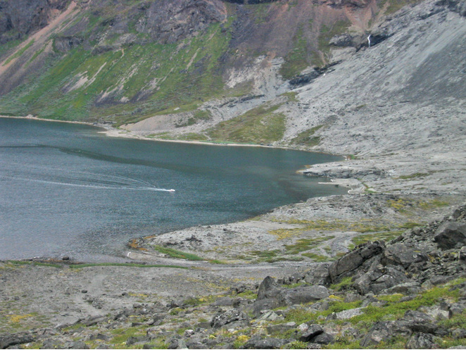


Kangerluarsuk Fjord, Ilímaussaq complex, Kujalleq, Greenland