Home PageAbout MindatThe Mindat ManualHistory of MindatCopyright StatusWho We AreContact UsAdvertise on Mindat
Donate to MindatCorporate SponsorshipSponsor a PageSponsored PagesMindat AdvertisersAdvertise on Mindat
Learning CenterWhat is a mineral?The most common minerals on earthInformation for EducatorsMindat ArticlesThe ElementsThe Rock H. Currier Digital LibraryGeologic Time
Minerals by PropertiesMinerals by ChemistryAdvanced Locality SearchRandom MineralRandom LocalitySearch by minIDLocalities Near MeSearch ArticlesSearch GlossaryMore Search Options
The Mindat ManualAdd a New PhotoRate PhotosLocality Edit ReportCoordinate Completion ReportAdd Glossary Item
Mining CompaniesStatisticsUsersMineral MuseumsClubs & OrganizationsMineral Shows & EventsThe Mindat DirectoryDevice SettingsThe Mineral Quiz
Photo SearchPhoto GalleriesSearch by ColorNew Photos TodayNew Photos YesterdayMembers' Photo GalleriesPast Photo of the Day GalleryPhotography
╳Discussions
💬 Home🔎 Search📅 LatestGroups
EducationOpen discussion area.Fakes & FraudsOpen discussion area.Field CollectingOpen discussion area.FossilsOpen discussion area.Gems and GemologyOpen discussion area.GeneralOpen discussion area.How to ContributeOpen discussion area.Identity HelpOpen discussion area.Improving Mindat.orgOpen discussion area.LocalitiesOpen discussion area.Lost and Stolen SpecimensOpen discussion area.MarketplaceOpen discussion area.MeteoritesOpen discussion area.Mindat ProductsOpen discussion area.Mineral ExchangesOpen discussion area.Mineral PhotographyOpen discussion area.Mineral ShowsOpen discussion area.Mineralogical ClassificationOpen discussion area.Mineralogy CourseOpen discussion area.MineralsOpen discussion area.Minerals and MuseumsOpen discussion area.PhotosOpen discussion area.Techniques for CollectorsOpen discussion area.The Rock H. Currier Digital LibraryOpen discussion area.UV MineralsOpen discussion area.Recent Images in Discussions


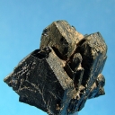
PhotosQingheiite-(Fe2+) - G. E. Smith Mine, Newport, Sullivan Co., New Hampshire, USA
14th Aug 2013 13:06 UTCFred E. Davis


14th Aug 2013 14:00 UTCVandall Thomas King Manager
Thank you for the name change information.
14th Aug 2013 14:22 UTCFred E. Davis
1) George F. Smith owned the property and was living there.
2) G. F. Smith opened the small pit just east of his residence near the Sugar River and was working it (G. F. Smith mine).
3) Smith leased the old, abandoned pegmatite further south up the hill to a Keene, NH mining company; it was reopened and worked (Chandlers Mill mine).
4) Both mines were active at the time of their visits, so there was no confusion about names (either owner or mine).
5) Maps were drawn and labeled (USGS PP255 Plate 41).
6) Other maps in that era (eg, Olson 1950) were similarly correctly labeled.
Names were clear then, but garbled with passing time. It's time to set them straight once again.
14th Aug 2013 15:44 UTCVandall Thomas King Manager
14th Aug 2013 16:41 UTCFred E. Davis
Since the mines are not adjacent, were operated independently by different mining companies and exhibit different minerals on the dumps, obviously they should be listed separately. Until they are listed correctly, I have no reason to add minerals & photos to an erroneous locality. I would like to see my contributions attributed to the locality where they were found.
Because the Orchard Pit and Bennett Quarries (Buckfield, ME) are so close, should you combine them into a single locality listing, mixing the reported minerals?
17th Aug 2013 17:22 UTCVandall Thomas King Manager
18th Aug 2013 00:19 UTCFred E. Davis
Fred

18th Aug 2013 13:15 UTCDon Kauffman
Thank you for the lively discussion regarding the Chandler Mills Quarry. Even though I'm from Pennsylvania, I love the history and local lore of the New Hampshire and Main countryside.
We (Linda and myself) still investigate sites and prospects around the Gilsum area at least once a year.
Keep up your good works.
Regards,
Don Kauffman
Reading, PA (tu)


Mindat.org is an outreach project of the Hudson Institute of Mineralogy, a 501(c)(3) not-for-profit organization.
Copyright © mindat.org and the Hudson Institute of Mineralogy 1993-2024, except where stated. Most political location boundaries are © OpenStreetMap contributors. Mindat.org relies on the contributions of thousands of members and supporters. Founded in 2000 by Jolyon Ralph.
Privacy Policy - Terms & Conditions - Contact Us / DMCA issues - Report a bug/vulnerability Current server date and time: May 10, 2024 19:21:52